Ferozepur Jhirka
Ferozepur Jhirka, also known as Ferojpur Jhirka, is a town in Nuh district in the state of Haryana, India.
Ferozepur Jhirka
| |
|---|---|
Township | |
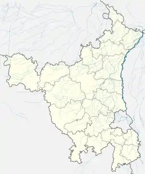 Ferozepur Jhirka Location in Haryana, India  Ferozepur Jhirka Ferozepur Jhirka (India) | |
| Coordinates: 27°47′15″N 76°56′47″E | |
| Country | |
| State | Haryana |
| District | Nuh |
| Population (2011) | |
| • Total | 24,750 |
| Language | |
| • Official | Hindi |
| Time zone | UTC+5:30 (IST) |
| ISO 3166 code | IN-HR |
| Vehicle registration | HR-28 |
| Website | haryana |
History
Ferozepur Jhirka was founded in 1419 by Wali (patriarch) of Mewat Khanzada Feroz Khan of Khanzada Rajput ancestry, who styled himself as "Raja" (King).
Mughal Era
Choudry Mohammad Hayat Khan Numberdar and his brother Choudry Burkat Ullah Khan Khanzada were landlord zamidar in Ferozepur Jhirka. Abu Mohammad along with Makhdoom Tahir (from Jhumrawat) turned this into larger estate (riyasat). Qazi Ghulam Mustafa from Ferozepur Jhirka, and who was honoured By Bahadur Shah I was close relative to these two and he was married to Bibi Rasti (died Dhu al-Qi'dah 1147 AH / 1734 AD), the daughter of Qazi Syed Rafi Mohammad.
Khan Zaman Khan Ali Asghar, who built the Ferozepur Jhirka Fort was a courtier of mughal emperor Farrukhsiyar of Delhi. He was the son of Bibi Rasti and Nawab Kar Talab Khan Qazi Ghulam Mustafa. He was Panj Hazari Mansabdar Emir (a courtier with a military rank of officer-in-charge of 5000 horses) and was posted first as Faujdar at Moazzam Abad (Sargodha), later as Khidmat Daroghi Topkhana (incharge of armory Armory (military) store) at Multan; Naib Subahdar at Azimabad (Patna), and then Subahdar at Awadh during the reigns of Farrukhsiyar to Muhammad Shah.[1] He died in Shahjahanbad (Delhi) on 4 Dhu al-Hijjah 1155 AH (1742 CE). Nazim khan son of Hasan Mohm Islam Khan V, who belonged to Ferozepur Jhirka, was also a close relative of Qazi Ghulam Mustafa.
This princely state was abolished by the British Raj in 1858 after the Rebellion of 1857.
Lesser Balochistan
The 1828 CE The Imperial Gazetteer of India of East India Company refers to this area as Lesser Balochistan, a likely reference to arrival of people from Balochistan during Lodhi era who might have been the rulers of Ferozepur Jhirka area from Lodhi era onward. They likely built the Taoru Tomb complex during the successive dynasties. The largests tomb belongs to a Baloch.[2][3]
District reorganisation
Previously Ferozepur Jhirka was part of district Gurgaon, but through gazette notification of Haryana government on 4 April 2005 it became part of Nuh district. Since then it has been sub-division of Nuh district.
Demographics
The area is dominated by Hindus. It was earlier in the Gurgaon district but was later moved to the Mewat district.[4] Ferozepur Jhirka constituency has 80% Hindus and 20% Meo Muslims.[5]
As of 2001 India census,[6] Ferozepur Jhirka had a population of 17,751. Males constitute 52% of the population and females 48%. Ferozepur Jhirka has an average literacy rate of 59.5%: male literacy is 70% and female literacy is 80%. In Ferozepur Jhirka, 19% of the population is under 6 years of age.
[7] are Dominant in Ferozepur Jhirka .
References
- Tazkirat us-Salatin Chaghta – A Mughal Chronicle of Post Aurangzeb Period (1707-1724) by Muhammad Hadi Kamwar Khan; edited Persian text and with an Introduction by Muzaffar Alam (1980), Centre Of Advanced Study Department of History, Aligarh Muslim University, Aligarh (U.P.) -202001, India
- lalit Mohan, "The timeless tombs of Tauru.", The Tribune, 23 Feb 2002.
- "Tombs in Tauru - A Small Dusty Town."Tombs in Tauru - A Small Dusty Town, Delhipedia.
- https://www.latestly.com/india/politics/ferozepur-jhirka-vidhan-sabha-constituency-in-haryana-sitting-mla-candidates-for-assembly-elections-2019-results-and-winners-1260900.html
- https://timesofindia.indiatimes.com/city/gurgaon/muslim-candidates-could-split-mewat-votes-dash-congress-hopes/articleshow/69016258.cms
- "Census of India 2001: Data from the 2001 Census, including cities, villages and towns (Provisional)". Census Commission of India. Archived from the original on 16 June 2004. Retrieved 1 November 2008.
- Ojha, Brahm Swarup; Singh, Jasbir; Planning Dept, Haryana (India) (1993). Resource Planning Atlas: South and southwestern Haryana. ISBN 9788185135731.