Flippin, Kentucky
Flippin [nb 1] is an unincorporated community located in Monroe County, Kentucky, United States. A small residential village is located on Highway 249, approximately 3.6 miles (5.8 km) south of the Monroe-Barren County line. The village and community surround the intersection of Highway 249, Highway 678, and Highway 100. Flippin is situated northwest of Gamaliel, west of Tompkinsville, and east of Fountain Run. Flippin's post office (42132) closed in 1964.
Flippin | |
|---|---|
 Flippin, Kentucky | |
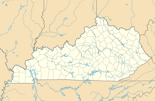 Flippin Location within the state of Kentucky  Flippin Flippin (the United States) | |
| Coordinates: 36°43′13″N 85°52′27″W | |
| Country | United States |
| State | Kentucky |
| County | Monroe |
| Elevation | 735 ft (224 m) |
| Time zone | UTC-6 (Central (CST)) |
| • Summer (DST) | UTC-5 (CDT) |
| ZIP Codes | 42167, 42133 |
| Area code(s) | 270 |
| GNIS feature ID | 492255[1] |
The south fork and main stream of Indian Creek, a tributary of the Barren River, merge at these crossroads in Flippin.
History
Pikesville
Before 1858, this community was known as “Pikesville”, or the “forks of Indian Creek”. The “town of Pikesville” was established with this spelling by Barren County, Kentucky Court in August, 1818, named for General Zebulon Pike (1779-1813), with the following Trustees: Leonard H. Maury, John Goodall, Archibald Sloan, Thomas Flippin (Sr.), and his son, James Flippin. The 75-acre town site was located east of Pikesville Branch of Indian Creek, approximately 1.25 miles north of present-day Flippin on Highway 249. The town site was situated in a 353-acre tract previously conveyed by Thomas Flippin (Sr.) and sons, James Flippin and Isaac Flippin, to son Thomas H. Flippin, William Baugh, and Rev. John Baugh who became the proprietary owners of the new town and its surrounding property.
Thomas Flippin (ca.1740-1830) claimed 800 acres (Grants South of Green River, 1797-1866) and first settled his family on the “waters of Indian Creek” (Pikesville Branch) by 1797, where he operated a grist mill, store, and tavern. He also served as court commissioner, justice of the peace, and sheriff of Barren County. Two of the earliest roads created by Barren County Court crossed near Thomas Flippin’s home: The “Flippin Road” (1799) from Glasgow to White Oak Creek at Barren River, and the route (1801) later known as Tompkinsville Pikesville Gallatin Road, a.k.a. “Old Pikeville Rd”.
Barren County Deeds, 1818-1820, described Pikesville as a town with ten named streets, a town square, and 189 town “Lots”. [6][7][8] Pikesville competed in the election (1819) for county seat of the new county of Monroe (1820), and lost to Tompkinsville by a plurality of four votes. The history of Pikesville after 1820 as told in public records was largely erased when Confederates burned the courthouse of Monroe County during the Civil War, in 1863.[9]
In his series of published (1889) Historical Sketches of Monroe County, Manlius Thompson Flippin, great-grandson of Thomas Flippin (Sr.), remembered a “three-story hotel, ... many houses that had been residences, stores, shops and barns when the town was at its zenith.” [10] When interviewed (1943) for a news article, some older residents of the Pikesville community remembered a town with six stores, grist mill, blacksmith shop, tan yard, and race track.[11] The blacksmith shop of William Hays Lewis and Bethel Methodist Episcopal Church (1857-1922) on Bethel Branch were located near Ward-Lewis Cemetery. Nothing of the town remains today. A short section of “Old Pikeville Rd” (est. 1801) now used as a farm road has been marked by the county. “Pikesville Branch”—variously spelled—has remained on maps as a landmark. A school at Pikesville continued well into the 20th century, after Pikesville School #1 (1855–1929) a.k.a. Common School #41 was replaced, until Pike(s)ville School #2 (1929–1951) was consolidated.[12][13]
Flippin
According to U. S. postal records in the National Archives, “Pikeville” in Monroe County had a post office, 1830-1833, with James Falconer as postmaster. In 1858, a new postal name, “Flippin, Kentucky,” was established in this community to avoid confusion with “Pikeville” in Pike County, Kentucky. Dr. William C. Brockett was the first postmaster of the new post office, traditionally named for the Family of Thomas Flippin (Sr.), whether for his son James, or grandson, James McAdoo Flippin. James McAdoo Flippin was the father of Manlius Thompson Flippin (1841-1899): teacher, orator, poet, lawyer, legislator, and judge.[14][10][15] According to U. S. postal records, Flippin had a post office from 1858 to 1964, except for a brief interval, 1870–72. Ella Hughes was the last postmaster. Flippin retained a postal station operated by Bela Turner from 1964 to 1981.
The site of Flippin at the forks of Indian Creek is situated in a two-mile long expanse of Indian Creek that was first recorded in 1797 as the “Reid and Pearson survey,” an 1,800-acre tract adjacent to (south of) Thomas Flippin’s land, which was a part of the military grant of Virginia Navy Captain Thomas Lilly for his service during the American Revolutionary War. A “large Sulphur Lick” near Indian Creek, mentioned in a previous survey (1796) as a “large Buffalo Lick,” was cited as a landmark in the metes and bounds of the Reid and Pearson survey. The tract was subdivided when surveyed, with 1,442 acres assigned to Charles Copland, Esq. of Richmond, Virginia, who later assigned (1808) his entire acreage to the family of his sister, John and Clarissa (Copland) Goodall, and to their son in law, John Martin. The remaining 358 acres were assigned to Major William Croghan, chief surveyor of the military district of Kentucky. Daniel Boone and John Raburn were two of the recorded surveyors and hunted here. In his Historical Sketches, Manlius T. Flippin reported the discovery in 1849 of a Beech tree in the vicinity bearing the inscriptions of Boone and Raburn.[16]
When the Civil War (1861–1865) began, hundreds of volunteer soldiers from Monroe and surrounding counties were first organized at several “Lincoln camps” in support of the Union, finally to rendezvous at Camp Robert Anderson, on the farm of John M. Fraim, on the south fork of Indian Creek.[17] Major Henry Dunn of the Monroe County Home Guard (US) superintended a drill school for volunteers at Indian Creek Baptist Church. Camp Anderson was located near the intersection of Highways 100 and 1366, about 1.5 miles south of the Church and present-day Flippin. A highway historical marker commemorates the site. John M. Fraim became a government contractor during the war and was instrumental in the formation of the unit that became the 9th Kentucky Volunteer Infantry Regiment when mustered into the U.S. Army, November 20, 1861, at Camp Boyle, Columbia, Kentucky.[18][19][14]
Monroe Normal School (a.k.a. Indian Creek College), located in Flippin, was incorporated by an Act (Chapter 646) of the Kentucky General Assembly, March 24, 1888, and was authorized to confer the Bachelor of Arts Degree as a teacher-training academy, with the following Trustees: Thomas C. Gillenwaters, Elijah A. Purcell, George T. Fraim, Daniel E. Downing, James T. Beals, Francis M. Button, Lilburne P. Flowers, James M. Neal, and Dr. Joseph A. Flippin. [20] The building also served as the site of Flippin Elementary and High Schools, until replaced in 1938 by a new elementary school building erected by the National Youth Administration.
The largest ever recorded old-growth tulip poplar tree grew in the Flippin community, located near the intersection of Highways 100 and 1366. Cut for timber in 1893, the tree measured 10–11 feet (3 to 3.4 m) in diameter at its base; its height was not recorded. A four-foot cross section was transported and displayed at the World's Columbian Exposition, in Chicago.[21][22] A photograph of the tree and a piece of its bark were later donated by descendants of the original landowner to Indian Creek Baptist Church. A Kentucky highway historical marker in Flippin commemorates this “Famous Tree” (Landrum, 1976).
Lumber from this tree was used to rebuild the (third) Indian Creek Baptist Church and also to build the new Flippin Methodist Episcopal Church, South (1894-1964), a splinter congregation of Bethel M. E. Church (1857-1922) at Pikesville. Indian Creek Baptists initially met from 1835 in the local school building. The first Baptist Church building of logs (1838–67) was replaced by a frame building (1867–93) that burned in 1893. Originally organized in 1835 near the forks of Indian Creek as the United Baptist Church of Christ, “United Baptist Church at Indian Creek” was formally incorporated by an Act (Chapter 1051) of the General Assembly, January 22, 1867, with Daniel E. Downing, Ellis Riggs, and James M. Neal as Trustees. This third Baptist Church building burned in 1921, and was replaced by a fourth building (Landrum, 1976). The fourth building has since been abandoned due to flood damage (2010) and replaced by a fifth Baptist Church building located near Neal Cemetery.[23]
Today, Flippin is a farming community surrounding a small crossroads village that was once a thriving center of mercantile and civic life, although never incorporated. Through the decades, Flippin was served by numerous merchants, millers, and hoteliers, among whom were James T. Beals, Joseph Loyd, Elijah A. Purcell, Francis M. Button, John T. Flowers, William S. Maxey, Mary J. Flowers, Kinchen D. Dossey, Tom and Sally Button, Frank and Hettie Button, Paul and Ella Hughes, Lewis and Annie Lee Hughes, Gus and Lura Arterburn, Carson Bailey, and Lester and Bela Turner. William T. Webb and John Lane were 19th-century investor-partners in the general store, Lane Webb and Company, operated by Francis M. Button, which retained this business name although successively owned and operated by his son, Francis L. “Frank” Button. After Frank Button died, his widow Hettie (Downing) Button with her sister, Ella and husband Paul Hughes, and his brother, Lewis and wife Annie Lee (Johnson) Hughes continued as storekeepers, until finally closed in 1964. Thomas and Sally (Register) Button, Frank’s brother, also operated a store concurrently in Flippin until closed, ca. 1960.
The stores, mills, shops, schools, hotels, factories, bank, and most of the buildings of Flippin’s past are gone. Two active churches remain: Indian Creek Baptist Church (est. 1835) and Flippin Church of Christ (est. 1879).[24][25][14][26]
Notes
- “Johnstonville” has been erroneously attributed in a published reference source[2] as an alternate earlier name for the Flippin community. Collins’ History of Kentucky (1874) mentioned the incorporated town of Johnstonville in Monroe County, without noting its location, but failed to mention either Flippin or Pikesville: “The other small villages and post offices in the county are—Martinsburg, on the Cumberland river, 20 miles from Tompkinsville, Johnstonville (incorporated February 13, 1846), Center Point, Gamaliel, Hilton, Fountain Run, Meshach’s Run, Mud Lick, Rock Bridge, and Sulphur Lick.”[3] However, “PikeV[ille]” was depicted on Collins’ frontispiece map as a place name, geographically located correctly; neither “Johnstonville” nor “Flippin” appeared on the Collins map. “Johnstonville” in Monroe County was incorporated by an Act (Chapter 164, February 13, 1846) of the General Assembly, and its location on John Black’s land in Monroe County on the south side of Cumberland River was clearly identified.[4] Johnstonville and Pike(s)ville of Monroe County both appear on the map of Kentucky included in the Official Atlas of the Civil War,[5] with Johnstonville correctly located near the Cumberland River. Johnstonville, originally planned as a town near present-day Black’s Ferry, had disappeared from maps by the 20th century.
References
- U.S. Geological Survey Geographic Names Information System: Flippin, Kentucky
- Rennick, Robert M. Kentucky Place Names. The University Press of Kentucky, 2013. pp. 103-4.
- Collins, Lewis, and Richard H. Collins. History of Kentucky. Covington, Ky: Collins & Co, 1874. p. 630.
- Kentucky. Acts of the General Assembly of the Commonwealth of Kentucky. Frankfort, Ky: [publisher not identified], [1846]. Chapter 164, p. 159.
- United States. The Official Atlas of the Civil War. New York: T. Yoseloff, 1958.
- Peden, Eva Coe, Gladys Benedict Wilson, Sandra K. Gorin, and Martha Powell Reneau. Barren County, Kentucky Order Book. Glasgow, Kentucky: S.K.L. Gorin, 1976.
- Gorin, Sandra Kaye Laughery. Barren County, Kentucky, Deed Books. Glasgow, KY (205 Clements Ave., Glasgow 42141-3409): S.K. Gorin, 1991.
- Lemons, Nova A. John McAdoo of Virginia, North Carolina, Tennessee and Kentucky. Dallas, Tex: N.A. Lemons, 1991. pp. 40–44.
- Montell, William Lynwood. Monroe County History, 1820–1970. Tompkinsville, Ky: Tompkinsville Lions Club, 1970. p. 17.
- Flippin, Manlius Thompson. Historical Sketches of Monroe County. Tompkinsville, Ky: The Enterprise, 1889.
- Simmons, Clayton C. Historical Trip Through East Barren County, Kentucky and the Hamilton Sanderson Murder Trial:" ”The Glasgow Times” December 3, 1942-September 2, 1943. Evansville, Ind: Whipporwill Publications, 1980. pp. 338–40.
- Monroe County Retired Teachers. Early School Days in Monroe County, Kentucky. Utica, KY: McDowell Publications, 2008. pp. 271–73.
- Arterburn, Charles R. A Forgotten Town Remembered: Pikesville of Monroe County, Kentucky. Lexington, Kentucky: C.R. Arterburn, 2014.
- Collins, Lewis, and William Henry Perrin. Monroe County, Kentucky: History and Biographies. Signal Mountain, Tenn: Mountain Press, 2002.
- Flippin, Manlius Thompson. Poems and Addresses. Chicago: American Publishers' Association, 1892.
- Arterburn, Charles R. Old Pikesville Days 1818-2018. Bowling Green, Kentucky: C.R. Arterburn, 2019.
- United States. The War of the Rebellion, a Compilation of the Official Records of the Union and Confederate Armies. Series 1. Vol. 4. Washington, D.C.: GPO, 1880.
- Woodcock, Marcus, and Kenneth W. Noe. A Southern Boy in Blue: The Memoir of Marcus Woodcock, 9th Kentucky Infantry (U.S.A.). Knoxville: University of Tennessee Press, 1996.
- Kentucky, and Michael L. Cook. Report of the Adjutant General of the State of Kentucky, 1861-1866. Utica, Kentucky: McDowell Publications, 1984.
- Kentucky. Acts Passed at the ... Session of the General Assembly for the Commonwealth of Kentucky. Lexington: J. Bradford, printer to the Commonwealth, [1888]. Chapter 646, pp. 394-95.
- Landrum, Alta. History of Indian Creek Missionary Baptist Church. 1976.
- Rand McNally and Company. Handbook of the World's Columbian Exposition. Chicago: Rand, McNally, 1893. p. 94.
- Kinslow, Gina. "Indian Creek Baptist finds hill for new church building!" Glasgow Daily Times N.p. 1 May 2011. Web. 15 Jan. 2019.
- Montell, William Lynwood. Monroe County History, 1820–1970. Tompkinsville, Ky: Tompkinsville Lions Club, 1970.
- Birdwell, Dayton. The History of Monroe County, Kentucky, 1820–1988. Tompkinsville, Ky: Monroe County Press, 1992.
- Monroe County Retired Teachers. Early School Days in Monroe County, Kentucky. Utica, KY: McDowell Publications, 2008.
External links
 Media related to Flippin, Kentucky at Wikimedia Commons
Municipalities and communities of Monroe County, Kentucky, United States | ||
|---|---|---|
| Cities |  Location of Monroe County, Kentucky | |
| Unincorporated communities | ||
| ||
- Pikesville Historical Marker at HMdb.org
- Famous Tree Historical Marker at HMdb.org