Florida State Road 388
State Road 388 (SR 388) is a 12.3-mile-long (19.8 km) state highway in Bay County, Florida, that runs from SR 79 northeast of West Bay to SR 77 and Edwards Road southeast of Vicksburg.
| ||||
|---|---|---|---|---|
| Don Johnson Memorial Highway | ||||
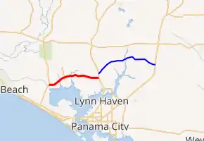
SR 388 in red, CR 388 in blue | ||||
| Route information | ||||
| Maintained by FDOT | ||||
| Length | 12.339 mi[1] (19.858 km) | |||
| Major junctions | ||||
| West end | ||||
| East end | ||||
| Location | ||||
| Counties | Bay | |||
| Highway system | ||||
| ||||

Major intersections
The entire route is in Bay County.
| Location | mi[1] | km | Destinations | Notes | |
|---|---|---|---|---|---|
| | 0.000 | 0.000 | Western terminus | ||
| | 12.339 | 19.858 | Eastern terminus; continues as Edwards Road beyond SR 77 | ||
| 1.000 mi = 1.609 km; 1.000 km = 0.621 mi | |||||
County Road 388
| |
|---|---|
| Location | rural Bay County |
| Length | 15.2 mi[2] (24.5 km) |
County Road 388 (CR 388) is a 15.2-mile-long (24.5 km) county road in Bay County, Florida that is a former extension of SR 388[3] from Florida State Road 77 northeast of Vicksburg to U.S. Route 231 (US 231) and Jadewood Circle at Youngstown.
Major intersections
The entire route is in Bay County.
| Location | mi[2] | km | Destinations | Notes | |
|---|---|---|---|---|---|
| | 0.0 | 0.0 | Western terminus | ||
| | 9.0 | 14.5 | Northern terminus of CR 2301 | ||
| Youngstown | 15.2 | 24.5 | Eastern terminus; continues beyond US 231 as Jadewood Circle | ||
| 1.000 mi = 1.609 km; 1.000 km = 0.621 mi | |||||
References
- "Florida Department of Transportation Straight Line Diagram of Road Inventory". Florida Department of Transportation. Retrieved June 13, 2018.
- "Google Maps Directions". Google Maps. Retrieved June 13, 2018.
- "General Highway Map Bay County". ufdc.ufl.edu. Retrieved June 13, 2018.
External links
This article is issued from Wikipedia. The text is licensed under Creative Commons - Attribution - Sharealike. Additional terms may apply for the media files.