Bay County, Florida
Bay County is a county on the Gulf coast in northwestern Florida. As of the 2010 census, the population was 168,852 (Estimate of 185,287 as of 1 July 2018).[1] Its county seat is Panama City.[2]
Bay County | |
|---|---|
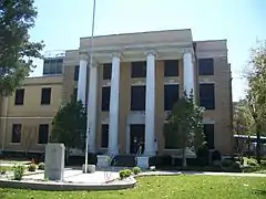 The Bay County Courthouse in March 2008 | |
 Flag  Seal | |
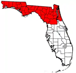
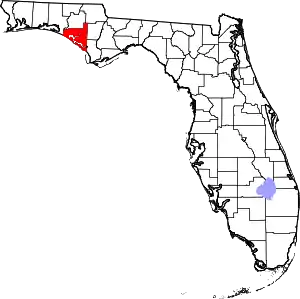 Location within the U.S. state of Florida | |
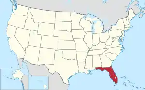 Florida's location within the U.S. | |
| Coordinates: 30°14′N 85°38′W | |
| Country | |
| State | |
| Founded | April 24, 1913 |
| Named for | St. Andrews Bay |
| Seat | Panama City |
| Largest city | Panama City |
| Area | |
| • Total | 1,033 sq mi (2,680 km2) |
| • Land | 758 sq mi (1,960 km2) |
| • Water | 275 sq mi (710 km2) 26.6%% |
| Population | |
| • Estimate (2019) | 174,705 |
| • Density | 242/sq mi (93/km2) |
| Time zone | UTC−6 (Central) |
| • Summer (DST) | UTC−5 (CDT) |
| Congressional district | 2nd |
| Website | www |
Bay County is included in the Panama City, Florida Metropolitan Statistical Area. The county is best known for its white sand beaches and emerald green water, where large pods of dolphins swim year-round. These beaches attract hundreds of thousands of visitors from all over the world each year.
History
On February 12, 1913, representatives from five towns on St. Andrews Bay met in Panama City to select a name for a proposed new county. The name Bay was selected because it was satisfactory to the majority of the citizens and descriptive of the territory that would be included. On July 1, 1913, the Legislature created Bay County from portions of Washington, Calhoun and Walton counties.
Panama City was where Gideon v. Wainwright, a 1963 US Supreme Court decision that gave all persons accused of a crime the right to an attorney, originated.
Hurricane Michael made landfall near Panama City in Bay County on October 10, 2018, as one of the strongest and most destructive hurricanes in American history, destroying a large part of the county, including many structures in Mexico Beach and Panama City.
Geography
According to the U.S. Census Bureau, the county has a total area of 1,033 square miles (2,680 km2), of which 758 square miles (1,960 km2) is land and 275 square miles (710 km2) (26.6%) is water.[3]
Adjacent counties
- Washington County - north
- Jackson County - northeast
- Calhoun County - east
- Gulf County - southeast
- Walton County - west
National protected area
- Apalachicola National Forest (part)
Demographics
| Historical population | |||
|---|---|---|---|
| Census | Pop. | %± | |
| 1920 | 11,407 | — | |
| 1930 | 12,091 | 6.0% | |
| 1940 | 20,686 | 71.1% | |
| 1950 | 42,689 | 106.4% | |
| 1960 | 67,131 | 57.3% | |
| 1970 | 75,283 | 12.1% | |
| 1980 | 97,740 | 29.8% | |
| 1990 | 126,994 | 29.9% | |
| 2000 | 148,217 | 16.7% | |
| 2010 | 168,852 | 13.9% | |
| 2019 (est.) | 174,705 | [4] | 3.5% |
| U.S. Decennial Census[5] 1790-1960[6] 1900-1990[7] 1990-2000[8] 2010-2015[1] | |||
As of the census[9] of 2000, there were 148,217 people, 59,597 households, and 40,466 families residing in the county. The population density was 194 people per square mile (75/km2). There were 78,435 housing units at an average density of 103 per square mile (40/km2). The racial makeup of the county was 84.17% White, 10.64% Black or African American, 0.78% Native American, 1.73% Asian, 0.08% Pacific Islander, 0.66% from other races, and 1.94% from two or more races. 2.42% of the population were Hispanic or Latino of any race.
There were 59,597 households, out of which 30.60% had children under the age of 18 living with them, 52.00% were married couples living together, 12.00% had a female householder with no husband present, and 32.10% were non-families. 26.00% of all households were made up of individuals, and 8.80% had someone living alone who was 65 years of age or older. The average household size was 2.43 and the average family size was 2.92.
In the county, the population was spread out, with 24.00% under the age of 18, 8.70% from 18 to 24, 30.20% from 25 to 44, 23.70% from 45 to 64, and 13.40% who were 65 years of age or older. The median age was 37 years. For every 100 females there were 98.10 males. For every 100 females age 18 and over, there were 95.80 males.
The median income for a household in the county was $36,092, and the median income for a family was $42,729. Males had a median income of $30,116 versus $21,676 for females. The per capita income for the county was $18,700. About 9.80% of families and 13.00% of the population were below the poverty line, including 18.30% of those under age 18 and 11.00% of those age 65 or over.
Government
Elected Officials
| Bay County Government | ||
|---|---|---|
| Sheriff | Tommy Ford [10] | Republican |
| Tax Collector | Chuck Perdue | Republican |
| Clerk of the Court | Bill Kinsaul | Republican |
| Supervisor of Elections | Mark Anderson | Republican |
| Superintendent of Schools | William Husfelt, III | Republican |
| Property Appraiser | Dan Sowell | Republican |
Board of Commissioners
5 members, elected from districts (zero Democrats, five Republicans)[11]
| District | Commissioner | Party | Positions |
|---|---|---|---|
| 1 | Tommy Hamm | Republican | |
| 2 | Robert Carroll | Republican | |
| 3 | Bill Dozier | Republican | Chair of the County Commission |
| 4 | Keith Baker | Republican | |
| 5 | Phillip "Griff" Griffits | Republican | Vice Chair of the County Commission |
Politics
Voter registration
According to the Secretary of State's office, Republicans are a majority of the registered voters in Bay County.
| Bay County Voter Registration & Party Enrollment as of August 31, 2017[12] | |||||
|---|---|---|---|---|---|
| Political Party | Total Voters | Percentage | |||
| Republican | 60,008 | 52.02% | |||
| Democratic | 30,391 | 26.35% | |||
| Independent | 24,244 | 21.02% | |||
| Third Parties | 704 | 0.61% | |||
| Total | 115,347 | 100% | |||
Statewide elections
| Year | Republican | Democratic | Third parties |
|---|---|---|---|
| 2020 | 70.9% 66,097 | 27.5% 25,614 | 1.6% 1,502 |
| 2016 | 70.5% 62,194 | 24.7% 21,797 | 4.8% 4,231 |
| 2012 | 71.0% 56,876 | 27.5% 22,051 | 1.5% 1,174 |
| 2008 | 69.7% 56,683 | 29.1% 23,653 | 1.3% 1,030 |
| 2004 | 71.2% 53,404 | 28.1% 21,068 | 0.7% 552 |
| 2000 | 65.7% 38,682 | 32.1% 18,873 | 2.2% 1,321 |
| 1996 | 54.9% 28,365 | 33.0% 17,068 | 12.1% 6,261 |
| 1992 | 49.9% 22,842 | 28.1% 12,846 | 21.9% 10,001 |
| 1988 | 72.5% 31,796 | 26.5% 11,603 | 1.0% 452 |
| 1984 | 75.8% 29,356 | 24.2% 9,384 | 0.0% 4 |
| 1980 | 60.6% 20,948 | 35.9% 12,389 | 3.5% 1,224 |
| 1976 | 48.2% 14,208 | 50.4% 14,858 | 1.4% 418 |
| 1972 | 83.8% 20,245 | 16.2% 3,914 | |
| 1968 | 21.1% 5,121 | 16.5% 4,020 | 62.4% 15,161 |
| 1964 | 62.1% 12,849 | 37.9% 7,846 | |
| 1960 | 33.9% 5,435 | 66.1% 10,579 | |
| 1956 | 36.5% 4,971 | 63.5% 8,645 | |
| 1952 | 35.4% 4,812 | 64.6% 8,789 | |
| 1948 | 12.7% 928 | 70.7% 5,168 | 16.6% 1,216 |
| 1944 | 15.1% 1,126 | 84.9% 6,317 | |
| 1940 | 11.7% 684 | 88.3% 5,153 | |
| 1936 | 14.5% 541 | 85.6% 3,202 | |
| 1932 | 13.8% 429 | 86.3% 2,692 | |
| 1928 | 44.3% 974 | 54.1% 1,190 | 1.6% 36 |
| 1924 | 25.5% 318 | 67.2% 838 | 7.4% 92 |
| 1920 | 37.0% 551 | 54.9% 818 | 8.1% 121 |
| 1916 | 23.6% 279 | 61.4% 725 | 14.9% 176 |
| Year | Republican | Democratic | Third parties |
|---|---|---|---|
| 2018 | 72.17% 45,709 | 26.46% 16,757 | 1.37% 865 |
| 2014 | 71.79% 40,956 | 22.77% 12,990 | 5.44% 3,104 |
| 2010 | 66.39% 36,512 | 28.53% 15,689 | 5.08% 2,796 |
| 2006 | 65.26% 31,382 | 30.78% 14,802 | 3.96% 1,907 |
| 2002 | 70.02% 34,107 | 29.27% 14,258 | 0.71% 344 |
| 1998 | 69.01% 26,759 | 30.99% 12,017 | 0.00% 2 |
| 1994 | 56.87% 23,498 | 43.12% 17,816 | 0.01% 2 |
Education
Bay District Schools operates public schools serving all portions of the county except Mexico Beach, which is served by Gulf County Schools.[14][15][16]
Pre-K – 12 schools
Deane Bozeman School
North Bay Haven Charter Academy
Palm Bay Preparatory Academy
PreK-8 Schools
Breakfast Point Academy
Bay Haven Charter Academy
University Academy
High schools
Zoned
J. R. Arnold High School (Panama City Beach)
Bay High School (Panama City)
A. Crawford Mosley High School (Lynn Haven)
Rutherford High School (Springfield) Optional
A.D. Harris High School (Panama City)
Haney Technical High School (Panama City)
New Horizons Learning Center(Lynn Haven)
Rosenwald High School(Panama City)
Middle schools
Everitt Middle Schoo
Jinks Middle School
Merritt Brown Middle School
Mowat Middle School
Surfside Middle School (Panama City Beach)
Elementary schools
Callaway Elementary School
Cedar Grove Elementary School
Hiland Park Elementary School
Hutchison Beach Elementary School (Panama City Beach)
Lucille Moore Elementary School
Lynn Haven Elementary School
M. Cherry Street Elementary School
Millville Elementary School
Northside Elementary School
Oakland Terrace Elementary School
Parker Elementary School
Patronis Elementary School (Panama City Beach)
Patterson Elementary School
Southport Elementary School
Springfield Elementary School
St. Andrew Elementary School
Tommy Smith Elementary School
Tyndall Elementary School
Waller Elementary School
West Bay Elementary School
Public transportation
Airports
The Northwest Florida Beaches International Airport opened for commercial flights in 2010. It connects the region to several major airports in the South and Midwest.
Public surface transportation
The county operates the Baytown Trolley, which runs several routes in and around Panama City. The county also have a greyhound in Panama City.[17]
Library
Bay County is part of the Northwest Regional Library System[18] (NWRLS), which serves Gulf and Liberty Counties as well.
Locations:
- Bay County Public Library
- Panama City Beach Public Library
- Parker Public Library
- Springfield Public Library
- Gulf County Public Library
- Charles Whitehead Public Library
- Harrell Memorial Library of Liberty County
- Jimmy Weaver Memorial Library
Communities
Census-designated places
Unincorporated communities
Former Census-designated places
References
- "Annual Estimates of the Resident Population 2018 Population Estimates". United States Census Bureau. December 2018. Retrieved June 22, 2019.
- "Find a County". National Association of Counties. Archived from the original on 2012-07-12. Retrieved 2011-06-07.
- "US Gazetteer files: 2010, 2000, and 1990". United States Census Bureau. 2011-02-12. Retrieved 2011-04-23.
- "Population and Housing Unit Estimates". Retrieved December 12, 2019.
- "U.S. Decennial Census". United States Census Bureau. Retrieved June 12, 2014.
- "Historical Census Browser". University of Virginia Library. Retrieved June 12, 2014.
- "Population of Counties by Decennial Census: 1900 to 1990". United States Census Bureau. Retrieved June 12, 2014.
- "Census 2000 PHC-T-4. Ranking Tables for Counties: 1990 and 2000" (PDF). United States Census Bureau. Retrieved June 12, 2014.
- "U.S. Census website". United States Census Bureau. Retrieved 2011-05-14.
- Jackson, Tiffany (7 August 2016). "New era for Bay County: Tommy Ford sworn-in as Sheriff". Archived from the original on 8 August 2016. Retrieved 13 August 2016.
- cysy.com, Cyber Sytes, Inc. "Page Not Found - Bay County Florida Online". Cite uses generic title (help)
- "Voter Registration - Current by County - Division of Elections - Florida Department of State". Archived from the original on 2016-10-24.
- Leip, David. "Dave Leip's Atlas of U.S. Presidential Elections". uselectionatlas.org. Retrieved 2018-06-13.
- "Bay District Schools High School Attendance Zones Archived 2009-02-27 at the Wayback Machine." Bay District Schools. Accessed October 10, 2008.
- "Bay District Schools Middle School Attendance Zones Archived 2009-02-27 at the Wayback Machine." Bay District Schools. Accessed October 10, 2008.
- "Bay District Schools Elementary School Attendance Zones Archived 2008-10-31 at the Wayback Machine." Bay District Schools. Accessed October 10, 2008.
- "Archived copy". Archived from the original on 2013-12-03. Retrieved 2013-11-26.CS1 maint: archived copy as title (link)
- "Archived copy". Archived from the original on 2013-11-01. Retrieved 2013-10-30.CS1 maint: archived copy as title (link)
External links
| Wikimedia Commons has media related to Bay County, Florida. |
Government links/Constitutional offices
Special districts
Judicial branch
- Bay County Clerk of Courts
- Circuit and County Court for the 14th Judicial Circuit of Florida serving Bay, Calhoun, Gulf, Holmes, Jackson and Washington counties
.jpg.webp)
