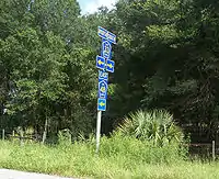
Florida State Road 48
State Road 48 (SR 48) was an east–west state highway that ran from U.S. Highway 41 in Floral City, Florida to Florida State Road 19 in Howey-in-the-Hills, Florida. In the last years of the route's existence, it was a 2.167 miles (3.487 km) state road in Bushnell, Florida which ran from Interstate 75 (I-75) at exit 314 to U.S. Highway 301 (US 301). Today, all segments are designated County Road 48 (CR 48) where they are under county maintenance. Segments in Sumter County are part of the Scenic Sumter Heritage Byway.[1]
| ||||
|---|---|---|---|---|
| Route information | ||||
| Maintained by FDOT | ||||
| Existed | 1945 renumbering (definition)–2016 | |||
| Major junctions | ||||
| West end | ||||
| East end | ||||
| Location | ||||
| Counties | Citrus, Sumter, Lake | |||
| Highway system | ||||
| ||||

Route description and History
The route includes former segments of Florida State Roads 2, 22, 23, 210, 212, and 214 which were designated as SR 48 as part of the 1945 great renumbering.
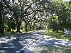
SR 48 ran from US 41 in Floral City, in Citrus County. Within Floral City itself, it is called East Orange Avenue, while east of the city it is known as East Bushnell Road. After crossing the Withlacoochee River it wound through western Sumter County along part of the DeSoto Trail. Within Wahoo, the road passes by the "DeSoto Trailhead" near a memorial for the Battle of Wahoo Swamp, and the Wahoo First Baptist Church.
East of CR 316A the road becomes a four lane undivided highway in Bushnell until it approaches Interstate 75 where it becomes a four-lane divided highway. The divided section ends east of the vicinity of the Walmart Supercenter. The widened segment continues into downtown Bushnell until in intersects CR 475 and CR 548. From there it turns south as a four-lane boulevard before intersecting with US 301.
The former SR 48 runs concurrently with southbound US 301 as well as westbound CR 476 along North Main Street which becomes South Main Street at the intersection with West and East Central Avenues. The overlap ends at West Seminole Avenue, where CR 476 turns west towards Nobleton, Lake Lindsey and US 19 at the Chassahowitzka Wildlife Management Area while CR 48 tuns east. West Seminole Avenue ends at the intersection with South Florida Street and East Southland Avenue. CR 48 turns south onto East Southland Avenue which curves east before leaving Bushnell's city limits, and heads through the rest of rural Sumter County. North of the city of Webster it intersects with SR 471 as it heads towards Center Hill. Northeast of Center Hill, SR 48 crossed the Sumter–Lake county line and was named Leesburg Highway. In Okahumpka, the road runs concurrently with CR 33, then turned at 1st Street, taking the designation from CR 470 on its way to SR 19 in Howey-in-the-Hills.
Major intersections
| County | Location | mi[2][3] | km | Destinations | Notes |
|---|---|---|---|---|---|
| Citrus | Floral City | 0.000 | 0.000 | ||
| | 1.7[4] | 2.7 | |||
| | 2.1[4] | 3.4 | |||
| Withlacoochee River | 4.0 | 6.4 | Bridge | ||
| Sumter | | 4.6[4] | 7.4 | ||
| | 12.116 | 19.499 | west end of state maintenance | ||
| | 12.17 | 19.59 | I-75 exit 314 | ||
| Bushnell | 14.030 | 22.579 | west end of SR 475 overlap | ||
| 14.283 | 22.986 | east end of SR 475 overlap; west end of US 301 / SR 35 overlap; east end of SR 48 (becomes CR 48) | |||
| 14.816 | 23.844 | east end of US 301 / SR 35 overlap (and of state maintenance); west end of CR 476 overlap | |||
| 15.1[4] | 24.3 | east end of CR 476 overlap | |||
| Bevilles Corner | 18.7[4] | 30.1 | |||
| Center Hill | 22.2[4] | 35.7 | |||
| 22.5[4] | 36.2 | ||||
| Lake | Leesburg | 31.2[4] | 50.2 | west end of CR 33 overlap | |
| Okahumpka | 31.7[4] | 51.0 | east end of CR 33 overlap | ||
| Leesburg | 32.8[4] | 52.8 | |||
| Howey-in-the-Hills | 39.8[4] | 64.1 | |||
1.000 mi = 1.609 km; 1.000 km = 0.621 mi
| |||||
References
- Map of the Scenic Sumter Heritage Byway (Official Site)
- FDOT straight line diagrams Archived March 6, 2014, at the Wayback Machine, accessed February 2014
- FDOT GIS data Archived 2008-12-11 at the Wayback Machine, accessed January 2014
- Google Maps distance
External links
| Wikimedia Commons has media related to Florida State and County Roads 48. |