Florida State Road 687
State Road 687 (SR 687) is a north–south state road located solely within the borders of St. Petersburg, Florida. The entire road runs from Interstate 175 north to Interstate 375 entirely along 4th Street N. It runs partly concurrent with US 92 along 4th Street from the SR 694/SR 686/unsigned SR 600 intersection in northeast St. Petersburg to 5th Avenue N (SR 595) in downtown St. Petersburg.
| ||||
|---|---|---|---|---|
| 4th Street | ||||
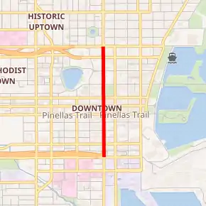
SR 687 highlighted in red | ||||
| Route information | ||||
| Maintained by FDOT | ||||
| Length | 9.446 mi[1] (15.202 km) | |||
| Existed | 1945–present | |||
| Major junctions | ||||
| South end | ||||
| North end | ||||
| Location | ||||
| Counties | Pinellas | |||
| Highway system | ||||
| ||||

History
Major intersections
The entire route is in St. Petersburg, Pinellas County.
| mi[1] | km | Destinations | Notes | ||||
|---|---|---|---|---|---|---|---|
| 0.000 | 0.000 | ||||||
| 0.018 | 0.029 | northbound access is via 4th Avenue South | |||||
| 0.377 | 0.607 | ||||||
| 0.895 | 1.440 | south end of US 92 overlap | |||||
| see US 92 (mile 0.000-5.998) | |||||||
| 6.893 | 11.093 | north end of US 92 overlap | |||||
| 9.446 | 15.202 | ||||||
1.000 mi = 1.609 km; 1.000 km = 0.621 mi
| |||||||
References
- FDOT straight line diagrams Archived March 6, 2014, at the Wayback Machine, accessed March 2014
This article is issued from Wikipedia. The text is licensed under Creative Commons - Attribution - Sharealike. Additional terms may apply for the media files.