Ford, Kansas
Ford is a city in Ford County, Kansas, United States. As of the 2010 census, the city population was 216.[6]
Ford, Kansas | |
|---|---|
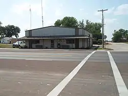 Post office in Ford (2009) | |
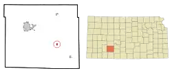 Location within Ford County and Kansas | |
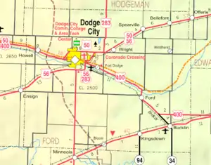 KDOT map of Ford County (legend) | |
| Coordinates: 37°38′10″N 99°45′11″W | |
| Country | United States |
| State | Kansas |
| County | Ford |
| Founded | 1885 |
| Incorporated | 1887 |
| Named for | Col. James Hobart Ford |
| Area | |
| • Total | 0.42 sq mi (1.10 km2) |
| • Land | 0.42 sq mi (1.10 km2) |
| • Water | 0.00 sq mi (0.00 km2) |
| Elevation | 2,398 ft (731 m) |
| Population | |
| • Total | 216 |
| • Estimate (2019)[3] | 216 |
| • Density | 510.64/sq mi (197.03/km2) |
| Time zone | UTC-6 (CST) |
| • Summer (DST) | UTC-5 (CDT) |
| ZIP code | 67842 |
| Area code | 620 |
| FIPS code | 20-23725 [4] |
| GNIS ID | 0473897 [5] |
History
Ford was founded in about 1885.[7] It was named for Col. James Hobart Ford.[8]
The first post office in Ford was established in February 1885.[9]
Geography
Ford is located at 37°38′10″N 99°45′11″W (37.635977, -99.753013).[10] According to the United States Census Bureau, the city has a total area of 0.42 square miles (1.09 km2), all land.[11]
Demographics
| Historical population | |||
|---|---|---|---|
| Census | Pop. | %± | |
| 1890 | 148 | — | |
| 1900 | 82 | −44.6% | |
| 1910 | 205 | 150.0% | |
| 1920 | 272 | 32.7% | |
| 1930 | 382 | 40.4% | |
| 1940 | 296 | −22.5% | |
| 1950 | 244 | −17.6% | |
| 1960 | 252 | 3.3% | |
| 1970 | 246 | −2.4% | |
| 1980 | 272 | 10.6% | |
| 1990 | 247 | −9.2% | |
| 2000 | 314 | 27.1% | |
| 2010 | 216 | −31.2% | |
| 2019 (est.) | 216 | [3] | 0.0% |
| U.S. Decennial Census | |||
2010 census
As of the census[2] of 2010, there were 216 people, 96 households, and 59 families residing in the city. The population density was 514.3 inhabitants per square mile (198.6/km2). There were 120 housing units at an average density of 285.7 per square mile (110.3/km2). The racial makeup of the city was 87.0% White, 0.5% African American, 3.7% Native American, 6.9% from other races, and 1.9% from two or more races. Hispanic or Latino of any race were 8.3% of the population.
There were 96 households, of which 25.0% had children under the age of 18 living with them, 44.8% were married couples living together, 12.5% had a female householder with no husband present, 4.2% had a male householder with no wife present, and 38.5% were non-families. 33.3% of all households were made up of individuals, and 10.5% had someone living alone who was 65 years of age or older. The average household size was 2.25 and the average family size was 2.88.
The median age in the city was 44.1 years. 20.4% of residents were under the age of 18; 6% were between the ages of 18 and 24; 26.3% were from 25 to 44; 31.5% were from 45 to 64; and 15.7% were 65 years of age or older. The gender makeup of the city was 50.0% male and 50.0% female.
2000 census
As of the census[4] of 2000, there were 314 people, 111 households, and 87 families residing in the city. The population density was 748.3 people per square mile (288.7/km2). There were 121 housing units at an average density of 288.4 per square mile (111.2/km2). The racial makeup of the city was 94.90% White, 0.32% Native American, 3.50% from other races, and 1.27% from two or more races. Hispanic or Latino of any race were 10.51% of the population.
There were 111 households, out of which 36.0% had children under the age of 18 living with them, 67.6% were married couples living together, 4.5% had a female householder with no husband present, and 21.6% were non-families. 20.7% of all households were made up of individuals, and 7.2% had someone living alone who was 65 years of age or older. The average household size was 2.83 and the average family size was 3.26.
In the city, the population was spread out, with 30.3% under the age of 18, 9.6% from 18 to 24, 30.3% from 25 to 44, 19.7% from 45 to 64, and 10.2% who were 65 years of age or older. The median age was 31 years. For every 100 females, there were 113.6 males. For every 100 females age 18 and over, there were 112.6 males.
The median income for a household in the city was $34,545, and the median income for a family was $36,346. Males had a median income of $27,917 versus $11,944 for females. The per capita income for the city was $15,037. About 8.7% of families and 9.7% of the population were below the poverty line, including 12.8% of those under age 18 and none of those age 65 or over.
Education
Ford is a part of USD 459 Bucklin. The Bucklin High School mascot is Bucklin Red Aces.[12]
Ford High School was closed in school unification. The Ford Bulldogs[13] won the Kansas State High School boys class BB Track & Field championship in 1964 and 1966.[14]
Parks and Recreation
References
- "2019 U.S. Gazetteer Files". United States Census Bureau. Retrieved July 24, 2020.
- "U.S. Census website". United States Census Bureau. Retrieved 2012-07-06.
- "Population and Housing Unit Estimates". United States Census Bureau. May 24, 2020. Retrieved May 27, 2020.
- "U.S. Census website". United States Census Bureau. Retrieved 2008-01-31.
- "US Board on Geographic Names". United States Geological Survey. 2007-10-25. Retrieved 2008-01-31.
- "2010 City Population and Housing Occupancy Status". U.S. Census Bureau. Retrieved July 20, 2011.
- Kansas State Historical Society (1916). Biennial Report of the Board of Directors of the Kansas State Historical Society. Kansas State Printing Plant. pp. 190.
- Gannett, Henry (1905). The Origin of Certain Place Names in the United States. Govt. Print. Off. pp. 128.
- "Kansas Post Offices, 1828-1961 (archived)". Kansas Historical Society. Archived from the original on October 9, 2013. Retrieved 10 June 2014.
- "US Gazetteer files: 2010, 2000, and 1990". United States Census Bureau. 2011-02-12. Retrieved 2011-04-23.
- "US Gazetteer files 2010". United States Census Bureau. Archived from the original on 2012-01-25. Retrieved 2012-07-06.
- "Bucklin USD 459". USD 459. Retrieved 5 January 2017.
- "Two Unbeaten Teams In Class BB State Tourney", The Salina Journal, 9 March 1966, p.12.
- "Track & Field". KSHSAA. Retrieved 6 January 2017.
Further reading
External links
- City
- Maps
- Ford City Map, KDOT
Municipalities and communities of Ford County, Kansas, United States | ||
|---|---|---|
| Cities | 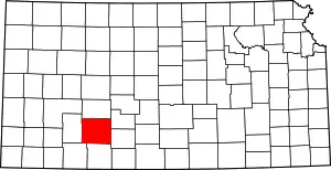 Map of Kansas highlighting Ford County | |
| Unincorporated communities | ||
| Townships | ||
| Footnotes | †This populated place is designated a Census-Designated Place (CDP) by the United States Census Bureau | |
| ||