Fork Branch (St. Jones River tributary)
Fork Branch is a 9.48 mi (15.26 km) long 3rd order tributary to the St. Jones River in Kent County, Delaware.
| Fork Branch Tributary to St. Jones River | |
|---|---|
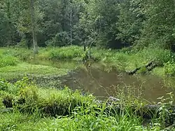 Fork Branch in Dover, Delaware | |
  | |
| Location | |
| Country | United States |
| State | Delaware |
| County | Kent |
| City | Dover |
| Physical characteristics | |
| Source | Pinks Branch and Jordan Branch divides |
| • location | about 0.1 miles west of Seeneytown, Delaware |
| • coordinates | 39°11′47″N 075°39′42″W[1] |
| • elevation | 70 ft (21 m)[2] |
| Mouth | St. Jones River |
• location | Silver Lake in Dover, Delaware |
• coordinates | 39°10′57″N 075°32′55″W[1] |
• elevation | 14 ft (4.3 m)[2] |
| Length | 9.48 mi (15.26 km)[3] |
| Basin size | 30.64 square miles (79.4 km2)[4] |
| Discharge | |
| • average | 37.81 cu ft/s (1.071 m3/s) at mouth with Fork Branch[4] |
| Basin features | |
| Progression | east then southeast |
| River system | St. Jones River |
| Tributaries | |
| • left | Maidstone Branch McKees Run |
| • right | unnamed tributaries |
| Bridges | Shaws Corner Road, Rose Dale Lane, Pearsons Corner Road, Kenton Road, McKee Road, W Denny Road, Scarborough Road, College Road, North State Street |
Variant names
According to the Geographic Names Information System, it has also been known historically as:[1]
- Cranbrook River
- Downs Branch
- Fisher Branch
- Warge Kijhlen
- Wulfs Creek
Course
Fork Branch rises on the Pinks Branch and Jordan Branch divide about 0.1 miles west of Seeneytown, Delaware.[2]
Watershed
Fork Branch drains 30.64 square miles (79.4 km2) of area, receives about 44.8 in/year of precipitation, has a topographic wetness index of 654.31 and is about 10.5% forested.[4]
See also
Maps
.jpg.webp)
Fork Branch (St. Jones River tributary)
.jpg.webp)
Watershed of Fork Branch (St. Jones River tributary)
References
- "GNIS Detail - Fork Branch". geonames.usgs.gov. US Geological Survey. Retrieved 5 March 2020.
- "Cahoon Branch Topo Map, Kent County DE (Dover Area)". TopoZone. Locality, LLC. Retrieved 5 March 2020.
- "ArcGIS Web Application". epa.maps.arcgis.com. US EPA. Retrieved 5 March 2020.
- "Fork Branch Watershed Report". Waters Geoviewer. US EPA. Retrieved 5 March 2020.
Dover (capital) | ||
| Topics |
|  |
| Society |
| |
| Cities | ||
| Towns |
| |
| Counties | ||
This article is issued from Wikipedia. The text is licensed under Creative Commons - Attribution - Sharealike. Additional terms may apply for the media files.