Francisco I. Madero, Coahuila
Francisco I. Madero is a city in the northern Mexican state of Coahuila. It is located at the southwestern part of the state near the Durango state border, in the economic region known as Laguna at 25°46′31″N 103°16′23″W, at a mean height of 1,100m above sea level. It serves as the municipal seat for the Francisco I. Madero Municipality, Coahuila.
Francisco I. Madero | |
|---|---|
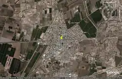 Aerial view of Francisco I. Madero | |
Francisco I. Madero Location in Mexico | |
| Coordinates: 25°46′31″N 103°16′23″W | |
| Country | |
| State | Coahuila |
| Municipality | Francisco I. Madero |
| First settled | 1895 |
| Town status | 30 November 1936 |
| City status | 30 November 1986 |
| Elevation | 1,100 m (3,600 ft) |
| Population (2005) | |
| • Total | 50,084 |
| Postal code | 27900 |
| Area code(s) | 872 |
| Website | www.fimcoahuila.gob.mx |
It is named for Revolutionary hero Francisco I. Madero, a native of nearby Parras de la Fuente.
The city is located 200 km from the state capital, Saltillo. It had a 2005 census population of 30,084, while its surrounding municipality had a total population of 51,528.
References
- Link to tables of population data from Census of 2005 INEGI: Instituto Nacional de Estadística, Geografía e Informática
- Coahuila Enciclopedia de los Municipios de México
External links
- Municipio Francisco I. Madero Official website

| Authority control |
|
|---|
This article is issued from Wikipedia. The text is licensed under Creative Commons - Attribution - Sharealike. Additional terms may apply for the media files.