Franklin Delano Roosevelt Bridge
The Franklin Delano Roosevelt Bridge is an international bridge which connects the community of Lubec, Maine[1] in the United States with Campobello Island in the Canadian province of New Brunswick across the Lubec Narrows. The decked steel beam bridge is named for Franklin D. Roosevelt, the 32nd President of the United States, who maintained a summer retreat on Campobello (now preserved as Roosevelt Campobello International Park). A plaque in the middle of the bridge is the easternmost physical marker of the Canada–United States border.[2]
Franklin Delano Roosevelt Bridge | |
|---|---|
| Coordinates | 44°51′33.8″N 66°58′48.8″W |
| Carries | |
| Crosses | Lubec Channel |
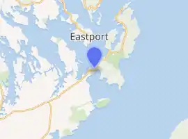
| Locale | Lubec, Maine and Campobello, New Brunswick |
| Other name(s) | Roosevelt International Bridge |
| Named for | Franklin D. Roosevelt |
| Characteristics | |
| Material | Steel |
| History | |
| Construction start | 1958 |
| Opened | 1962 |
| Location | |
| |
The bridge, connecting New Brunswick Route 774 to Maine State Route 189, is Campobello Island's only fixed connection to the mainland of North America; all of the island's transportation connections to the rest of New Brunswick are by seasonal ferry.[3]
Border crossing
U.S. Customs and Border Protection and Canada Border Services Agency stations are located at each end of the Franklin Delano Roosevelt Bridge, forming the Lubec-Campobello Border Crossing. Although a ferry connected Lubec with Campobello Island for many years, permanent border inspection facilities were not deployed until the bridge was completed in 1962. The US operated out of a mobile home for the first two years.[4]
History
In 1958, the Canadian government passed the Campobello-Lubec Bridge Act providing for the framework for the construction of the span.[5] Following a few years of planning, the bridge opened to traffic in 1962, with its official dedication occurring on August 15, 1962.[6]
Gallery
 Lubec, Maine and the FDR Bridge
References
- "Lubec, Maine - Building the Roosevelt Bridge to Campobello". Lubec.mainememory.net. Retrieved 2016-02-27.
- "Chapter 1: Eastern Maine". United Divide: A Linear Portrait of the USA/Canada Border. The Center for Land Use Interpretation. Winter 2015.
- Cuprisin, Tim (June 14, 2008). "Tranquil Campobello Island honors FDR". The Milwaukee Journal-Sentinel.
- "U.S. Customs and Post Office construction, Lubec, ca. 1963". Retrieved 2014-08-24.
- "Campobello-Lubec Bridge Act ( 1958, c. 23 )". Retrieved 2008-08-19.
- Mahar, Martin (April 10, 2000). "Local town history centennial projects written by students about their communities". The Bangor Daily News.