Frilihorn
The Frilihorn is a mountain of the Swiss Pennine Alps, located between the Val d'Anniviers and the Turtmanntal in the canton of Valais.
| Frilihorn | |
|---|---|
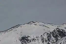 View from Sorebois (west side) | |
| Highest point | |
| Elevation | 3,124 m (10,249 ft) [1] |
| Coordinates | 46°10′4.8″N 7°40′17.3″E |
| Geography | |
 Frilihorn Location in Switzerland | |
| Location | Valais, Switzerland |
| Parent range | Pennine Alps |
The Frilihorn rises to a height of 10,249 ft (3,124 m), making it the 758th highest mountain in Switzerland. It is located east of Ayer and south of Gruben. It sits to the north of Wängerhorn peak, south of Minugrat peak and south east of L'Omen Roso peak.[2]
External links
References
- Retrieved from the Swisstopo topographic maps.
- "Archived copy". Archived from the original on 2012-07-16. Retrieved 2011-12-02.CS1 maint: archived copy as title (link)
This article is issued from Wikipedia. The text is licensed under Creative Commons - Attribution - Sharealike. Additional terms may apply for the media files.