Fryerstown, Victoria
Fryerstown is a small town in the Goldfields region of Victoria, Australia.
| Fryerstown Victoria | |||||||||||||||
|---|---|---|---|---|---|---|---|---|---|---|---|---|---|---|---|
 Fryerstown | |||||||||||||||
| Coordinates | 37°08′S 144°15′E | ||||||||||||||
| Population | 228 (2016 census)[1] | ||||||||||||||
| Postcode(s) | 3451 | ||||||||||||||
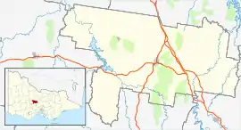
| Location |
| ||||||||||||||
| LGA(s) | Shire of Mount Alexander | ||||||||||||||
| State electorate(s) | Macedon | ||||||||||||||
| Federal Division(s) | Bendigo | ||||||||||||||
| |||||||||||||||
At the 2016 census, Fryerstown and the surrounding area had a population of 228,[1] which peaked at 15,000 during the Victorian gold rush.
The Post Office opened on 19 April 1854 as Fryer's Creek, was renamed Fryerstown in 1856, and closed in 1975.[2] Fryerstown Court House opened in 1879 and closed in 1930.[3]
Fryerstown formerly had a police station, court, churches, school, hotels and various stores. All are now closed and the nearest general store, church or petrol station is now at Chewton or Castlemaine. There is a public hall.
References
- "2016 Census QuickStats Fryerstown". Australian Bureau of Statistics. Retrieved 24 January 2019.
- Premier Postal History, Post Office List, retrieved 11 April 2008
- "Special Report No. 4 - Court Closures in Victoria" (PDF). Auditor-General of Victoria. 1986. p. 58. Retrieved 12 April 2020.
External links
This article is issued from Wikipedia. The text is licensed under Creative Commons - Attribution - Sharealike. Additional terms may apply for the media files.