Galina (Austria)
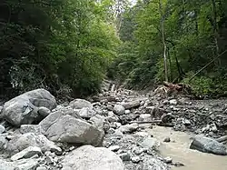
The Galina originates near the northeast of the Galinakopf summit,[1] near the Rossboden, 2,060 metres (6,760 ft) above sea level. With a length of about 5.80 km (3.60 mi) it is one of the shortest rivers of Vorarlberg. It flows into the Ill between Frastanz and Feldkirch.[2]
| Galina | |
|---|---|
 | |
| Location | |
| Country | Austria |
| State | Vorarlberg |
| Physical characteristics | |
| Source | |
| • location | northeast of the Galinakopf |
| • coordinates | 47.1608°N 9.6393°E |
| • elevation | 2,060 m (6,760 ft) |
| Mouth | |
• location | into the Ill between Frastanz and Feldkirch |
• coordinates | 47.2085°N 9.6662°E |
| Length | ~ 5.80 km (3.60 mi) |
| Basin features | |
| Progression | Ill→ Rhine→ North Sea |
The Galina is a river of Vorarlberg, Austria.
References
- Google (8 February 2020). "Galina source" (Map). Google Maps. Google. Retrieved 8 February 2020.
- Google (8 February 2020). "Galina mouth" (Map). Google Maps. Google. Retrieved 8 February 2020.
This article is issued from Wikipedia. The text is licensed under Creative Commons - Attribution - Sharealike. Additional terms may apply for the media files.