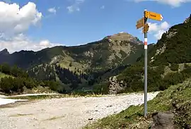
Galinakopf
Galinakopf is a mountain on the border of Austria and Liechtenstein in the Rätikon range of the Eastern Alps, with a height of 2,198 metres (7,211 ft).
| Galinakopf | |
|---|---|
 | |
| Highest point | |
| Elevation | 2,198 m (7,211 ft) |
| Prominence | 331 m (1,086 ft) |
| Isolation | 3.85 km (2.39 mi) |
| Coordinates | 47°09′06″N 9°37′14″E |
| Geography | |
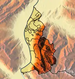 Galinakopf Location in Liechtenstein, on the border with Austria | |
| Location | Liechtenstein / Vorarlberg, Austria |
| Parent range | Rätikon, Alps |
References
- Unfolding Liechtenstein, Panorama Map (Map). Liechtenstein Tourismus. 2007.
- Feldkirch - Vaduz (Map). 1:50000. Wander, Bike- und Skitourenkarte. Cartography by Kompass-Karten GmbH. Kompass. 2007.
This article is issued from Wikipedia. The text is licensed under Creative Commons - Attribution - Sharealike. Additional terms may apply for the media files.