Garfield, Indiana
Garfield is an unincorporated community in Union Township, Montgomery County, in the U.S. state of Indiana.[3]
Garfield, Indiana | |
|---|---|
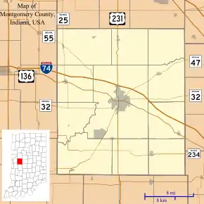 Garfield Location in Montgomery County | |
| Coordinates: 40°04′59″N 86°49′26″W | |
| Country | United States |
| State | Indiana |
| County | Montgomery |
| Township | Union |
| Elevation | 797 ft (243 m) |
| Time zone | UTC-5 (Eastern (EST)) |
| • Summer (DST) | UTC-4 (EDT) |
| ZIP code | 47933 |
| Area code(s) | 765 |
| FIPS code | 18-26375[2] |
| GNIS feature ID | 434956 |
History
A post office was established at Garfield in 1880, and remained in operation until 1907.[4] The community was named after James A. Garfield (1831–1881), 20th President of the United States.[5]
Geography
Garfield is located at 40°04′59″N 86°49′26″W.
Education
Residents are zoned to North Montgomery Community School Corporation schools. Elementary students are zoned to Sugar Creek Elementary School.[6] Secondary students attend Northridge Middle School and North Montgomery High School.
References
- "US Board on Geographic Names". United States Geological Survey. October 25, 2007. Retrieved 2017-05-09.
- "U.S. Census website". United States Census Bureau. Retrieved 2008-01-31.
- "Garfield, Indiana". Geographic Names Information System. United States Geological Survey. Retrieved 2009-10-17.
- "Montgomery County". Jim Forte Postal History. Retrieved 7 September 2015.
- Baker, Ronald L. (October 1995). From Needmore to Prosperity: Hoosier Place Names in Folklore and History. Indiana University Press. p. 141. ISBN 978-0-253-32866-3.
...probably named for James A. Garfield, who was elected president...
- "About Us" (Archive). North Montgomery School Corporation. Retrieved on December 25, 2016. See attendance boundary map on the page.
Municipalities and communities of Montgomery County, Indiana, United States | ||
|---|---|---|
| City | Map of Indiana highlighting Montgomery County | |
| Towns | ||
| Townships | ||
| CDP | ||
| Other unincorporated communities |
| |
| Footnotes | ‡This populated place also has portions in an adjacent county or counties | |
| ||
This article is issued from Wikipedia. The text is licensed under Creative Commons - Attribution - Sharealike. Additional terms may apply for the media files.
