Gascoyne Junction, Western Australia
Gascoyne Junction is a small town in the Gascoyne region of Western Australia, inland from Carnarvon on the junction of the Gascoyne River and Lyons River. At the 2006 census, Gascoyne Junction had a population of 149.[1]
| Gascoyne Junction Western Australia | |
|---|---|
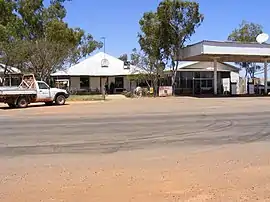 The Gascoyne Junction Hotel in 2007, destroyed in the 2010 floods | |
 Gascoyne Junction | |
| Coordinates | 25.05°S 115.21°E |
| Population | 149 (2006 census)[1] |
| Established | 1897 |
| Postcode(s) | 6705 |
| Elevation | 144 m (472 ft) |
| Location | |
| LGA(s) | Shire of Upper Gascoyne |
| State electorate(s) | North West |
| Federal Division(s) | Durack |
History
The town is named for its position at the junction of the Gascoyne and Lyons Rivers. The Gascoyne River was named by the explorer Lieutenant George Grey in 1839 after his friend, Captain J. Gascoyne (RN).
A police station was built in about 1897, and settlers asked the Government to declare a townsite. By 1909, a general store and other buildings had been erected on private land, and in 1912, the Government finally acceded to the request, naming the town "Killili" after a local Aboriginal word meaning "bullrush" following the Surveyor General's request for a "euphonious native name". For many years, the police station, road board (1912) and hotel were the only buildings in the area, and in 1938, the Roads Board complained about the name, saying that "Gascoyne Junction" and "The Junction" were the names in common use, and asking the Lands Department to "expunge" the name of Killili. The name was changed and gazetted in 1939.[2]
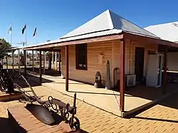
The local road board office, now a heritage-listed site, was used as a meeting place for local associations, and later as the first school in the area (1960–1965) and, since the late 1990s, as a museum.[3] The town's population has been stable since the 1950s.
Present day
Gascoyne Junction is now a centre for mining, pastoral and desert merino fine wool industries, and serves as a gateway to nearby attractions such as Mount Augustus National Park. The town contains the council office, as well as The Junction Hotel, which offers accommodation and pub meals and was originally constructed in 1906 as the general store. A fuel station, visitor centre and picnic facilities at Federation Park (2001) are also available, and a library at the school is open to the public, while a telecentre is proposed. The Junction Hotel has facilities for caravans, camper trailers and motorhomes as does a basic caravan park adjacent to the hotel. It was reported to be the least religious place in Australia, with 66.5 per cent of the population stating that they had no religion in the 2016 Census.[4]
Transport and utilities
Power is supplied by Horizon Power, who run a diesel power station in the town. The town supplies its own water from bores, which is treated by the Water Corporation. The Carnarvon–Mullewa Road, which passes through the town, is sealed between Carnarvon and Gascoyne Junction; a ceremony to mark the reconstruction of the last section was held on 20 May 2011. Australia Post services the region with private contractors, who also deliver petroleum and cargo.[5][6]
Education
A new Remote Community School was opened in 2005 for kindergarten through year 12, with high school and some TAFE classes being provided through the School of Isolated and Distance Education. It replaces an earlier school going back to 1960, and its students have historically used the Carnarvon School of the Air program. Many of the students are of Indigenous origin.[7] The nearest TAFE facility is in Carnarvon, and the nearest university courses are offered at Carnarvon High School through Open Universities Australia, and through Pilbara TAFE in Karratha and Port Hedland, which offer some Curtin University courses through the Centre for Regional Education.
2010 floods
Evacuation was required due to the Gascoyne River floods of late December 2010.[8]
Climate
Gascoyne Junction has a hot desert climate (Köppen climate classification: DWH), with very hot summers and mild winters. It holds the Australian record for the hottest Christmas day of 48.3 °C (118.9 °F), set in 1997.[9]
| Month | Jan | Feb | Mar | Apr | May | Jun | Jul | Aug | Sep | Oct | Nov | Dec | Year |
|---|---|---|---|---|---|---|---|---|---|---|---|---|---|
| Record high °C (°F) | 48.6 (119.5) |
48.8 (119.8) |
46.5 (115.7) |
44.2 (111.6) |
38.5 (101.3) |
30.8 (87.4) |
32.1 (89.8) |
36.2 (97.2) |
39.6 (103.3) |
42.5 (108.5) |
45.0 (113.0) |
48.3 (118.9) |
48.8 (119.8) |
| Average high °C (°F) | 40.7 (105.3) |
39.8 (103.6) |
37.5 (99.5) |
32.9 (91.2) |
27.7 (81.9) |
23.8 (74.8) |
23.1 (73.6) |
24.9 (76.8) |
28.3 (82.9) |
32.4 (90.3) |
35.3 (95.5) |
38.7 (101.7) |
32.1 (89.8) |
| Average low °C (°F) | 23.9 (75.0) |
24.4 (75.9) |
22.5 (72.5) |
18.7 (65.7) |
13.8 (56.8) |
10.5 (50.9) |
9.5 (49.1) |
10.0 (50.0) |
12.0 (53.6) |
15.5 (59.9) |
18.1 (64.6) |
21.3 (70.3) |
16.7 (62.0) |
| Record low °C (°F) | 15.5 (59.9) |
15.6 (60.1) |
13.0 (55.4) |
8.3 (46.9) |
3.9 (39.0) |
2.4 (36.3) |
1.4 (34.5) |
1.3 (34.3) |
4.4 (39.9) |
6.1 (43.0) |
8.9 (48.0) |
14.0 (57.2) |
1.3 (34.3) |
| Average rainfall mm (inches) | 23.7 (0.93) |
29.1 (1.15) |
30.2 (1.19) |
14.4 (0.57) |
27.2 (1.07) |
31.5 (1.24) |
27.0 (1.06) |
11.9 (0.47) |
3.0 (0.12) |
4.5 (0.18) |
3.5 (0.14) |
4.2 (0.17) |
210.2 (8.29) |
| Average rainy days | 2.3 | 2.7 | 2.2 | 1.6 | 2.8 | 3.6 | 3.3 | 2.1 | 0.7 | 0.7 | 0.6 | 0.6 | 23.2 |
| Average relative humidity (%) (at 3pm) | 20 | 24 | 24 | 29 | 34 | 42 | 40 | 33 | 25 | 21 | 20 | 18 | 28 |
| Source: Bureau of Meteorology[10] | |||||||||||||
References
- Australian Bureau of Statistics (25 October 2007). "Gascoyne Junction (State Suburb)". 2006 Census QuickStats. Retrieved 10 July 2011.
- Western Australian Land Information Authority. "History of country town names – G". Retrieved 17 January 2007.
- Heritage Council of WA. "Register of Heritage Places - Upper Gascoyne Road Board Office (fmr)" (PDF). Archived from the original (PDF) on 23 August 2006. Retrieved 15 November 2006.
- Matt Young and Charis Chang (7 July 2017). "Australia's most religious and non-religious postcodes based on who answered the Census question regarding religion". News.com.au. News Pty Limited. Retrieved 31 August 2019.CS1 maint: uses authors parameter (link)
- Gascoyne Development Commission. "Gascoyne Economic Perspective (2006)" (PDF). Archived from the original (PDF) on 17 October 2006. Retrieved 15 November 2006.
- "Carnarvon–Mullewa Road". Main Roads Western Australia. 3 September 2014. Retrieved 1 October 2015.
- Information sourced from Education Department portal Archived 2007-10-28 at the Wayback Machine, accessed 2006-11-15
- http://www.abc.net.au/news/stories/2010/12/22/3099473.htm
- "Queensland to bake on Christmas Day". AM. Australian Broadcasting Corporation. 24 December 2003. Retrieved 11 March 2017.
- "Gascoyne Junction". Climate statistics for Australian locations. Bureau of Meteorology. Retrieved 11 March 2017.
External links
- Gascoyne Junction (WA Tourism)
- Gascoyne Junction - Climate (Bureau of Meteorology)