Gazzirola
The Gazzirola (also known as Garzirola) is a mountain of the Lugano Prealps on the Swiss-Italian border.
| Garzirola | |
|---|---|
| Garzirola | |
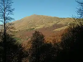 View from Val Colla (south-west side) | |
| Highest point | |
| Elevation | 2,116 m (6,942 ft) |
| Prominence | 56 m (184 ft) [1] |
| Parent peak | Vetta del Vallone |
| Coordinates | 46°07′05″N 9°04′21″E |
| Geography | |
 Garzirola Location in the Alps | |
| Location | Ticino, Switzerland Lombardy, Italy |
| Parent range | Lugano Prealps |
SOIUSA classification
According to the SOIUSA (International Standardized Mountain Subdivision of the Alps) the mountain can be classified in the following way:[2]
- main part = Western Alps
- major sector = North Western Alps
- section = Lugano Prealps
- subsection = Prealpi Comasche
- supergroup = Catena Gino-Camoghè-Fiorina
- group = Gruppo Camoghè-Bar
- subgroup = Sottogruppo del Camoghè
- code = I/B-11.I-A.2.a
Mountain huts
Not far from the mountain are located three mountain huts: Capanna San Lucio (1,540 m), Rifugio San Lucio (1,554 m) and Rifugio Garzirola (1,974 m).
Notes
- Retrieved from the Swisstopo topographic maps and Google Earth. The key col is located east of Monte Segor at 2,060 metres.
- Marazzi, Sergio (2005). Atlante Orografico delle Alpi. SOIUSA (in Italian). Priuli & Verlucca. ISBN 978-88-8068-273-8.
This article is issued from Wikipedia. The text is licensed under Creative Commons - Attribution - Sharealike. Additional terms may apply for the media files.