Geisenfeld
Geisenfeld is a town in the district of Pfaffenhofen, in Bavaria, Germany. It is situated on the river Ilm, 16 km (9.94 mi) southeast of Ingolstadt. The town grew up around Geisenfeld Abbey, a convent founded in 1037.
Geisenfeld | |
|---|---|
 Coat of arms | |
Location of Geisenfeld within Pfaffenhofen an der Ilm district  | |
 Geisenfeld  Geisenfeld | |
| Coordinates: 48°40′N 11°36′E | |
| Country | Germany |
| State | Bavaria |
| Admin. region | Oberbayern |
| District | Pfaffenhofen an der Ilm |
| Municipal assoc. | Geisenfeld |
| Subdivisions | 12 Ortsteile |
| Government | |
| • Mayor | Christian Staudter |
| Area | |
| • Total | 88.33 km2 (34.10 sq mi) |
| Elevation | 385 m (1,263 ft) |
| Population (2019-12-31)[1] | |
| • Total | 11,473 |
| • Density | 130/km2 (340/sq mi) |
| Time zone | UTC+01:00 (CET) |
| • Summer (DST) | UTC+02:00 (CEST) |
| Postal codes | 85290 |
| Dialling codes | 08452 |
| Vehicle registration | PAF |
| Website | www.geisenfeld.de |
Subdivisions
Geisenfeld has twelve districts, formerly independent municipalities:
- Engelbrechtsmünster
- Gaden including Wasenstadt and Furthof
- Geisenfeld
- Geisenfeldwinden
- Ilmendorf including Einberg
- Nötting
- Parleiten including Eichelberg, Holzleiten and Scheuerhof
- Rottenegg including Hornlohe, Moosmühle and Brunn
- Schillwitzried including Schillwitzhausen, Schafhof and Gießübel
- Untermettenbach including Obermettenbach and Ziegelstadel
- Unterpindhart including Kolmhof, Untereulenthal and Obereulenthal
- Zell including Ainau, Ritterswörth, Unterzell and Oberzell
Sons and daughters of the town

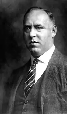
Gregor Strasser 1928
- Gregor Strasser (1892-1934), national socialist politician, publisher and participant in Hitler-Ludendorff-Putsch
References
- "Tabellenblatt "Daten 2", Statistischer Bericht A1200C 202041 Einwohnerzahlen der Gemeinden, Kreise und Regierungsbezirke". Bayerisches Landesamt für Statistik und Datenverarbeitung (in German). July 2020.
This article is issued from Wikipedia. The text is licensed under Creative Commons - Attribution - Sharealike. Additional terms may apply for the media files.