Georgia State Route 102
State Route 102 (SR 102) is a 32.0-mile-long (51.5 km) state highway in the east-central part of the U.S. state of Georgia. The highway travels from Warthen northeast through Mitchell, east through Gibson, southeast to Avera, and arcing east to Wrens.
| ||||
|---|---|---|---|---|
| Mitchell Road, Main Street, Broad Street | ||||
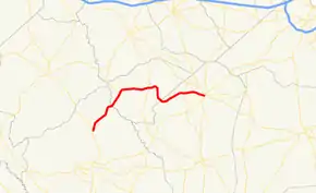 Georgia State Route 102 highlighted in red | ||||
| Route information | ||||
| Maintained by GDOT | ||||
| Length | 32.0 mi[1] (51.5 km) | |||
| Major junctions | ||||
| West end | ||||
| East end | ||||
| Location | ||||
| Counties | Washington, Glascock, Jefferson | |||
| Highway system | ||||
| ||||

Route description
SR 102 begins at an intersection with SR 15 in Warthen, in the north-central part of Washington County. The highway travels to the northeast, and crosses the Ogeechee River into Glascock County, before intersecting SR 123 (Mitchell–Shoals–Jewell Road) in Mitchell. Beginning with a short northeast portion, the highway turns east to an intersection with SR 171 in Gibson. The two highways have a one-block concurrency. SR 102 heads east, and, then, southeast to enter Jefferson County and then the town of Avera. It arcs to Stapleton, where it intersects SR 296. The two highways have a one-block concurrency. Finally, it arcs to its eastern terminus in Wrens, at an intersection with SR 17 (Thomson Road) and SR 80 (Stapleton Highway).[1]
SR 102 is not part of the National Highway System, a system of roadways important to the nation's economy, defense, and mobility.[2]
Major intersections
| County | Location | mi[1] | km | Destinations | Notes |
|---|---|---|---|---|---|
| Washington | Warthen | 0.0 | 0.0 | Western terminus | |
| Glascock | Mitchell | 10.5 | 16.9 | ||
| Gibson | 17.1 | 27.5 | West end of SR 171 concurrency | ||
| 17.1 | 27.5 | East end of SR 171 concurrency | |||
| Jefferson | Stapleton | 27.4 | 44.1 | West end of SR 296 concurrency | |
| 27.4 | 44.1 | East end of SR 296 concurrency | |||
| Wrens | 32.0 | 51.5 | Eastern terminus | ||
1.000 mi = 1.609 km; 1.000 km = 0.621 mi
| |||||
See also
.svg.png.webp) Georgia (U.S. state) portal
Georgia (U.S. state) portal U.S. roads portal
References
- Google (February 20, 2017). "Overview map of SR 102" (Map). Google Maps. Google. Retrieved February 20, 2017.
- National Highway System: Georgia (PDF) (Map). Federal Highway Administration. March 25, 2015. Retrieved February 20, 2017.
External links
![]() Media related to Georgia State Route 102 at Wikimedia Commons
Media related to Georgia State Route 102 at Wikimedia Commons