Georgia State Route 152
State Route 152 (SR 152) is a state highway that runs southwest–to–northeast through portions of Toombs and Tattnall counties in the east-central part of the U.S. state of Georgia. It runs from Lyons to Cobbtown.
| ||||
|---|---|---|---|---|
| New Cobbtown Road | ||||
 | ||||
| Route information | ||||
| Maintained by GDOT | ||||
| Length | 13.2 mi[1] (21.2 km) | |||
| Major junctions | ||||
| West end | ||||
| East end | ||||
| Location | ||||
| Counties | Toombs, Tattnall | |||
| Highway system | ||||
| ||||

Route description
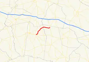
The route begins at an intersection with SR 292 in Lyons. It heads northeast to an intersection with SR 86, located southeast of Oak Park. It continues to the northeast until it meets its eastern terminus, an intersection with SR 23/SR 57/SR 121 in Cobbtown.
SR 152 is not part of the National Highway System, a system of routes determined to be the most important for the nation's economy, mobility and defense.[2]
Major intersections
| County | Location | mi[1] | km | Destinations | Notes |
|---|---|---|---|---|---|
| Toombs | Lyons | 0.0 | 0.0 | Western terminus | |
| | 6.4 | 10.3 | |||
| Ohoopee River | 7.7 | 12.4 | Unnamed bridge over the Ohoopee River; Toombs–Tattnall county line | ||
| Tattnall | Cobbtown | 13.2 | 21.2 | Eastern terminus | |
| 1.000 mi = 1.609 km; 1.000 km = 0.621 mi | |||||
See also
.svg.png.webp) Georgia (U.S. state) portal
Georgia (U.S. state) portal U.S. roads portal
References
- Google (June 13, 2013). "Route of SR 152" (Map). Google Maps. Google. Retrieved June 13, 2013.
- "National Highway System: Georgia" (PDF). United States Department of Transportation. May 8, 2009. Retrieved June 13, 2013.
This article is issued from Wikipedia. The text is licensed under Creative Commons - Attribution - Sharealike. Additional terms may apply for the media files.