Georgia State Route 153
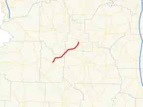
State Route 153 (SR 153) is a state highway that runs southwest–to–northeast through portions of Webster, Marion, Sumter, and Schley counties in the west-central part of the U.S. state of Georgia. The route runs from Preston to Ellaville.
| ||||
|---|---|---|---|---|
| Preston Road | ||||
 | ||||
| Route information | ||||
| Maintained by GDOT | ||||
| Length | 19.1 mi[1] (30.7 km) | |||
| Major junctions | ||||
| South end | ||||
| North end | ||||
| Location | ||||
| Counties | Webster, Marion, Sumter, and Schley | |||
| Highway system | ||||
| ||||
Route description
SR 153 begins at an intersection with SR 41 in Preston. It heads northeast through rural Webster County, before cutting across the extreme southeast corner of Marion County. It enters Sumter County to an intersection with SR 30. The route enters Schley County, and travels through rural portions of the county. It then meets its northern terminus, an intersection with SR 26 in Ellaville.[1]
SR 153 is not part of the National Highway System, a system of routes determined to be the most important for the nation's economy, mobility and defense.[2]
History
As of September 2009, the northern terminus of SR 153 was at US 19/SR 3 just south of Ellaville.[3] By 2012, when a new four-lane bypass moved US 19/SR 3 east of the city, SR 153 was extended north to SR 26.[4]
Major intersections
| County | Location | mi[1] | km | Destinations | Notes | |||
|---|---|---|---|---|---|---|---|---|
| Webster | Preston | 0.0 | 0.0 | Southern terminus | ||||
| Marion |
No major junctions | |||||||
| Sumter | | 9.2 | 14.8 | |||||
| Schley | Ellaville | 19.1 | 30.7 | Northern terminus | ||||
| 1.000 mi = 1.609 km; 1.000 km = 0.621 mi | ||||||||
See also
.svg.png.webp) Georgia (U.S. state) portal
Georgia (U.S. state) portal U.S. roads portal
References
- Google (June 13, 2013). "Route of SR 153" (Map). Google Maps. Google. Retrieved June 13, 2013.
- "National Highway System: Georgia" (PDF). United States Department of Transportation. May 8, 2009. Retrieved June 13, 2013.
- Google (January 6, 2012). "January 2008 StreetView of SR 153's former northern terminus" (Map). Google Maps. Google. Retrieved January 6, 2012.
- General Highway Map – Schley County, Georgia (PDF) (Map). Georgia Department of Transportation. 2012. Archived from the original (PDF) on January 6, 2013. Retrieved January 6, 2013.
