Georgia State Route 71
State Route 71 (SR 71) is a state highway in the northwest part of the U.S. state of Georgia. The highway runs 13.6 miles (21.9 km) from Dalton northeast and, then, north, to the Tennessee state line, northeast of Cohutta, where the roadway continues as Tennessee State Route 60.
| ||||
|---|---|---|---|---|
| Cleveland Highway | ||||
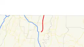 Georgia State Route 71 highlighted in red | ||||
| Route information | ||||
| Maintained by GDOT | ||||
| Length | 13.6 mi[1] (21.9 km) | |||
| Major junctions | ||||
| South end | ||||
| North end | ||||
| Location | ||||
| Counties | Whitfield | |||
| Highway system | ||||
| ||||

Route description
SR 71 begins at an intersection with US 41/US 76/SR 3 in Dalton as the Cleveland Highway. South of the intersection, the roadway continues as North Glenwood Avenue. The route briefly heads north out of the city. It then turns northeast before heading north for the rest of its routing. In Varnell is an intersection with SR 2. About two miles before the Tennessee State Line, the route narrows to two lanes. At the state line, SR 71 meets its northern terminus continuing into Bradley County towards Cleveland as Tennessee State Route 60.[1]
Major intersections
The entire route is in Whitfield County.
| Location | mi[1] | km | Destinations | Notes | |
|---|---|---|---|---|---|
| Dalton | 0.0 | 0.0 | Southern terminus | ||
| Varnell | 7.0 | 11.3 | |||
| | 13.6 | 21.9 | Continuation into Tennessee | ||
| 1.000 mi = 1.609 km; 1.000 km = 0.621 mi | |||||
See also
.svg.png.webp) Georgia (U.S. state) portal
Georgia (U.S. state) portal U.S. roads portal
References
- Google (October 11, 2012). "Route of SR 71" (Map). Google Maps. Google. Retrieved October 11, 2012.