Varnell, Georgia
Varnell is a city in Whitfield County, Georgia, United States. It is part of the Dalton, Georgia Metropolitan Statistical Area. The population was 1,744 at the 2010 census.
Varnell, Georgia | |
|---|---|
 Varnell City Hall | |
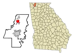 Location in Whitfield County and the state of Georgia | |
| Coordinates: 34°53′58″N 84°57′52″W | |
| Country | United States |
| State | Georgia |
| County | Whitfield |
| Area | |
| • Total | 3.83 sq mi (9.91 km2) |
| • Land | 3.83 sq mi (9.91 km2) |
| • Water | 0.00 sq mi (0.00 km2) |
| Elevation | 807 ft (246 m) |
| Population (2010) | |
| • Total | 1,744 |
| • Estimate (2019)[2] | 2,139 |
| • Density | 559.07/sq mi (215.87/km2) |
| Time zone | UTC-5 (Eastern (EST)) |
| • Summer (DST) | UTC-4 (EDT) |
| ZIP code | 30756 |
| Area code(s) | 706/762 |
| FIPS code | 13-78996[3] |
| GNIS feature ID | 0356614[4] |
| Website | cityofvarnell |
History
The Georgia General Assembly incorporated Varnell in 1968.[5] The community was named after M.P. Varnell, a railroad official.[6]
Geography
Varnell is located at 34°53′58″N 84°57′52″W (34.899367, -84.964573).[7]
According to the United States Census Bureau, the city has a total area of 2.5 square miles (6.5 km2), all land.
Demographics
| Historical population | |||
|---|---|---|---|
| Census | Pop. | %± | |
| 1880 | 99 | — | |
| 1970 | 314 | — | |
| 1980 | 282 | −10.2% | |
| 1990 | 358 | 27.0% | |
| 2000 | 1,491 | 316.5% | |
| 2010 | 1,744 | 17.0% | |
| 2019 (est.) | 2,139 | [2] | 22.6% |
| U.S. Decennial Census[8] | |||
As of the 2010 Census Varnell had a population of 1,744. The racial and ethnic composition of the population was 83.0% white (74.8% non-Hispanic white), 4.3% black or African American, 0.6% Native American, 1.5% Vietnamese, 1.3% other Asian, 8.0% some other race (0.3% non-Hispanic of some other race) and 1.4% from two or more races. 17.3% of the population was Hispanic or Latino, with the largest portion of that being the 14.0% of the population that was Mexican.[9]
As of the census[3] of 2000, there were 1,491 people, 510 households, and 421 families residing in the city. The population density was 606.9 people per square mile (234.0/km2). There were 526 housing units at an average density of 214.1 per square mile (82.6/km2). The racial makeup of the city was 88.73% White, 4.76% African American, 0.07% Native American, 0.40% Asian, 3.55% from other races, and 2.48% from two or more races. Hispanic or Latino of any race were 5.23% of the population.
There were 510 households, out of which 43.7% had children under the age of 18 living with them, 65.7% were married couples living together, 13.1% had a female householder with no husband present, and 17.3% were non-families. 12.9% of all households were made up of individuals, and 3.3% had someone living alone who was 65 years of age or older. The average household size was 2.92 and the average family size was 3.21.
In the city, the population was spread out, with 30.2% under the age of 18, 9.1% from 18 to 24, 32.9% from 25 to 44, 21.4% from 45 to 64, and 6.4% who were 65 years of age or older. The median age was 32 years. For every 100 females, there were 92.6 males. For every 100 females age 18 and over, there were 90.0 males.
The median income for a household in the city was $46,875, and the median income for a family was $48,674. Males had a median income of $34,000 versus $25,216 for females. The per capita income for the city was $18,214. About 5.8% of families and 6.8% of the population were below the poverty line, including 11.3% of those under age 18 and 15.3% of those age 65 or over.
References
- "2019 U.S. Gazetteer Files". United States Census Bureau. Retrieved July 9, 2020.
- "Population and Housing Unit Estimates". United States Census Bureau. May 24, 2020. Retrieved May 27, 2020.
- "U.S. Census website". United States Census Bureau. Retrieved January 31, 2008.
- "US Board on Geographic Names". United States Geological Survey. October 25, 2007. Retrieved January 31, 2008.
- "Varnell". GeorgiaGov. Retrieved June 25, 2019.
- Krakow, Kenneth K. (1975). Georgia Place-Names: Their History and Origins (PDF). Macon, GA: Winship Press. p. 241. ISBN 0-915430-00-2.
- "US Gazetteer files: 2010, 2000, and 1990". United States Census Bureau. February 12, 2011. Retrieved April 23, 2011.
- "Census of Population and Housing". Census.gov. Retrieved June 4, 2015.
- 2010 general profile of population and housing characteristics for Varnell from the US Census]
Municipalities and communities of Whitfield County, Georgia, United States | ||
|---|---|---|
| Cities | 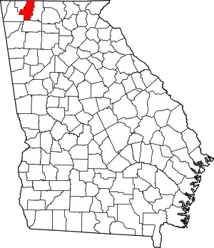 Map of Georgia highlighting Whitfield County | |
| Town | ||
| Unincorporated communities | ||
| ||