Glenville, Delaware
Glenville is a ghost town in Delaware, United States, at 39°42′45″N 75°38′24″W. The community consisted of a development on Bread and Cheese Island, on the east bank of the Red Clay Creek near its mouth, just south of Delaware Route 4 near Stanton. Located in the floodplain for Red Clay Creek, the subdivision has always been prone to flooding, such as flooding from Hurricane Floyd in 1999 and Tropical Storm Henri in 2003. After floods caused by Tropical Storm Henri on September 15, 2003, homeowners were bought out by the state and local government, and the community was abandoned in 2004. Demolition began in 2005. [2]
Glenville, Delaware | |
|---|---|
 A destroyed Glenville home on October 2, 2003, two weeks after Tropical Storm Henri flooded the subdivision | |
 Glenville  Glenville | |
| Coordinates: 39°42′45″N 75°38′24″W | |
| Country | United States |
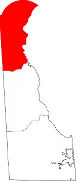
| State | Delaware |
| County | New Castle |
| Elevation | 20 ft (6 m) |
| Time zone | UTC-5 (Eastern (EST)) |
| • Summer (DST) | UTC-4 (EDT) |
| Area code(s) | 302 |
| GNIS feature ID | 216920[1] |
References
- "Glenville". Geographic Names Information System. United States Geological Survey.
- Chadderdon, Jesse (2005-08-19). "Ceremony marks end of Glenville community" (PDF). Brandywine Community News. p. 3. Archived from the original (PDF) on March 3, 2006. Retrieved 2007-01-29.
This article is issued from Wikipedia. The text is licensed under Creative Commons - Attribution - Sharealike. Additional terms may apply for the media files.