Glyka Nera
Glyka Nera (Greek: Γλυκά Νερά, Greek pronunciation: [ɣliˈka neˈra], meaning "sweet waters", named after an underground water source), is a rapidly growing suburb in the northeastern part of Athens, Greece. Since the 2011 local government reform it is part of the municipality Paiania, of which it is a municipal unit.[2] The municipal unit has an area of 9.238 km2.[3]
Glyka Nera
Γλυκά Νερά | |
|---|---|
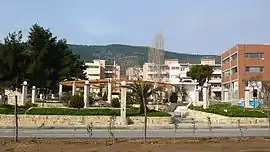 Main Square | |
 Glyka Nera Location within the regional unit 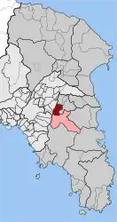 | |
| Coordinates: 37°59.5′N 23°50.9′E | |
| Country | Greece |
| Administrative region | Attica |
| Regional unit | East Attica |
| Municipality | Paiania |
| • Municipal unit | 9.238 km2 (3.567 sq mi) |
| Elevation | 220 m (720 ft) |
| Population (2011)[1] | |
| • Municipal unit | 11,049 |
| • Municipal unit density | 1,200/km2 (3,100/sq mi) |
| Time zone | UTC+2 (EET) |
| • Summer (DST) | UTC+3 (EEST) |
| Postal code | 153 xx |
| Area code(s) | 210 |
| Vehicle registration | Z |
| Website | paiania.gov.gr |
Geography
Glyka Nera is situated on the eastern slope of the northernmost part of the forested Hymettus mountain. It is 11 km east of central Athens, and 11 km northwest of the Eleftherios Venizelos International Airport. Adjacent towns are Gerakas to the northeast and Paiania to the south. Motorway 64 passes north of the town.
Historical population
| Year | Population |
|---|---|
| 1981 | 3,547 |
| 1991 | 5,813 |
| 2001 | 6,623 |
| 2011 | 11,049 |
Gallery
 Panorama
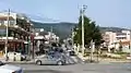 Downtown
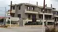 Architecture of Stavros
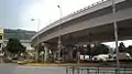 Stavros road junction
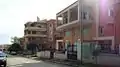 Residential architecture
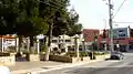 Main square
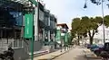 Shopping area
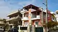 Residential architecture
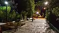 Road behind the church of Metamorfoseos Sotiros
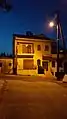 Night residential street scene
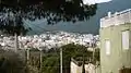
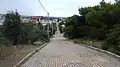 Looking down from hill
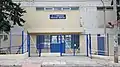 Middle school
See also
- List of municipalities of Attica
References
- "Απογραφή Πληθυσμού - Κατοικιών 2011. ΜΟΝΙΜΟΣ Πληθυσμός" (in Greek). Hellenic Statistical Authority.
- Kallikratis law Greece Ministry of Interior (in Greek)
- "Population & housing census 2001 (incl. area and average elevation)" (PDF) (in Greek). National Statistical Service of Greece. Archived from the original (PDF) on 2015-09-21.
External links
- Official website (in Greek)
- Former official website, archived (in Greek)
Places adjacent to Glyka Nera | ||||||||||
|---|---|---|---|---|---|---|---|---|---|---|
| ||||||||||
| Wikimedia Commons has media related to Glyka Nera. |
This article is issued from Wikipedia. The text is licensed under Creative Commons - Attribution - Sharealike. Additional terms may apply for the media files.
