Gmina Dobrodzień
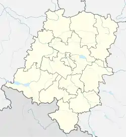
Gmina Dobrodzień, German Gemeinde Guttentag is an urban-rural gmina (administrative district) in Olesno County, Opole Voivodeship, in south-western Poland. Its seat is the town of Dobrodzień, which lies approximately 17 kilometres (11 mi) south of Olesno and 37 km (23 mi) east of the regional capital Opole.
Gmina Dobrodzień
Gemeinde Guttentag Dobrodzień Commune | |
|---|---|
 Flag  Coat of arms | |
 Dobrodzień 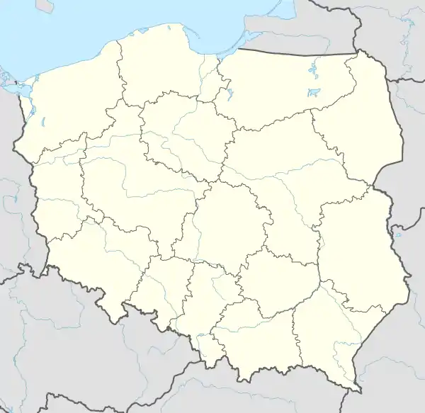 Dobrodzień | |
| Coordinates (Dobrodzień): 50°43′40″N 18°26′40″E | |
| Country | |
| Voivodeship | |
| County | Olesno |
| Seat | Dobrodzień |
| Area | |
| • Total | 162.84 km2 (62.87 sq mi) |
| Population (2019-06-30[1]) | |
| • Total | 10,651 |
| • Density | 65/km2 (170/sq mi) |
| • Urban | 3,720 |
| • Rural | 6,157 |
| Website | https://dobrodzien.pl |
The gmina covers an area of 162.84 square kilometres (62.9 sq mi), and as of 2019 its total population is 9,877.
Prior to 1945 the area was part of Germany. Since 2009 the commune has been officially bilingual in German and Polish due to the large German minority in the area, many ethnic Germans have remained despite the area being transferred to Poland after World War II.
Villages
The commune contains the villages and settlements of:
Neighbouring gminas
Gmina Dobrodzień is bordered by the gminas of Ciasna, Kolonowskie, Olesno, Ozimek, Pawonków, Zawadzkie and Zębowice.
References
- "Population. Size and structure and vital statistics in Poland by territorial divison in 2019. As of 30th June". stat.gov.pl. Statistics Poland. 2019-10-15. Retrieved 2020-02-14.
- "Haan". dobrodzien.pl (in Polish). Gmina Dobrodzień. Retrieved 2020-03-10.
- "Czortków - Ukraina". dobrodzien.pl (in Polish). Gmina Dobrodzień. Retrieved 2020-03-10.
| Town and seat |  | |
|---|---|---|
| Villages | ||
Seat: Olesno | ||
| Urban-rural gminas |  | |
| Rural gminas | ||