Gmina Ostrowice
Gmina Ostrowice was a rural gmina (administrative district) in Drawsko County, West Pomeranian Voivodeship, in north-western Poland. Its seat was the village of Ostrowice, which lies approximately 17 kilometres (11 mi) north-east of Drawsko Pomorskie and 96 km (60 mi) east of the regional capital Szczecin.
Gmina Ostrowice
Ostrowice Commune | |
|---|---|
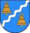 Coat of arms | |
| Coordinates (Ostrowice): 53°38′17″N 15°58′26″E | |
| Country | |
| Voivodeship | West Pomeranian |
| County | Drawsko |
| Seat | Ostrowice |
| Area | |
| • Total | 150.42 km2 (58.08 sq mi) |
| Population (2006) | |
| • Total | 2,531 |
| • Density | 17/km2 (44/sq mi) |
| Website | http://www.ostrowice.pl/ |
The gmina covered an area of 150.42 square kilometres (58.1 sq mi), and as of 2006 its total population was 2,531.
The gmina contained part of the protected area called Drawsko Landscape Park. The gmina was divided between Gmina Drawsko Pomorskie i Gmina Złocieniec on January the 1st, 2019 because of bankruptcy, being the first municipality to do so in Poland.[1][2]
Villages
Gmina Ostrowice contained the villages and settlements of Bolegorzyn, Borne, Chlebowo, Cieminko, Dołgie, Donatowo, Drzeńsko, Grabinek, Gronowo, Grzybno, Jelenino, Jutrosin, Kania Górka, Karpno, Kiełpin, Kleszczno, Kołatka, Kolno, Kosobądź, Marysin, Miłobądź, Nowe Worowo, Ostrowice, Płocie, Przystanek, Przytoń, Siecino, Śmidzięcino, Smołdzęcino, Śródlesie, Szczycienko, Szczytniki, Tęczyn, Węglin and Wiercienko.
Neighbouring gminas
Gmina Ostrowice was bordered by the gminas of Brzeżno, Czaplinek, Drawsko Pomorskie, Połczyn-Zdrój, Świdwin and Złocieniec.
References
Seat: Drawsko Pomorskie | ||
| Urban-rural gminas |  | |
| Rural gminas | ||
