Goolwa South, South Australia
Goolwa South (previously known as South Goolwa) is a locality in the Australian state of South Australia located about 67 kilometres (42 miles) south of the state capital of Adelaide on both on the southern continental coastline and the south-western coast of Lake Alexandrina. It occupies the full extent of the Sir Richard Peninsula, land to the immediate west and part of the Goolwa Channel in the lake system to its north.[2][3]
| Goolwa South South Australia | |||||||||||||||
|---|---|---|---|---|---|---|---|---|---|---|---|---|---|---|---|
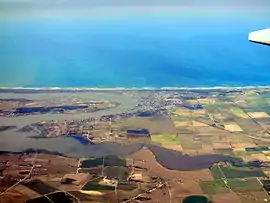
 Goolwa South located on the oceanic coastline between the left-hand side of and the middle of the image. | |||||||||||||||
 Goolwa South | |||||||||||||||
| Coordinates | 35.512270°S 138.779410°E | ||||||||||||||
| Population | 971 (2016 census)[1] | ||||||||||||||
| Established | 1925[2] | ||||||||||||||
| Postcode(s) | 5214 [3] | ||||||||||||||
| Time zone | ACST (UTC+9:30) | ||||||||||||||
| • Summer (DST) | ACST (UTC+10:30) | ||||||||||||||
| Location | 67 km (42 mi) south of Adelaide | ||||||||||||||
| LGA(s) | Alexandrina Council[2] | ||||||||||||||
| Region | Fleurieu and Kangaroo Island[4] | ||||||||||||||
| County | Hindmarsh[2] | ||||||||||||||
| State electorate(s) | Finniss | ||||||||||||||
| Federal Division(s) | Mayo[5] | ||||||||||||||
| |||||||||||||||
| |||||||||||||||
| Footnotes | Coordinates[2] Locations[3] Climate[6] Adjoining localities[2][7] | ||||||||||||||
The name was first used in respect to a private sub-division of land within the cadastral unit of the Hundred of Goolwa in 1925. Boundaries were created for the “long established name” in 1993 and were again adjusted in August 2000 to include the Sir Richard Peninsula in the adjoining Hundred of Nangkita.[2]
The western end of the locality is occupied by an urban area which extends into the adjoining localities of Goolwa and Goolwa Beach while the remainder of the locality is zoned for conservation and includes part of the Coorong National Park.[8][2]
Goolwa South is located within the federal division of Mayo, the state electoral district of Finniss and the local government area of the Alexandrina Council.[5][2]
See also
References
- Australian Bureau of Statistics (27 June 2017). "Goolwa South (State Suburb)". 2016 Census QuickStats. Retrieved 20 April 2018.

- "Search result for "Goolwa South(Locality Bounded)" (Record no SA0026985) with the following layers selected - "Suburbs and Localities", "Counties" and "Hundreds"". Department of Planning, Transport and Infrastructure. Retrieved 29 April 2016.
- "Postcode for Goolwa South, South Australia". postcodes-australia.com. Retrieved 29 April 2016.
- "Fleurieu Kangaroo Island SA Government region" (PDF). The Government of South Australia. Retrieved 17 April 2017.
- "Federal electoral division of Mayo, boundary gazetted 16 December 2011" (PDF). Australian Electoral Commission. Retrieved 2 August 2015.
- "Monthly climate statistics: Summary statistics HINDMARSH ISLAND AWS (nearest station)". Commonwealth of Australia , Bureau of Meteorology. Retrieved 29 April 2016.
- "Search result for "Encounter Bay (Bay)" (Record no SA0022623) with the following layers selected - "Suburbs and Localities"". Department of Planning, Transport and Infrastructure. Retrieved 30 April 2016.
- "Development Plan, Alexandrina Council Consolidated – 7 May 2015". Department of Planning, Transport and Infrastructure. pp. 508 and 514. Retrieved 29 April 2016.
