Grabonoški Vrh
Grabonoški Vrh (pronounced [ɡɾabɔˈnoːʃki ˈʋəɾx]) is a settlement in the Municipality of Cerkvenjak in northeastern Slovenia. It lies in the Slovene Hills (Slovene: Slovenske gorice) east of Cerkvenjak. The area is part of the traditional region of Styria and is now included in the Drava Statistical Region.[2]
Grabonoški Vrh | |
|---|---|
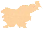
 Grabonoški Vrh Location in Slovenia | |
| Coordinates: 46°34′41.76″N 15°58′10.43″E | |
| Country | |
| Traditional region | Styria |
| Statistical region | Drava |
| Municipality | Cerkvenjak |
| Area | |
| • Total | 0.53 km2 (0.20 sq mi) |
| Elevation | 281.5 m (923.6 ft) |
| Population (2002) | |
| • Total | 77 |
| [1] | |
Two of originally six Roman period burial mounds are still preserved in a nearby forest. Artefacts from the four destroyed in 1954 are kept in the regional museum in Maribor.[3]
References
This article is issued from Wikipedia. The text is licensed under Creative Commons - Attribution - Sharealike. Additional terms may apply for the media files.
