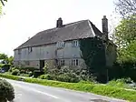
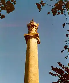
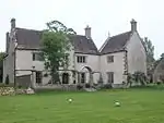
Grade II* listed buildings in South Somerset
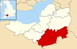
South Somerset is a local government district in the English county of Somerset. The South Somerset district occupies an area of 370 square miles (958 km2),[1] stretching from its borders with Devon and Dorset to the edge of the Somerset Levels. The district has a population of about 158,000,[2] and has Yeovil as its administrative centre.
In the United Kingdom, the term listed building refers to a building or other structure officially designated as being of special architectural, historical or cultural significance; Grade II* structures are those considered to be "particularly significant buildings of more than local interest".[3] Listing was begun by a provision in the Town and Country Planning Act 1947. Once listed, severe restrictions are imposed on the modifications allowed to a building's structure or its fittings. In England, the authority for listing under the Planning (Listed Buildings and Conservation Areas) Act 1990[4] rests with Historic England, a non-departmental public body sponsored by the Department for Digital, Culture, Media and Sport; local authorities have a responsibility to regulate and enforce the planning regulations.
There are 266 Grade II* listed buildings in South Somerset.
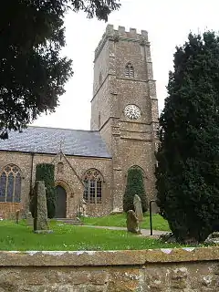
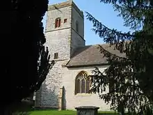
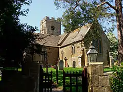
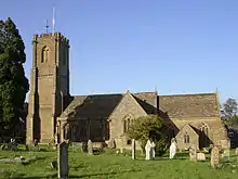
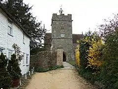
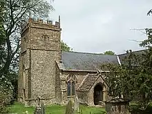
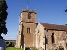
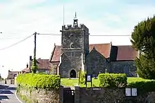
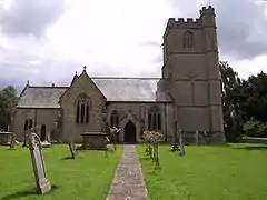
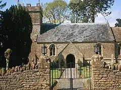
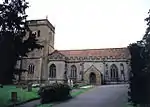
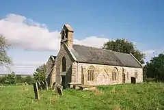
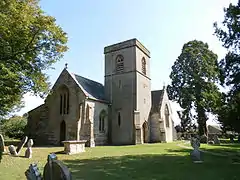
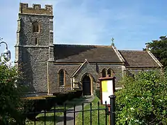
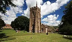
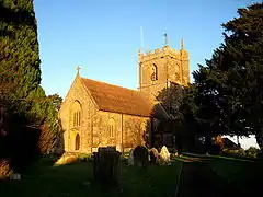
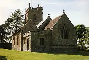
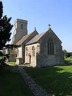
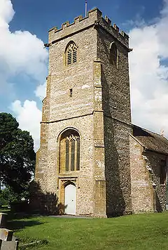
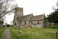
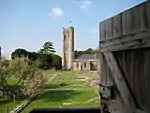
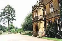
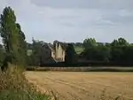
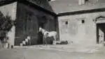
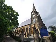
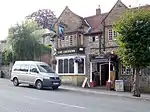
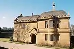
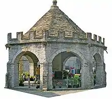
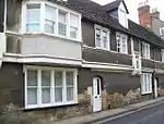
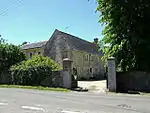
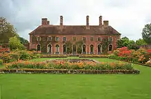
Buildings

.jpg.webp)
.jpg.webp)


.jpg.webp)

.jpg.webp)
.jpg.webp)
.jpg.webp)
.jpg.webp)
.jpg.webp)


.jpg.webp)

_(geograph_4040069).jpg.webp)
.jpg.webp)


.jpg.webp)
.jpg.webp)

.jpg.webp)

.jpg.webp)
.jpg.webp)

.jpg.webp)
.jpg.webp)
Aug2006.jpg.webp)
.jpg.webp)
.jpg.webp)
.jpg.webp)

.jpg.webp)
.jpg.webp)

Notes
- The date given is the date used by Historic England as significant for the initial building or that of an important part in the structure's description.
- Sometimes known as OSGB36, the grid reference is based on the British national grid reference system used by the Ordnance Survey.
- The "List Entry Number" is a unique number assigned to each listed building and scheduled monument by Historic England.
References
- "An introduction to South Somerset" (PDF). South Somerset District Council. Archived from the original (PDF) on 30 August 2012. Retrieved 29 March 2017.
- "Population of South Somerset". South Somerset District Council. Archived from the original on 2007-10-30. Retrieved 2009-07-11.
- "Listed Buildings". Historic England. Retrieved 23 August 2017.
- "Planning (Listed Buildings and Conservation Areas) Act 1990 (c. 9)". Ministry of Justice. Archived from the original on 2010-04-18. Retrieved 2007-12-17.
- "1-2 Castle Cottages". NHLE. Retrieved 15 July 2013.
- Historic England, "Abbey House (1258892)", National Heritage List for England, retrieved 5 March 2018
- "Admiral Hood Monument". NHLE. Retrieved 15 July 2013.
- "Ansford Lodge". NHLE. Retrieved 8 August 2013.
- "Ashford House". NHLE. Retrieved 8 August 2013.
- "Ashington Manor". NHLE. Retrieved 8 August 2013.
- "Ashlar House (Formerly Listed With The Clerks House As The Cedars) And Boundary Railings To North And East". NHLE. Retrieved 8 August 2013.
- "Avishays". NHLE. Retrieved 8 August 2013.
- "Balsam House". NHLE. Retrieved 8 August 2013.
- "Baptist Church". NHLE. Retrieved 8 August 2013.
- "Bromes House". NHLE. Retrieved 8 August 2013.
- "Burton Pynsent House". NHLE. Retrieved 8 August 2013.
- "Candle Cottage And Garden Walls And Railings To East". NHLE. Retrieved 8 August 2013.
- "Cathanger". NHLE. Retrieved 8 August 2013.
- "Chapel Cross". NHLE. Retrieved 8 August 2013.
- "Chard Manor Farmhouse". NHLE. Retrieved 8 August 2013.
- "Chard School". NHLE. Retrieved 8 August 2013.
- "Charlton House". NHLE. Retrieved 8 August 2013.
- "Church Cross In Churchyard of St James' Church". NHLE. Retrieved 8 August 2013.
- "Church House with integral orangery". NHLE. Retrieved 15 July 2013.
- "Church Of All Saints". NHLE. Retrieved 15 July 2013.
- "Church Of All Saints". NHLE. Retrieved 15 July 2013.
- "Church Of All Saints". NHLE. Retrieved 15 July 2013.
- "Church Of All Saints". NHLE. Retrieved 15 July 2013.
- "Church Of All Saints". NHLE. Retrieved 15 July 2013.
- "Church Of All Saints". NHLE. Retrieved 15 July 2013.
- "Church of St Andrew". NHLE. Retrieved 12 August 2013.
- "Church of St Andrew". NHLE. Retrieved 22 August 2013.
- "Church of St Andrew". NHLE. Retrieved 22 August 2013.
- "Church of St Andrew". NHLE. Retrieved 22 August 2013.
- "Church of St Andrew". NHLE. Retrieved 22 August 2013.
- "Church of St Andrew". NHLE. Retrieved 22 August 2013.
- "Church of St Andrew". NHLE. Retrieved 22 August 2013.
- "Church of St Bartholomew". NHLE. Retrieved 15 July 2013.
- "Church of St Catherine". NHLE. Retrieved 22 August 2013.
- "Church of St David". NHLE. Retrieved 22 August 2013.
- "Church of St James". NHLE. Retrieved 22 August 2013.
- "The Church of St James". NHLE. Retrieved 28 August 2013.
- "Church of St James With Its South Boundary Wall". NHLE. Retrieved 22 August 2013.
- "Church of St John The Baptist". NHLE. Retrieved 22 August 2013.
- "Church of St John Baptist". NHLE. Retrieved 15 July 2013.
- "Church of St John The Baptist". NHLE. Retrieved 22 August 2013.
- "Church of St John The Baptist". NHLE. Retrieved 22 August 2013.
- "Church of St John The Evangelist And All Saints". NHLE. Retrieved 22 August 2013.
- "Church of St Lawrence". NHLE. Retrieved 22 August 2013.
- "Church of St Margaret". NHLE. Retrieved 22 August 2013.
- "Church of St Martin Of Tours". NHLE. Retrieved 22 August 2013.
- "Church of St Mary". NHLE. Retrieved 22 August 2013.
- "Church of St Mary". NHLE. Retrieved 22 August 2013.
- "Church of St Mary". NHLE. Retrieved 22 August 2013.
- "Church of St Mary". NHLE. Retrieved 22 August 2013.
- "Church of St Mary". NHLE. Retrieved 22 August 2013.
- "Church of St Mary". NHLE. Retrieved 22 August 2013.
- "Church of St Mary". NHLE. Retrieved 22 August 2013.
- "Church of St Mary". NHLE. Retrieved 22 August 2013.
- "Church of St Mary". NHLE. Retrieved 22 August 2013.
- "Church of St Mary". NHLE. Retrieved 22 August 2013.
- "Church of St Mary Magdalen". NHLE. Retrieved 22 August 2013.
- "Church of St Mary Magdalene". NHLE. Retrieved 22 August 2013.
- "Church of St Mary Major". NHLE. Retrieved 22 August 2013.
- "Church of St Mary The Virgin". NHLE. Retrieved 22 August 2013.
- "Church of St Mary The Virgin". NHLE. Retrieved 22 August 2013.
- "Church of St Mary Magdalene". NHLE. Retrieved 22 August 2013.
- "Church of St Michael". NHLE. Retrieved 22 August 2013.
- "Church of St Michael". NHLE. Retrieved 22 August 2013.
- "Church of St Michael". NHLE. Retrieved 22 August 2013.
- "Church of St Michael". NHLE. Retrieved 22 August 2013.
- "Church of St Michael". NHLE. Retrieved 22 August 2013.
- "Church of St Michael And All Angels". NHLE. Retrieved 22 August 2013.
- "Church of St Michael And All Angels". NHLE. Retrieved 22 August 2013.
- "Church of St Michael And All Angels". NHLE. Retrieved 22 August 2013.
- "Church of St Nicholas". NHLE. Retrieved 22 August 2013.
- "Church of St Nicholas". NHLE. Retrieved 22 August 2013.
- "Church of St Nicholas". NHLE. Retrieved 22 August 2013.
- "Church of St Nicholas". NHLE. Retrieved 22 August 2013.
- "Church of St Peter". NHLE. Retrieved 22 August 2013.
- "Church of St Peter". NHLE. Retrieved 22 August 2013.
- "Church of St Peter". NHLE. Retrieved 22 August 2013.
- "Church of St Peter And St Paul". NHLE. Retrieved 22 August 2013.
- "Church of St Peter And St Paul". NHLE. Retrieved 22 August 2013.
- "Church of St Peter And St Paul". NHLE. Retrieved 22 August 2013.
- "Church of St Peter And St Paul". NHLE. Retrieved 22 August 2013.
- "Church of St Roch". NHLE. Retrieved 22 August 2013.
- "Church of St Stephen". NHLE. Retrieved 22 August 2013.
- "Church of St Stephen". NHLE. Retrieved 22 August 2013.
- "Church of St Thomas". NHLE. Retrieved 22 August 2013.
- "Church of St Thomas A Becket". NHLE. Retrieved 22 August 2013.
- "Church of St Thomas Of Canterbury". NHLE. Retrieved 22 August 2013.
- "Church of The Blessed Virgin Mary". NHLE. Retrieved 22 August 2013.
- "Church of The Holy Cross". NHLE. Retrieved 22 August 2013.
- "Church of The Holy Cross". NHLE. Retrieved 22 August 2013.
- "Churchyard Cross In Churchyard Of Church of St Catherine". NHLE. Retrieved 22 August 2013.
- "Churchyard Cross, 10 Metres West Of The Church Of All Saints". NHLE. Retrieved 22 August 2013.
- "Churchyard Cross, About 5 Metres South Of Nave, Church of St Aldhelm And St Eadburgha". NHLE. Retrieved 22 August 2013.
- "Clapton Farmhouse". NHLE. Retrieved 22 August 2013.
- "Clapton Mill (Lockyer And Son), With Aqueduct To North East". NHLE. Retrieved 22 August 2013.
- "Collins Chest Tomb, 2 Metres South Of The South East Nave Window, Church Of All Saints". NHLE. Retrieved 22 August 2013.
- "Congregational Chapel, Now United Reformed Church". NHLE. Retrieved 22 August 2013.
- "Coombe Hill House". NHLE. Retrieved 22 August 2013.
- "Cosenes Monument In Churchyard 5 Metres South South East Of South Transept, Church Of All Saints". NHLE. Retrieved 22 August 2013.
- "Court Farm House". NHLE. Retrieved 22 August 2013.
- "Court House". NHLE. Retrieved 22 August 2013.
- "Court House". NHLE. Retrieved 22 August 2013.
- "Craigmore House". NHLE. Retrieved 22 August 2013.
- "Crane Farmhouse". NHLE. Retrieved 22 August 2013.
- "Cricket Court, And Attached Balustraded Walling Around Basement Areas". NHLE. Retrieved 22 August 2013.
- "Danyell Monument In Churchyard About 0.5 Metres South Of Chancel, Church of St Thomas Of Canterbury". NHLE. Retrieved 22 August 2013.
- "Darvole Farm House". NHLE. Retrieved 22 August 2013.
- "Dental Surgery Priors House". NHLE. Retrieved 22 August 2013.
- "Dillington House". NHLE. Retrieved 22 August 2013.
- "Donisthorpe". NHLE. Retrieved 22 August 2013.
- "Dovecote About 370 Metres South Of Bruton Church". NHLE. Retrieved 22 August 2013.
- "Dovecote In Churchyard, About 15 Metres South West Of Church, Church of St Mary The Virgin". NHLE. Retrieved 22 August 2013.
- "Dowlish Manor Farmhouse". NHLE. Retrieved 22 August 2013.
- "East Lambrook Manor And Forecourt Wall Manor Cottage". NHLE. Retrieved 22 August 2013.
- "Easton House And Forecourt Wall". NHLE. Retrieved 22 August 2013.
- "Essex House". NHLE. Retrieved 22 August 2013.
- "Factory Building,Formerly Of Gifford Fox And Company Limited". NHLE. Retrieved 22 August 2013.
- "Former Priests House, About 10 Metres East Of Wayford Manor House". NHLE. Retrieved 13 July 2013.
- "Front Boundary Wall, Piers And Gate, 15 Metres North Of Manor Farm House". NHLE. Retrieved 22 August 2013.
- "Gants Mill". NHLE. Retrieved 22 August 2013.
- "Gatehouse To Cathanger". NHLE. Retrieved 22 August 2013.
- "Gatepiers And Boundary Walling To The Manor House And Mallet Court, Bounding Gardens". NHLE. Retrieved 22 August 2013.
- "Gazebo, Steps, Terraces And Walls To North West Of Merefield House". NHLE. Retrieved 22 August 2013.
- "George Hotel". NHLE. Retrieved 22 August 2013.
- "Godminster Manor". NHLE. Retrieved 22 August 2013.
- "Group Of Eight Monuments In Churchyard, South And West Of Nave, Church of St Andrew". NHLE. Retrieved 22 August 2013.
- "Hadspen House". NHLE. Retrieved 22 August 2013.
- "Haselbury Old Bridge". NHLE. Retrieved 22 August 2013.
- "Heale House". NHLE. Retrieved 22 August 2013.
- "Hendford Manor". NHLE. Retrieved 22 August 2013.
- "Henley Manor Farmhouse". NHLE. Retrieved 22 August 2013.
- "Hey Farmhouse". NHLE. Retrieved 22 August 2013.
- "High Leaze Farmhouse". NHLE. Retrieved 22 August 2013.
- "Higher Farmhouse". NHLE. Retrieved 22 August 2013.
- "Hinton House (South Range)". NHLE. Retrieved 22 August 2013.
- "Home Farmhouse And Farm Buildings Attached To North East Corner Of Brympton House". NHLE. Retrieved 22 August 2013.
- "Homefield". NHLE. Retrieved 22 August 2013.
- "Honeywick". NHLE. Retrieved 22 August 2013.
- "Hurds Mill House And Courtyard Walling". NHLE. Retrieved 22 August 2013.
- "Hurds Key Farm House". NHLE. Retrieved 22 August 2013.
- "Kincora And Attached Railings". NHLE. Retrieved 22 August 2013.
- "Kingstone Farmhouse". NHLE. Retrieved 22 August 2013.
- "Lancin Farmhouse". NHLE. Retrieved 22 August 2013.
- "Langford Fivehead". NHLE. Retrieved 22 August 2013.
- "Leigh House". NHLE. Retrieved 22 August 2013.
- "Lockyer's Farmhouse". NHLE. Retrieved 22 August 2013.
- "Long Load Bridge". NHLE. Retrieved 22 August 2013.
- "Lower Cockhill Farmhouse, With Mounting Block 5 Metres West". NHLE. Retrieved 22 August 2013.
- "Lullingstone". NHLE. Retrieved 22 August 2013.
- "Madey Mill". NHLE. Retrieved 22 August 2013.
- "Main Building Of The Former Parrett Iron Works". NHLE. Retrieved 22 August 2013.
- "Manning Chest Tomb, In Churchyard 4 Metres South Of South East Corner Church of St John The Baptist". NHLE. Retrieved 22 August 2013.
- "Mannings". NHLE. Retrieved 22 August 2013.
- "Manor Farm House". NHLE. Retrieved 22 August 2013.
- "Manor Farm House". NHLE. Retrieved 22 August 2013.
- "Manor Farmhouse". NHLE. Retrieved 22 August 2013.
- "Manor Farmhouse". NHLE. Retrieved 22 August 2013.
- "Manor Farmhouse". NHLE. Retrieved 22 August 2013.
- "Manor Farmhouse". NHLE. Retrieved 22 August 2013.
- "Manor Farmhouse". NHLE. Retrieved 22 August 2013.
- "Manor Farmhouse And Front Boundary Railings". NHLE. Retrieved 22 August 2013.
- "Manor House". NHLE. Retrieved 22 August 2013.
- "Manor House". NHLE. Retrieved 22 August 2013.
- "Manor House". NHLE. Retrieved 22 August 2013.
- "Manor House , King Ina's Palace". NHLE. Retrieved 22 August 2013.
- "Maperton House". NHLE. Retrieved 22 August 2013.
- "Merefield House". NHLE. Retrieved 22 August 2013.
- "Mid Lambrook Manor". NHLE. Retrieved 22 August 2013.
- "Middlethorpe House". NHLE. Retrieved 22 August 2013.
- "Mill, Attached House And Former Drying Kiln". NHLE. Retrieved 22 August 2013.
- "Monks' Reredorter, Muchelney Abbey". NHLE. Retrieved 22 August 2013.
- "Monmouth House And Attached Walls And Railings". NHLE. Retrieved 22 August 2013.
- "Naish's Farm House, With Front Boundary Wall And Gate Piers". NHLE. Retrieved 24 August 2013.
- "National Westminster Bank". NHLE. Retrieved 24 August 2013.
- "No 3 (Hayes End Manor) No 5 And No 7". NHLE. Retrieved 24 August 2013.
- "18 And 20, High Street". NHLE. Retrieved 24 August 2013.
- "17, North Street". NHLE. Retrieved 24 August 2013.
- "9, Church Street". NHLE. Retrieved 24 August 2013.
- "29, Court Barton". NHLE. Retrieved 24 August 2013.
- "28, Court Barton". NHLE. Retrieved 24 August 2013.
- "21, Woolston Road". NHLE. Retrieved 24 August 2013.
- "North Perrott Manor House Perrott Hill School". NHLE. Retrieved 24 August 2013.
- "Nos 2 And 3 And Attached Railings, Gate Piers And Gates". NHLE. Retrieved 24 August 2013.
- "Numbers 19-21, Attached Gateway And Outbuildings To The Rear Of No 19". NHLE. Retrieved 24 August 2013.
- "Old Somerton Mill". NHLE. Retrieved 24 August 2013.
- "Oscars". NHLE. Retrieved 24 August 2013.
- "Oxenford House The Cottage Attached To West Gable With Pump". NHLE. Retrieved 24 August 2013.
- "Pavyotts Mill House". NHLE. Retrieved 24 August 2013.
- "Pen Pits". NHLE. Retrieved 24 August 2013.
- "Penny Tombstone, In Churchyard 11 Metres South Of Chancel, Church of St Peter And St Paul". NHLE. Retrieved 24 August 2013.
- "Physicwell House". NHLE. Retrieved 24 August 2013.
- "Pittards Farmhouse". NHLE. Retrieved 24 August 2013.
- "Prankerd Chest Tomb, In Churchyard 7 Metres South East Of South Door, Church of St John Evangelist". NHLE. Retrieved 24 August 2013.
- "Priory Farmhouse". NHLE. Retrieved 24 August 2013.
- "Privy About 35 Metres South Of The Manor House". NHLE. Retrieved 24 August 2013.
- "Red Lion Hotel, With Front Boundary Railings Attached". NHLE. Retrieved 24 August 2013.
- "Rodwell Manor". NHLE. Retrieved 24 August 2013.
- "Rowland's Farm House, And Attached Outbuildings Around Courtyard On North Side, Including Well". NHLE. Retrieved 24 August 2013.
- "Rowland's Mill". NHLE. Retrieved 24 August 2013.
- "Stable Block About 70 Metres West Of Brympton House". NHLE. Retrieved 24 August 2013.
- "Standerwick Farm". NHLE. Retrieved 24 August 2013.
- "Stapleton Farmhouse". NHLE. Retrieved 24 August 2013.
- "Stembridge Mill". NHLE. Retrieved 24 August 2013.
- "Stocklinch Grove". NHLE. Retrieved 24 August 2013.
- "Stoke Sub Hamdon United Reformed Church". NHLE. Retrieved 24 August 2013.
- "Summerhouse About 15 Metres North West Of The Manor House". NHLE. Retrieved 24 August 2013.
- "Swadel Chest Tomb, 8 Metres South Of The South Door Of The Chancel, Church of St Peter". NHLE. Retrieved 24 August 2013.
- "The Chantry". NHLE. Retrieved 28 August 2013.
- "The Chantry". NHLE. Retrieved 28 August 2013.
- "The Choughs Public House". NHLE. Retrieved 28 August 2013.
- "The Coign". NHLE. Retrieved 28 August 2013.
- "The Court". NHLE. Retrieved 28 August 2013.
- "The Dovecot, 30 metres north east of Godminster Manor". NHLE. Retrieved 28 August 2013.
- "The Dower House". NHLE. Retrieved 28 August 2013.
- "The former ropewalk 75 metres north west of Millbrook House". NHLE. Retrieved 28 August 2013.
- "The Gables". NHLE. Retrieved 28 August 2013.
- "The Garden Sculpture, 20 metres north of porch to Shanks House". NHLE. Retrieved 28 August 2013.
- "The Granary, 20 metres east of Godminster Manor". NHLE. Retrieved 28 August 2013.
- "The Grotto at Jordans". NHLE. Retrieved 28 August 2013.
- "The Guildhall". NHLE. Retrieved 28 August 2013.
- "The Hext Almshouses". NHLE. Retrieved 28 August 2013.
- "The Langport Arms Hotel". NHLE. Retrieved 28 August 2013.
- "The Limes". NHLE. Retrieved 28 August 2013.
- "The Lodge, about 165 metres south south west of Montacute House". NHLE. Retrieved 28 August 2013.
- "The Manor House". NHLE. Retrieved 28 August 2013.
- "The Manor House". NHLE. Retrieved 28 August 2013.
- "The Manor House". NHLE. Retrieved 28 August 2013.
- "The Manor House". NHLE. Retrieved 28 August 2013.
- "The Manor House". NHLE. Retrieved 28 August 2013.
- "The Market Cross". NHLE. Retrieved 28 August 2013.
- "The Market House". NHLE. Retrieved 15 July 2013.
- "The Market House". NHLE. Retrieved 28 August 2013.
- "The Music Room, 90 metres north west of Pen Pits". NHLE. Retrieved 28 August 2013.
- "The Old Cottage". NHLE. Retrieved 28 August 2013.
- "The Old Parsonage". NHLE. Retrieved 28 August 2013.
- "The Old Parsonage". NHLE. Retrieved 28 August 2013.
- "The Old Rectory". NHLE. Retrieved 28 August 2013.
- "The Old Rectory, with boundary wall attached to south east corner". NHLE. Retrieved 28 August 2013.
- "The Pines". NHLE. Retrieved 28 August 2013.
- "The Priory". NHLE. Retrieved 28 August 2013.
- "The Priory, including attached wall with 2 gatepiers to left". NHLE. Retrieved 28 August 2013.
- "The railings, gate and gate piers about 9 metes south of Donisthorpe". NHLE. Retrieved 28 August 2013.
- "The Rectory". NHLE. Retrieved 28 August 2013.
- "The Towers". NHLE. Retrieved 28 August 2013.
- "The Unicorn". NHLE. Retrieved 28 August 2013.
- "The Vicarage". NHLE. Retrieved 28 August 2013.
- "The Village Cross". NHLE. Retrieved 28 August 2013.
- "Thorne Chest Tomb, 2 metres north of organ chamber door, churchyard of Church of St Lawrence". NHLE. Retrieved 28 August 2013.
- "Top Mill Building, About 110 Metres South East Of Lodge, Higher Flax Mills". NHLE. Retrieved 13 July 2013.
- "Triumphal arch gateway to Hazelgrove House". NHLE. Retrieved 28 August 2013.
- "Tudor Cottage". NHLE. Retrieved 28 August 2013.
- "Two monuments in churchyard, about 6 and 8 metres south of south transept, Church of St Mary the Virgin". NHLE. Retrieved 28 August 2013.
- "Under Sheriff's Office". NHLE. Retrieved 28 August 2013.
- "Unitarian Church and attached schoolhouse to the north". NHLE. Retrieved 28 August 2013.
- "Wales Cottages, row of cottages about 10 metres north east of Wales Farmhouse". NHLE. Retrieved 28 August 2013.
- "Wales Farmhouse". NHLE. Retrieved 28 August 2013.
- "Walls, gate piers, gates and railings to Merefield House". NHLE. Retrieved 28 August 2013.
- "Weston Farmhouse". NHLE. Retrieved 28 August 2013.
- "Weston House". NHLE. Retrieved 28 August 2013.
- "Weylands". NHLE. Retrieved 28 August 2013.
- "White Horse Hotel". NHLE. Retrieved 28 August 2013.
- "Whitelackington House, and gazebos to south east and south west corners". NHLE. Retrieved 28 August 2013.
- "Wing to Barrington Court". NHLE. Retrieved 28 August 2013.
- "Woodlands Farmhouse". NHLE. Retrieved 28 August 2013.
- "Yarlington House". NHLE. Retrieved 28 August 2013.
The National Heritage List for England (NHLE) is published by Historic England.
External links
![]() Media related to Grade II* listed buildings in Somerset at Wikimedia Commons
Media related to Grade II* listed buildings in Somerset at Wikimedia Commons