Grafenrheinfeld
Grafenrheinfeld is a municipality in the district of Schweinfurt in Bavaria, Germany. The municipality is home to the nuclear power station, Grafenrheinfeld, which opened in 1982.
Grafenrheinfeld | |
|---|---|
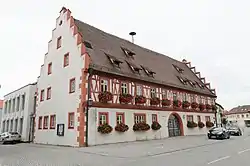
 Town hall | |
 Coat of arms | |
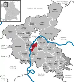
Location of Grafenrheinfeld within Schweinfurt district  | |
 Grafenrheinfeld  Grafenrheinfeld | |
| Coordinates: 50°0′N 10°12′E | |
| Country | Germany |
| State | Bavaria |
| Admin. region | Unterfranken |
| District | Schweinfurt |
| Government | |
| • Mayor | Christian Keller (CSU) |
| Area | |
| • Total | 11.35 km2 (4.38 sq mi) |
| Elevation | 208 m (682 ft) |
| Population (2019-12-31)[1] | |
| • Total | 3,426 |
| • Density | 300/km2 (780/sq mi) |
| Time zone | UTC+01:00 (CET) |
| • Summer (DST) | UTC+02:00 (CEST) |
| Postal codes | 97506 |
| Dialling codes | 09723 |
| Vehicle registration | SW |
| Website | www.grafenrheinfeld.de |
Grafenrheinfeld Nuclear Power Station
The nuclear power station Grafenrheinfeld (short: KKG - not to confused with the similarly abbreviated nuclear power station Goesgen in Switzerland) is located south of Schweinfurt at the Main. Commencement of construction was 1974, start-up took place 1981. It consists of a 3rd Generation pressurized water reactor ("pre-Konvoi") with an electrical output of 1345 MW. Operator is the E.ON nuclear power GmbH headquartered in Hanover. The two cooling towers with a height of 143 m are visible from far away. The nuclear power station was "power station world champion" in both years 1984 and 1985. In the much discussed anti-nuclear power novel Die Wolke by Gudrun Pausewang, a fictitious nuclear disaster occurs at Grafenrheinfeld, releasing a radioactive cloud which pollutes much of Germany. In the film of the same name, a fictitious plant name is used. Temporary storage facilities for depleted core fuel elements at the location went into use on 1 March 2006.
KFU-Mast
The KFU (nuclear reactor remote control, German Kernenergiefernüberwachung) mast Grafenrheinfeld is a guyed steel framework mast for the measurement of meteorological parameters and environmental radioactivity. It is visible for a long distance and is outside of the plant area approximately 750 meters south the power station. The KFU-mast is 164 meters high and was built in 1977/78.
References
| Wikimedia Commons has media related to Grafenrheinfeld. |
- "Tabellenblatt "Daten 2", Statistischer Bericht A1200C 202041 Einwohnerzahlen der Gemeinden, Kreise und Regierungsbezirke". Bayerisches Landesamt für Statistik und Datenverarbeitung (in German). July 2020.