Gresham Park, Georgia
Gresham Park is a census-designated place (CDP) in DeKalb County, Georgia, United States. The population was 7,432 at the 2010 census.[3]
Gresham Park, Georgia | |
|---|---|
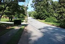 A street in Gresham Park | |
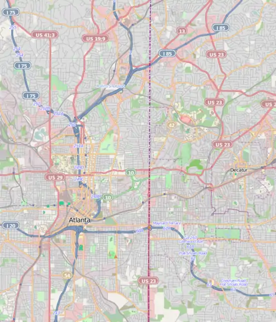 Gresham Park Location within central Metro Atlanta | |
| Coordinates: 33°42′12″N 84°18′52″W | |
| Country | United States |
| State | Georgia |
| County | DeKalb |
| Area | |
| • Total | 2.8 sq mi (7.3 km2) |
| • Land | 2.8 sq mi (7.3 km2) |
| • Water | 0.0 sq mi (0.0 km2) |
| Elevation | 899 ft (274 m) |
| Population (2010) | |
| • Total | 7,432 |
| • Density | 2,700/sq mi (1,000/km2) |
| Time zone | UTC-5 (Eastern (EST)) |
| • Summer (DST) | UTC-4 (EDT) |
| FIPS code | 13-35240[1] |
| GNIS feature ID | 1867241[2] |
Geography
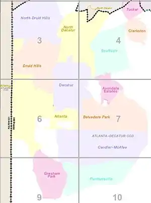
Gresham Park is located at 33°42′12″N 84°18′52″W (33.703357, -84.314366).[4] It is bordered by, on the:
- North: I-20, across which is the Longdale Park area of unincorporated DeKalb County
- Northwest: by the East Atlanta neighborhood of the city of Atlanta
- West: unincorporated DeKalb County, to the west of which is southeast Atlanta
- South: Constitution Road and Clifton Church Road, across which are the Bouldercrest and Cedar Grove areas of unincorporated DeKalb County
- East: Flat Shoals Road and Clifton Church Road, across which is the Panthersville CDP
- Northeast: at Flat Shoals Blvd. and I-20, to the northeast of which is the Candler-McAfee CDP
According to the United States Census Bureau, the CDP has a total area of 2.8 square miles (7.3 km2), all land.
Demographics
As of the census[1] of 2010, there were 7,432 people, 2,797 households, and 2,397 families residing in the CDP. The population density was 3,252.1 people per square mile (1,257.2/km2). There were 3,362 housing units at an average density of 1,095.4/sq mi (423.5/km2). The racial makeup of the CDP was 8.4% White, 89% African American, 0.1% Native American, 0.3% Asian, 0.01% Pacific Islander, 0.30% from other races, and 1.7% from two or more races. Hispanic or Latino of any race were 1.5% of the population.
There were 2,797 households, out of which 24% had children under the age of 18 living with them, 35.6% were married couples living together, 37.7% had a female householder with no husband present, and 19.8% were non-families. 16.4% of all households were made up of individuals, and 2.5% had someone living alone who was 65 years of age or older. The average household size was 3.08 and the average family size was 3.39.
In the CDP, the population was spread out, with 31.3% under the age of 18, 10.8% from 18 to 24, 28.5% from 25 to 44, 23.6% from 45 to 64, and 5.9% who were 65 years of age or older. The median age was 30 years. For every 100 females, there were 82.2 males. For every 100 females age 18 and over, there were 75.5 males.
The median income for a household in the CDP was $35,502, and the median income for a family was $33,938. Males had a median income of $27,063 versus $22,365 for females. The per capita income for the CDP was $18,151. About 16.1% of families and 18.2% of the population were below the poverty line, including 27.2% of those under age 18 and 11.5% of those age 65 or over.
Education

It is in the DeKalb County Public Schools.[5] Zoned schools:
- Elementary schools: Barack H. Obama EMST (most) and Ronald E. McNair DLA (some) (both outside of the CDP)[6]
- Middle schools: Ronald E. McNair (outside of the CDP)[7]
- High schools: Ronald E. McNair High School (in the CDP)[8]
References
| Wikimedia Commons has media related to Gresham Park, Georgia. |
- "U.S. Census website". United States Census Bureau. Retrieved 2008-01-31.
- "US Board on Geographic Names". United States Geological Survey. 2007-10-25. Retrieved 2008-01-31.
- "Race, Hispanic or Latino, Age, and Housing Occupancy: 2010 Census Redistricting Data (Public Law 94-171) Summary File (QT-PL), Gresham Park CDP, Georgia". United States Census Bureau. Retrieved October 28, 2011.
- "US Gazetteer files: 2010, 2000, and 1990". United States Census Bureau. 2011-02-12. Retrieved 2011-04-23.
- "2010 CENSUS - CENSUS BLOCK MAP: Gresham Park CDP, GA" (PDF). U.S. Census Bureau. Retrieved 2020-05-07. - Compare with school addresses and boundary maps.
- "Elementary School Attendance Areas 2016 - 2017 School Year." DeKalb County School System. Retrieved on June 1, 2017.
- "Middle School Attendance Areas 2016 - 2017 School Year." DeKalb County School System. Retrieved on June 1, 2017.
- "High School Attendance Areas 2016 - 2017 School Year." DeKalb County School System. Retrieved on June 1, 2017.
Municipalities and communities of DeKalb County, Georgia, United States | ||
|---|---|---|
| Cities | 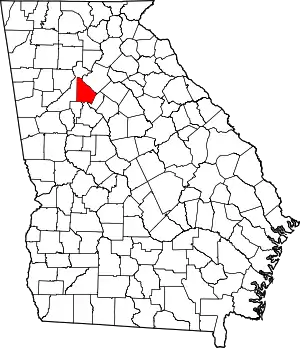 Map of Georgia highlighting DeKalb County | |
| CDPs | ||
| Neighborhoods and unincorporated communities | ||
| Ghost town | ||
| Footnotes | ‡This populated place also has portions in an adjacent county or counties | |
| ||