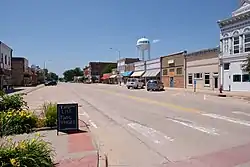
Griswold, Iowa
Griswold is a city in Cass County, Iowa, United States. The population was 1,036 at the 2010 census.
Griswold, Iowa | |
|---|---|
 | |
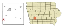 Location of Griswold, Iowa | |
| Coordinates: 41°14′N 95°8′W | |
| Country | |
| State | |
| County | Cass |
| Area | |
| • Total | 0.62 sq mi (1.61 km2) |
| • Land | 0.62 sq mi (1.61 km2) |
| • Water | 0.00 sq mi (0.00 km2) |
| Elevation | 1,102 ft (336 m) |
| Population | |
| • Total | 1,036 |
| • Estimate (2019)[3] | 944 |
| • Density | 1,520.13/sq mi (586.95/km2) |
| Time zone | UTC-6 (Central (CST)) |
| • Summer (DST) | UTC-5 (CDT) |
| ZIP code | 51535 |
| Area code(s) | 712 Exchange: 778 |
| FIPS code | 19-33150 |
| GNIS feature ID | 0457153 |
| Website | www |
History
The town was named for J. N. A. Griswold, a railroad director.[4]
Geography
Griswold is located at 41°14′N 95°8′W (41.2354, -95.1406).[5]
According to the United States Census Bureau, the city has a total area of 0.62 square miles (1.61 km2), all land.[6]
Demographics
| Year | Pop. | ±% |
|---|---|---|
| 1880 | 350 | — |
| 1890 | 752 | +114.9% |
| 1900 | 900 | +19.7% |
| 1910 | 949 | +5.4% |
| 1920 | 1,264 | +33.2% |
| 1930 | 1,139 | −9.9% |
| 1940 | 1,132 | −0.6% |
| 1950 | 1,149 | +1.5% |
| 1960 | 1,207 | +5.0% |
| 1970 | 1,181 | −2.2% |
| 1980 | 1,176 | −0.4% |
| 1990 | 1,049 | −10.8% |
| 2000 | 1,039 | −1.0% |
| 2010 | 1,036 | −0.3% |
| 2019 | 944 | −8.9% |
| Source:"U.S. Census website". United States Census Bureau. Retrieved 2020-03-28. and Iowa Data Center Source: | ||
2010 census
As of the census[2] of 2010, there were 1,036 people, 445 households, and 278 families living in the city. The population density was 1,671.0 inhabitants per square mile (645.2/km2). There were 507 housing units at an average density of 817.7 per square mile (315.7/km2). The racial makeup of the city was 97.5% White, 1.0% African American, 0.3% Native American, 0.1% Asian, 0.3% from other races, and 0.9% from two or more races. Hispanic or Latino of any race were 1.1% of the population.
There were 445 households, of which 27.9% had children under the age of 18 living with them, 50.1% were married couples living together, 8.3% had a female householder with no husband present, 4.0% had a male householder with no wife present, and 37.5% were non-families. 33.0% of all households were made up of individuals, and 17.7% had someone living alone who was 65 years of age or older. The average household size was 2.25 and the average family size was 2.85.
The median age in the city was 44.9 years. 23.7% of residents were under the age of 18; 5.7% were between the ages of 18 and 24; 20.8% were from 25 to 44; 25.2% were from 45 to 64; and 24.7% were 65 years of age or older. The gender makeup of the city was 45.7% male and 54.3% female.
2000 census
As of the census[8] of 2000, there were 1,039 people, 440 households, and 282 families living in the city. The population density was 1,691.0 people per square mile (657.6/km2). There were 491 housing units at an average density of 799.1 per square mile (310.8/km2). The racial makeup of the city was 99.04% White, 0.19% Native American, 0.10% Pacific Islander, 0.38% from other races, and 0.29% from two or more races. Hispanic or Latino of any race were 1.35% of the population.
There were 440 households, out of which 25.7% had children under the age of 18 living with them, 54.3% were married couples living together, 6.1% had a female householder with no husband present, and 35.9% were non-families. 31.4% of all households were made up of individuals, and 18.6% had someone living alone who was 65 years of age or older. The average household size was 2.24 and the average family size was 2.82.
21.6% are under the age of 18, 5.6% from 18 to 24, 23.5% from 25 to 44, 21.8% from 45 to 64, and 27.5% who were 65 years of age or older. The median age was 45 years. For every 100 females, there were 86.5 males. For every 100 females age 18 and over, there were 85.2 males.
The median income for a household in the city was $31,538, and the median income for a family was $38,125. Males had a median income of $27,667 versus $18,542 for females. The per capita income for the city was $16,430. About 5.5% of families and 6.6% of the population were below the poverty line, including 8.2% of those under age 18 and 9.4% of those age 65 or over.
Education
The Griswold Community School District operates area public schools.[9]
Notable people
- Neville Brand — television and movie actor
- Guy Lowman - college basketball, football and baseball coach
References
- "2019 U.S. Gazetteer Files". United States Census Bureau. Retrieved July 17, 2020.
- "U.S. Census website". United States Census Bureau. Retrieved 2012-05-11.
- "Population and Housing Unit Estimates". United States Census Bureau. May 24, 2020. Retrieved May 27, 2020.
- Gannett, Henry (1905). The Origin of Certain Place Names in the United States. Govt. Print. Off. pp. 145.
- "US Gazetteer files: 2010, 2000, and 1990". United States Census Bureau. 2011-02-12. Retrieved 2011-04-23.
- "US Gazetteer files 2010". United States Census Bureau. Archived from the original on 2012-01-25. Retrieved 2012-05-11.
- "Census of Population and Housing". Census.gov. Retrieved June 4, 2015.
- "U.S. Census website". United States Census Bureau. Retrieved 2008-01-31.
- "FY20_GRISWOLD" (PDF). Iowa Department of Education. Retrieved 2020-08-05.
External links
| Wikimedia Commons has media related to Griswold, Iowa. |
- City of Griswold
- City-Data Comprehensive statistical data and more about Griswold
Municipalities and communities of Cass County, Iowa, United States | ||
|---|---|---|
| Cities | Map of Iowa highlighting Cass County | |
| Townships | ||
| Unincorporated communities | ||
| ||
| Authority control |
|
|---|