Großer Priepertsee
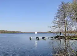
Großer Priepertsee is a lake in the Mecklenburg Lake District, in the German state of Mecklenburg-Vorpommern. It is in the district of Mecklenburgische Seenplatte.
| Großer Priepertsee | |
|---|---|
 | |
 Großer Priepertsee | |
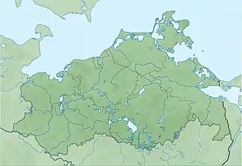
| Location | Mecklenburgische Seenplatte, Mecklenburg-Vorpommern |
| Coordinates | 53°13′34.62″N 13°2′29.87″E |
| Primary inflows | River Havel |
| Primary outflows | River Havel |
| Basin countries | Germany |
| Surface area | 1.04 square kilometres (0.40 sq mi) |
| Max. depth | 32 metres (105 ft) |
| Surface elevation | 54.9 metres (180 ft) |
The lake has an elevation of 54.9 metres (180 ft) and a surface area of 1.04 square kilometres (0.40 sq mi).
The navigable River Havel flows the length of the Großer Priepertsee, entering it directly from the connecting Wangnitzsee to the north, and leaving it at Priepert via a 0.6-kilometre (0.37 mi) long channel to the Ellbogensee to the south. Navigation is administered as part of the Obere–Havel–Wasserstraße.[1][2]
References
- Sheffield, Barry (1995). Inland Waterways of Germany. St Ives: Imray Laurie Norie & Wilson. pp. 106–108. ISBN 0-85288-283-1.
- "Hauptstrecken Abkürzungen" [Main route abbreviations] (in German). Wasser- und Schifffahrtsverwaltung des Bundes. Archived from the original on 2011-07-19. Retrieved 2011-02-06.
This article is issued from Wikipedia. The text is licensed under Creative Commons - Attribution - Sharealike. Additional terms may apply for the media files.
