Grovetown, New Zealand
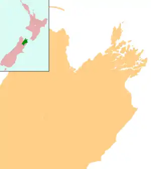
Grovetown is a small town in Marlborough, New Zealand. State Highway 1 runs past the settlement to the west, and the Wairau River flows past to the northeast. Spring Creek is about 2.5 km to the north, and Blenheim is about 3.5 km to the south.[1][2] To the east is Grovetown Lagoon, an oxbow loop of the Wairau River.[3] The settlement had a usual resident population of 357 at the 2018 New Zealand census.[4]
Grovetown | |
|---|---|
 Grovetown | |
| Coordinates: 41°28′52″S 173°58′5″E | |
| Country | New Zealand |
| Region | Marlborough |
| Population (2018) | |
| • Total | 357 |
| Postcode(s) | 7202 |
Grovetown School is a coeducational contributing primary (years 1-6) school with a decile rating of 7 and a roll of 49.[5]
Tua Mātene Marae is located in Grovetown. It is a marae (meeting ground) of Rangitāne o Wairau and includes Te Huataki wharenui (meeting house).[6][7]
Notes
- Peter Dowling (editor) (2004). Reed New Zealand Atlas. Reed Books. pp. map 61. ISBN 0-7900-0952-8.CS1 maint: extra text: authors list (link)
- Roger Smith, GeographX (2005). The Geographic Atlas of New Zealand. Robbie Burton. pp. map 139. ISBN 1-877333-20-4.
- "Grovetown Lagoons Restoration Project". Marlborough District Council.
- "Age and sex by ethnic group (grouped total response), for census usually resident population counts, 2006, 2013, and 2018 Censuses (urban rural areas)". nzdotstat.stats.govt.nz. Retrieved 4 October 2020.
- "Te Kete Ipurangi - Grovetown School". Ministry of Education. Archived from the original on 29 September 2007. Retrieved 31 May 2008.
- "Te Kāhui Māngai directory". tkm.govt.nz. Te Puni Kōkiri.
- "Māori Maps". maorimaps.com. Te Potiki National Trust.
This article is issued from Wikipedia. The text is licensed under Creative Commons - Attribution - Sharealike. Additional terms may apply for the media files.
