Gunnison–Crested Butte Regional Airport
Gunnison–Crested Butte Regional Airport (IATA: GUC, ICAO: KGUC, FAA LID: GUC) is a county-owned, public airport one mile southwest of Gunnison, in Gunnison County, Colorado, United States.[1] Also known as Gunnison County Airport, it serves the valley and nearby Crested Butte, Colorado with airline and general aviation flights.
Gunnison-Crested Butte Regional Airport | |||||||||||||||
|---|---|---|---|---|---|---|---|---|---|---|---|---|---|---|---|
 The terminal building in 2014 | |||||||||||||||
| Summary | |||||||||||||||
| Airport type | Public | ||||||||||||||
| Owner | County of Gunnison | ||||||||||||||
| Serves | Gunnison, Colorado | ||||||||||||||
| Elevation AMSL | 7,680 ft / 2,341 m | ||||||||||||||
| Coordinates | 38°32′02″N 106°55′59″W | ||||||||||||||
| Map | |||||||||||||||
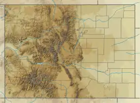 GUC Location of airport in Colorado / United States  GUC GUC (the United States) | |||||||||||||||
| Runways | |||||||||||||||
| |||||||||||||||
| Statistics (2012) | |||||||||||||||
| |||||||||||||||
This airport is in the National Plan of Integrated Airport Systems for 2011–2015, which called it a primary commercial service airport (more than 10,000 enplanements per year).[2] Federal Aviation Administration records say it had 36,035 passenger boardings (enplanements) in calendar year 2008,[3] 42,130 in 2009 and 37,316 in 2010.[4]
Passengers at Gunnison are mainly vacationers coming to the area for year-round outdoor activities, such as skiing, snowmobiling, snowshoeing, mountain biking, fishing, rafting, hiking and camping. The terminal is one large building with two jetbridge gates, two ground-level gates, and a variety of rental car or shuttle bus companies. One baggage claim area in the lower lobby level houses a single carousel and a dedicated ski/oversize baggage slide. The airport sees limited regional jet service during the summer from Denver and Houston on United Express; however, frequent larger aircraft service during winter months occurs from additional cities.
It is at 38°32′02″N 106°55′59″W at an elevation of 7678 feet or 2340 meters above mean sea level. U.S. 50 runs along the northwest side of the airport. Its close location is due in part to redevelopment of land formerly occupied by the Denver & Rio Grande narrow gauge railroad and rail yards, abandoned in 1953.[5] Currecanti Recreation Area and Blue Mesa Reservoir is located nine miles West of Gunnison. Also nearby is the Black Canyon of the Gunnison National Park, Taylor Reservoir, and Roaring Judy fish hatchery. Numerous ghost towns and scenic drives are located throughout the region as well.
In the months after the September 11 attacks, Gunnison–Crested Butte Regional Airport was one of several airports to have a temporary presence of the National Guard.
Facilities and aircraft

Gunnison–Crested Butte Regional Airport covers 1,600 acres (650 ha) and has two runways. The main runway, 6/24, has an asphalt pavement 9,400 by 150 ft (2,865 by 46 m) and is lighted during operational hours (0600-2230 MST). A second unpaved runway, 17/35, south of the main, is available to small aircraft in the summer; it has a turf and gravel surface 3,000 by 150 ft (914 by 46 m) and is open for daylight use only, as it is unlighted.[1]
In the year ending January 1, 2012 the airport had 7,632 aircraft operations, average 20 per day: 88% general aviation, 11% scheduled commercial, and 1% military. 25 aircraft were then based at this airport: 84% single-engine and 16% multi-engine.[1]
Airlines and destinations
Passenger
| Airlines | Destinations |
|---|---|
| American Airlines | Seasonal: Dallas/Fort Worth |
| United Airlines | Seasonal: Houston–Intercontinental |
| United Express | Denver Seasonal: Houston–Intercontinental |
| Destinations map |
|---|
Destinations from Gunnison-Crested Regional Airport Red = Year-round destination Green = Seasonal destination |

Statistics
Top destinations
| Rank | Airport | Passengers | Carriers |
|---|---|---|---|
| 1 | Denver, Colorado | 14,690 | United |
| 2 | Dallas/Fort Worth, Texas | 10,360 | American |
| 3 | Houston–Intercontinental, Texas | 5,210 | United |
References
- FAA Airport Form 5010 for GUC PDF. Federal Aviation Administration. Effective November 15, 2012.
- "2011–2015 NPIAS Report, Appendix A" (PDF, 2.03 MB). faa.gov. Federal Aviation Administration. October 4, 2010.
- "Enplanements for CY 2008" (PDF, 1.0 MB). faa.gov. Federal Aviation Administration. December 18, 2009.
- "Enplanements for CY 2010" (PDF, 189 KB). faa.gov. Federal Aviation Administration. October 4, 2011.
- Gunnison, CO Archived 2006-05-05 at the Wayback Machine. GhostDepot.com. Retrieved September 2, 2009.
External links
- Airport page at Gunnison - Crested Butte Tourism Association
- Gunnison - Crested Butte Regional Airport (GUC) at Colorado DOT airport directory
- Gunnison Valley Aviation, the fixed-base operator (FBO)
- Aerial image as of September 1993 from USGS The National Map
- FAA Terminal Procedures for GUC, effective January 28, 2021
- Resources for this airport:
- FAA airport information for GUC
- AirNav airport information for KGUC
- ASN accident history for GUC
- FlightAware airport information and live flight tracker
- NOAA/NWS weather observations: current, past three days
- SkyVector aeronautical chart, Terminal Procedures