Guntur mandal
Guntur Urban mandal (or Guntur mandal) was a former mandal in Guntur district of the Indian state of Andhra Pradesh, before it was split into Guntur East and Guntur West mandals in 2018.[2] It was under the administration of Guntur revenue division and its headquarters at Guntur,[3][4] The mandal was bounded by Medikonduru, Tadikonda, Pedakakani, Edlapadu, Prathipadu, Vatticherukuru and Chebrole mandals.[5]
Guntur Urban mandal | |
|---|---|
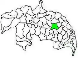 Mandal map of Guntur district showing Guntur mandal (in green) | |
.svg.png.webp) Guntur Urban mandal Location in Andhra Pradesh, India | |
| Coordinates: 16.3008°N 80.4428°E | |
| Country | India |
| State | Andhra Pradesh |
| District | Guntur |
| Headquarters | Guntur |
| Government | |
| • Tehsildar | Tata Mohan Rao |
| Population (2011)[1] | |
| • Total | 779,289 |
| Languages | |
| • Official | Telugu |
| Time zone | UTC+5:30 (IST) |
Demographics
As of 2011 census, the mandal had a population of 779,289. The total population constituted 389,582 males and 389,707 females — a sex ratio of 1000 females per 1000 males. 77,189 children were in the age group of 0–6 years, of which 39,616 were boys and 37,573 were girls. The average literacy rate stood at 78.82% with 553,422 literates.[1] The mandal had unique characteristics like having largest urban area, highest population and population density and the most number of literates of all the mandals of the district.[6]
Governance
The mandal was a part of the Andhra Pradesh Capital Region, under the jurisdiction of APCRDA.[7] It was shared by two assembly constituencies namely, Guntur East (Assembly constituency) and Guntur West (Assembly constituency), which were segments of Guntur (Lok Sabha constituency).[8]
Settlements
Guntur Urban mandal covered Guntur Municipal Corporation and its urban agglomerations, covering gram panchayats of ten merged surrounding villages of Nallapadu, Pedapalakaluru, Ankireddipalem, Adavitakkellapadu, Gorantla, Pothuru, Chowdavaram, Etukuru, Budampadu and Reddy Palem.[9][10] Chinapalakaluru and Jonnalagadda were the villages in the mandal.[11][3]
See also
- List of mandals in Andhra Pradesh
- Villages in Guntur mandal
References
- "Census 2011". The Registrar General & Census Commissioner, India. Retrieved 5 August 2014.
- India, The Hans (31 March 2018). "Guntur urban divided into east, East mandals". www.thehansindia.com. Guntur. Retrieved 1 May 2019.
- "Guntur District Mandals" (PDF). Census of India. pp. 83, 110. Retrieved 11 February 2015.
- "Adminsistrative divisions of Guntur district" (PDF). guntur.nic.in. Archived from the original (PDF) on 26 June 2014. Retrieved 5 August 2014.
- "Mandals in Guntur district". aponline.gov.in. Archived from the original on 28 April 2015. Retrieved 5 August 2014.
- "District wise mandals and villages covered in Krishna and Guntur districts" (PDF). Andhra Pradesh Capital Region Development Authority. Government of Andhra Pradesh. Archived from the original (PDF) on 23 September 2015. Retrieved 23 September 2015.
- "Delimitation of Parliamentary and Assembly Constituencies Order, 2008" (pdf). Election Commission of India. p. 22. Retrieved 11 October 2014.
- "Merger of gram panchayats in Guntur Municipal Corporation" (PDF). Guntur Municipal Corporation. Municipal Administration & Urban Development Department. Retrieved 31 January 2016.
- "Panchayat Raj and Rural Development (Pts.IV) Department" (PDF). 12 July 2012.
- "Sub-District Details of Guntur District". The Registrar General & Census Commissioner, India. Archived from the original on 15 April 2015. Retrieved 8 August 2014.
Places adjacent to Guntur mandal | ||||||||||
|---|---|---|---|---|---|---|---|---|---|---|
| ||||||||||