Hainberg (hills)
The Hainberg (known locally as the Hainberge as it has several summits. Also the old form Heinberg) is a hill range, up to 299 metres high,[1] northwest of the Harz Mountains in the eastern part of Lower Saxony, Germany.
|
| Hainberg | |
|---|---|
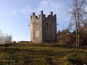
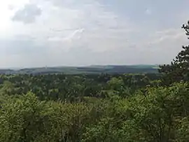 View from the Hunters' Tower (northern Jägerturmskopf) over the Hainberg | |
| Highest point | |
| Peak | Kalter Buschkopf |
| Elevation | 299 m (981 ft) |
| Dimensions | |
| Length | 15 km (9.3 mi) |
| Geography | |
| Country | Germany |
| State | Lower Saxony |
| Range coordinates | 52°02′00″N 10°12′00″E |
| Parent range | Lower Saxon Hills |
Hills
Amongst the hills in the Hainberg are the following:
- Kalter Buschkopf (299 m above sea level (NN))
- Schlahköpfe (285 m)
- Steinberg (283 m; part of the Bodensteiner Klippen)
- Hohlenberg (263 m)
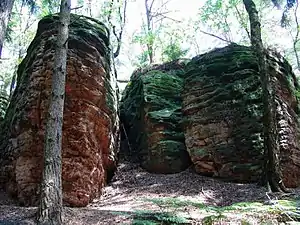
- Bodensteiner Klippen (ca. 200 to 283 m)
- Kliebenkopf (254 m)
- Lauhberg (253 m)
- Jägerturmsköpfe (251 m)
- Nördlicher Jägertumskopf (244 m) - with Jägerturm
- Osterklippe (235 m; part of the Bodensteiner Klippen)
- Eichenberg (226 m)
- Papenberg (226 m)
- Hillenberg (224 m)
- Langenberg (224 m)
- Spitzer Hai (222 m)
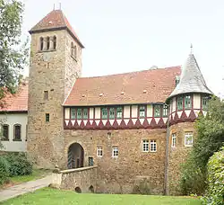
- Wohldenberg (218 m) - with Wohldenberg Castle
- Kapitelhai (209 m)
- Hützlah (206 m)
Settlements
Settlements in and near the Hainberg are:
References
- Map services of the Federal Agency for Nature Conservation
This article is issued from Wikipedia. The text is licensed under Creative Commons - Attribution - Sharealike. Additional terms may apply for the media files.
