Hansell, Iowa
Hansell is a city in Franklin County, Iowa, United States. The population was 98 at the 2010 census.
Hansell, Iowa | |
|---|---|
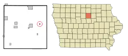 Location of Hansell, Iowa | |
| Coordinates: 42°45′26″N 93°6′13″W | |
| Country | |
| State | |
| County | Franklin |
| Area | |
| • Total | 0.22 sq mi (0.58 km2) |
| • Land | 0.22 sq mi (0.58 km2) |
| • Water | 0.00 sq mi (0.00 km2) |
| Elevation | 1,037 ft (316 m) |
| Population | |
| • Total | 98 |
| • Estimate (2019)[3] | 90 |
| • Density | 401.79/sq mi (155.02/km2) |
| Time zone | UTC-6 (Central (CST)) |
| • Summer (DST) | UTC-5 (CDT) |
| ZIP code | 50441 |
| Area code(s) | 641 |
| FIPS code | 19-34365 |
| GNIS feature ID | 0457236 |
History
Hansell was platted in 1880. It was named by its founders, George W. Hansell and his wife, Laura B. Hansell.[4]
Geography
Hansell is located at 42°45′26″N 93°6′13″W (42.757219, -93.103638).[5]
According to the United States Census Bureau, the city has a total area of 0.23 square miles (0.60 km2), all land.[6]
Demographics
| Year | Pop. | ±% |
|---|---|---|
| 1920 | 163 | — |
| 1930 | 172 | +5.5% |
| 1940 | 183 | +6.4% |
| 1950 | 190 | +3.8% |
| 1960 | 168 | −11.6% |
| 1970 | 124 | −26.2% |
| 1980 | 138 | +11.3% |
| 1990 | 83 | −39.9% |
| 2000 | 96 | +15.7% |
| 2010 | 98 | +2.1% |
| 2019 | 90 | −8.2% |
| Source:"U.S. Census website". United States Census Bureau. Retrieved 2020-03-29. and Iowa Data Center Source: | ||
2010 census
As of the census[2] of 2010, there were 98 people, 48 households, and 29 families living in the city. The population density was 426.1 inhabitants per square mile (164.5/km2). There were 52 housing units at an average density of 226.1 per square mile (87.3/km2). The racial makeup of the city was 99.0% White and 1.0% Asian.
There were 48 households, of which 18.8% had children under the age of 18 living with them, 54.2% were married couples living together, 4.2% had a female householder with no husband present, 2.1% had a male householder with no wife present, and 39.6% were non-families. 29.2% of all households were made up of individuals, and 14.6% had someone living alone who was 65 years of age or older. The average household size was 2.04 and the average family size was 2.55.
The median age in the city was 50.5 years. 14.3% of residents were under the age of 18; 9.2% were between the ages of 18 and 24; 18.4% were from 25 to 44; 32.6% were from 45 to 64; and 25.5% were 65 years of age or older. The gender makeup of the city was 48.0% male and 52.0% female.
2000 census
As of the census[8] of 2000, there were 96 people, 42 households, and 27 families living in the city. The population density was 441.8 people per square mile (168.5/km2). There were 46 housing units at an average density of 211.7 per square mile (80.7/km2). The racial makeup of the city was 97.92% White, 2.08% from other races. Hispanic or Latino of any race were 3.12% of the population.
There were 42 households, out of which 21.4% had children under the age of 18 living with them, 59.5% were married couples living together, 2.4% had a female householder with no husband present, and 35.7% were non-families. 28.6% of all households were made up of individuals, and 16.7% had someone living alone who was 65 years of age or older. The average household size was 2.29 and the average family size was 2.85.
In the city, the population was spread out, with 19.8% under the age of 18, 9.4% from 18 to 24, 27.1% from 25 to 44, 31.3% from 45 to 64, and 12.5% who were 65 years of age or older. The median age was 42 years. For every 100 females, there were 88.2 males. For every 100 females age 18 and over, there were 97.4 males.
The median income for a household in the city was $32,250, and the median income for a family was $47,500. Males had a median income of $31,250 versus $23,750 for females. The per capita income for the city was $17,389. There were 13.9% of families and 12.3% of the population living below the poverty line, including no under eighteens and 12.0% of those over 64.
Education
Hampton-Dumont Community School District operates the area public schools.[9] It was established on July 1, 1995 by the merger of the Dumont and Hampton school districts.[10]
References
- "2019 U.S. Gazetteer Files". United States Census Bureau. Retrieved July 17, 2020.
- "U.S. Census website". United States Census Bureau. Retrieved 2012-05-11.
- "Population and Housing Unit Estimates". United States Census Bureau. May 24, 2020. Retrieved May 27, 2020.
- Stuart, I. L. (1914). History of Franklin County, Iowa: A Record of Settlement, Organization, Progress and Achievement, Volume 1. S. J. Clarke Publishing Company. p. 280.
- "US Gazetteer files: 2010, 2000, and 1990". United States Census Bureau. 2011-02-12. Retrieved 2011-04-23.
- "US Gazetteer files 2010". United States Census Bureau. Retrieved 2012-05-11.
- "Census of Population and Housing". Census.gov. Retrieved June 4, 2015.
- "U.S. Census website". United States Census Bureau. Retrieved 2008-01-31.
- "Hampton-Dumont." Iowa Department of Education. Retrieved on September 15, 2018.
- "REORGANIZATION & DISSOLUTION ACTIONS SINCE 1965-66" (PDF). Iowa Department of Education. Archived from the original (PDF) on 2019-02-09. Retrieved 2019-08-01.
Municipalities and communities of Franklin County, Iowa, United States | ||
|---|---|---|
| Cities | Map of Iowa highlighting Franklin County | |
| Townships | ||
| CDPs | ||
| Unincorporated communities | ||
| Footnotes | ‡This populated place also has portions in an adjacent county or counties | |
| ||
