Har Amasa
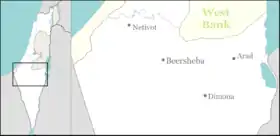
Har Amasa (Hebrew: הַר עֲמָשָׂא, lit. Mount Amasa) is a Moshav shitufi in the south of Israel. Located near the Yatir Forest 20 kilometres south of Hebron and 14 km northwest of Arad, it is the only member of the Tamar Regional Council to be located in the highlands outside the Jordan Rift Valley. In 2019 it had a population of 198.[1]
Har Amasa
הר עמשא هار عماسا | |
|---|---|
 Har Amasa | |
| Coordinates: 31°20′36″N 35°6′6″E | |
| Country | Israel |
| District | Southern |
| Council | Tamar |
| Affiliation | Agricultural Union |
| Founded | 1984–1989 |
| Founded by | Gush Emunim |
| Population (2019)[1] | 198 |
| Website | www.amasa.co.il |
It was named after the nearby Mount Amasa (859 m), which was in turn named after Amasa son of Ithra the Israelite (2 Samuel 17:25).[2]
History
The village was initially founded as a Gush Emunim settlement,[2] from a government decision made on September 14, 1980. It was handed over to the kibbutz of the United Kibbutz Movement on June 30, 1983.[3] It gradually changed its operations over the next 20 years. In 2003, it was transferred to the authority of the Agricultural Union movement, and it was preparing to expand to include many new residents in a less formal framework, while still preserving its social fabric.
In 2006, Ynet reported that the kibbutz was undergoing a religious conversion through Chabad. According to certain members of the kibbutz, the reason was that they were abandoned by the Kibbutz Movement that purposely kept their status as a "kibbutz under construction" in order to receive its funding. The movement denied the allegations and stated that the religious converts were new residents.[4] In 2006, the kibbutz members sent a petition to the High Court of Justice to transfer the village's administration to them and remove the "under construction" status, instead of being administered by the Kibbutz Movement.[5]
Climate
Har Amasa has a semi-arid climate (Köppen climate classification: BSk). The average annual temperature is 17.1 °C (62.8 °F), and around 330 mm (12.99 in) of precipitation falls annually.
| Climate data for Har Amasa | |||||||||||||
|---|---|---|---|---|---|---|---|---|---|---|---|---|---|
| Month | Jan | Feb | Mar | Apr | May | Jun | Jul | Aug | Sep | Oct | Nov | Dec | Year |
| Average high °C (°F) | 13.3 (55.9) |
14.3 (57.7) |
17.6 (63.7) |
21.9 (71.4) |
26.6 (79.9) |
29.1 (84.4) |
30.3 (86.5) |
30.5 (86.9) |
28.8 (83.8) |
26.2 (79.2) |
20.9 (69.6) |
15.3 (59.5) |
22.9 (73.2) |
| Daily mean °C (°F) | 9.1 (48.4) |
9.8 (49.6) |
12.3 (54.1) |
15.7 (60.3) |
19.8 (67.6) |
22.1 (71.8) |
23.6 (74.5) |
23.8 (74.8) |
22.2 (72.0) |
19.7 (67.5) |
15.6 (60.1) |
10.9 (51.6) |
17.1 (62.7) |
| Average low °C (°F) | 5 (41) |
5.4 (41.7) |
7 (45) |
9.5 (49.1) |
13 (55) |
15.2 (59.4) |
16.9 (62.4) |
17.2 (63.0) |
15.6 (60.1) |
13.3 (55.9) |
10.3 (50.5) |
6.6 (43.9) |
11.3 (52.3) |
| Average precipitation mm (inches) | 78 (3.1) |
67 (2.6) |
57 (2.2) |
16 (0.6) |
4 (0.2) |
0 (0) |
0 (0) |
0 (0) |
0 (0) |
6 (0.2) |
40 (1.6) |
62 (2.4) |
330 (13.0) |
| Source: [6] | |||||||||||||
References
- "Population in the Localities 2019" (XLS). Israel Central Bureau of Statistics. Retrieved 16 August 2020.
- HaReuveni, Immanuel (1999). Lexicon of the Land of Israel (in Hebrew). Miskal - Yedioth Ahronoth Books and Chemed Books. p. 258. ISBN 965-448-413-7.
- "Har Amasa". Or Movement. Retrieved 2009-06-19.
- הר עמשא: הקיבוץ חוזר בתשובה [Har Amasa: The Kibbutz is Turning Orthodox] (in Hebrew). Ynet. August 26, 2004. Retrieved 2009-06-19.
- Greenberg, Michal (May 24, 2006). תושבי קיבוץ הר עמשא שבהר חברון עתרו לבג"ץ: דורשים להפסיק להיות "קיבוץ בהתהוות" [Residents of Kibbutz Har Amasa in the Hebron Mountains Petitioned the High Course of Justice: Demand Stopping being Kibbutz Under Construction]. Haaretz (in Hebrew). Retrieved August 14, 2014.
- "Climate: Har Amasa". September 2019.
