Harmony, New York
Harmony is a town in Chautauqua County, New York, United States. The population was 2,206 at the 2010 census.[3] The town is on the south border of the county and southwest of Jamestown.
Harmony, New York | |
|---|---|
 Location within Chautauqua County and New York | |
 Harmony Location within the state of New York | |
| Coordinates: 42°3′30″N 79°26′30″W | |
| Country | United States |
| State | New York |
| County | Chautauqua |
| Government | |
| • Type | Town Council |
| • Town Supervisor | Todd Eddy (R) |
| • Town Council | Members' List
|
| Area | |
| • Total | 45.56 sq mi (118.00 km2) |
| • Land | 45.40 sq mi (117.58 km2) |
| • Water | 0.16 sq mi (0.42 km2) |
| Elevation | 1,699 ft (518 m) |
| Population (2010) | |
| • Total | 2,206 |
| • Estimate (2016)[2] | 2,106 |
| • Density | 46.39/sq mi (17.91/km2) |
| Time zone | UTC-5 (Eastern (EST)) |
| • Summer (DST) | UTC-4 (EDT) |
| ZIP code | 14767 (Panama) |
| FIPS code | 36-013-32248 |
| GNIS feature ID | 0979048 |
| Website | thetownofharmony |
History
First settlement began around 1809. The town of Harmony was established in 1816 from a part of the town of Chautauqua. The size of Harmony was reduced when the newer towns of Busti and North Harmony were formed.
Residents of note
- J. Samuel Fowler, former New York state senator
- James H. McGraw, McGraw-Hill Publishing Company, born in Harmony
- Loren B. Sessions, former US congressman
- Walter L. Sessions, former US congressman
Geography
According to the United States Census Bureau, the town has a total area of 45.6 square miles (118.0 km2), of which 45.4 square miles (117.6 km2) is land and 0.15 square miles (0.4 km2), or 0.35%, is water.[3]
New York State Route 474 is a major east-west highway through the north part of the town.
Adjacent towns and regions
Harmony is bordered to the south by Columbus Township, the borough of Bear Lake, Freehold Township, and Sugar Grove Township, all in Warren County, Pennsylvania. The town to the north is North Harmony. On the east is the town of Busti, and on the west is the town of Clymer.
Demographics
| Historical population | |||
|---|---|---|---|
| Census | Pop. | %± | |
| 1820 | 845 | — | |
| 1830 | 1,988 | 135.3% | |
| 1840 | 3,340 | 68.0% | |
| 1850 | 3,749 | 12.2% | |
| 1860 | 3,606 | −3.8% | |
| 1870 | 3,416 | −5.3% | |
| 1880 | 3,455 | 1.1% | |
| 1890 | 3,174 | −8.1% | |
| 1900 | 2,988 | −5.9% | |
| 1910 | 2,847 | −4.7% | |
| 1920 | 1,443 | −49.3% | |
| 1930 | 1,425 | −1.2% | |
| 1940 | 1,473 | 3.4% | |
| 1950 | 1,736 | 17.9% | |
| 1960 | 1,797 | 3.5% | |
| 1970 | 1,922 | 7.0% | |
| 1980 | 2,121 | 10.4% | |
| 1990 | 2,177 | 2.6% | |
| 2000 | 2,339 | 7.4% | |
| 2010 | 2,206 | −5.7% | |
| 2016 (est.) | 2,106 | [2] | −4.5% |
| U.S. Decennial Census[4] | |||
As of the census[5] of 2000, there were 2,339 people, 837 households, and 662 families residing in the town. The population density was 51.4 people per square mile (19.8/km2). There were 931 housing units at an average density of 20.5 per square mile (7.9/km2). The racial makeup of the town was 97.95% White, 0.38% African American, 0.26% Native American, 0.09% Asian, 0.13% from other races, and 1.20% from two or more races. Hispanic or Latino of any race were 0.47% of the population.
There were 837 households, out of which 37.6% had children under the age of 18 living with them, 67.5% were married couples living together, 8.6% had a female householder with no husband present, and 20.9% were non-families. 16.8% of all households were made up of individuals, and 8.0% had someone living alone who was 65 years of age or older. The average household size was 2.79 and the average family size was 3.15.
In the town, the population was spread out, with 28.7% under the age of 18, 7.6% from 18 to 24, 27.9% from 25 to 44, 24.2% from 45 to 64, and 11.7% who were 65 years of age or older. The median age was 37 years. For every 100 females, there were 98.9 males. For every 100 females age 18 and over, there were 100.0 males.
The median income for a household in the town was $32,578, and the median income for a family was $39,167. Males had a median income of $31,927 versus $19,122 for females. The per capita income for the town was $15,292. About 8.6% of families and 10.6% of the population were below the poverty line, including 15.7% of those under age 18 and 3.9% of those age 65 or over.
Communities and locations in Harmony
- Blockville – A hamlet near the north town line by the junction of County Road 35 and NY-474.
- Brokenstraw Creek – A stream which rises on the west side of the town; a tributary of the Allegheny River in Pennsylvania.
- Cherry Hill – A hamlet in the southeast corner of the town by the junction of County Roads 12 and 35.
- Kings Corners – A location at the west town line, west of Panama village on County Road 10.
- Little Brokenstraw Creek – A stream flowing southward through the west side of the town, joining Brokenstraw Creek in Pennsylvania.
- Niobe – A location in the southeast part of the town and west of Cherry Hill on County Road 12.
- North East Junction – A hamlet in the southeast part of the town
- Panama – The village of Panama is in the northwest part of the town on Route 474 and County Roads 10 and 33.
- Watts Flats – A hamlet by the eastern town and south of Blockville on County Road 35.
References in popular culture
Harmony is the setting for The Twilight Zone episode "Once Upon a Time".
References
- "2016 U.S. Gazetteer Files". United States Census Bureau. Retrieved Jul 4, 2017.
- "Population and Housing Unit Estimates". Retrieved June 9, 2017.
- "Geographic Identifiers: 2010 Demographic Profile Data (G001): Harmony town, Chautauqua County, New York". U.S. Census Bureau, American Factfinder. Archived from the original on February 12, 2020. Retrieved November 6, 2014.
- "Census of Population and Housing". Census.gov. Retrieved June 4, 2015.
- "U.S. Census website". United States Census Bureau. Retrieved 2008-01-31.
External links
Municipalities and communities of Chautauqua County, New York, United States | ||
|---|---|---|
| Cities | 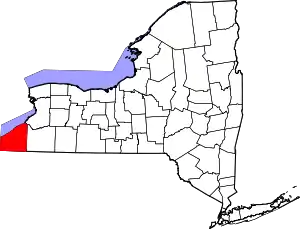 | |
| Towns | ||
| Villages | ||
| CDPs | ||
| Other hamlets | ||
| Indian reservation | ||
| ||