Harrisville, New Zealand
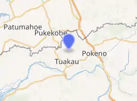
Harrisville is a locality about 3 km northeast of Tuakau and 5.5 km southeast of Pukekohe in the North Island of New Zealand.
Harrisville | |
|---|---|
Locality | |
| |
| Coordinates: 37.2394°S 174.952°E | |
| Country | New Zealand |
| Region | Waikato |
| District | Waikato District |
| Elevation | 80 m (260 ft) |
| Population (2018 census) | |
| • Total | 99 |
| Time zone | UTC+12 (NZST) |
| • Summer (DST) | UTC+13 (NZDT) |
Harrisville is in meshblocks 0828202 (SE) and 0828302 (NW), which had a combined population of 99 people in the 2018 New Zealand census.[1]
The area was named for an early landowner and politician, Major Harris, and was largely settled by Danes.[2][3][4]
Demographics
| Year | Pop. | ±% p.a. |
|---|---|---|
| 2006 | 1,335 | — |
| 2013 | 1,461 | +1.30% |
| 2018 | 1,581 | +1.59% |
| Source: [5] | ||
The statistical area of Tuakau Rural, which at 46 square kilometres is larger than this locality, had a population of 1,581 at the 2018 New Zealand census, an increase of 120 people (8.2%) since the 2013 census, and an increase of 246 people (18.4%) since the 2006 census. There were 531 households. There were 819 males and 762 females, giving a sex ratio of 1.07 males per female. The median age was 44.2 years, with 312 people (19.7%) aged under 15 years, 276 (17.5%) aged 15 to 29, 765 (48.4%) aged 30 to 64, and 231 (14.6%) aged 65 or older.
Ethnicities were 84.8% European/Pākehā, 14.2% Māori, 3.2% Pacific peoples, 8.5% Asian, and 1.1% other ethnicities (totals add to more than 100% since people could identify with multiple ethnicities).
The proportion of people born overseas was 19.4%, compared with 27.1% nationally.
Although some people objected to giving their religion, 51.2% had no religion, 35.3% were Christian, 1.5% were Hindu, 0.4% were Muslim, 0.4% were Buddhist and 1.9% had other religions.
Of those at least 15 years old, 228 (18.0%) people had a bachelor or higher degree, and 201 (15.8%) people had no formal qualifications. The median income was $40,700. The employment status of those at least 15 was that 705 (55.6%) people were employed full-time, 207 (16.3%) were part-time, and 42 (3.3%) were unemployed.[5]
Education
Harrisville School is a co-educational state primary school covering years 1 to 6,[6] with a roll of 198 as of March 2020.[7] The school opened in 1877.[8] In the 2019 Education Review Office report, 38% of the students were Māori.[9]
References
- "Meshblock Electoral Populations 2020 for proposed boundaries data". Statistics New Zealand. April 2020. Meshblocks 0828202 and 0828302.
- "Harrisville". The Cyclopedia of New Zealand. 2. Auckland Povincial District. 1902.
- "The Franklin North Election". Timaru Herald. XXXVI (2414). 17 June 1882. p. 2.
- "Untitled". Auckland Star. XXIV (283). 29 November 1893.
- "Statistical area 1 dataset for 2018 Census". Statistics New Zealand. March 2020. Tuakau Rural (169900). 2018 Census place summary: Tuakau Rural
- Education Counts: Harrisville School
- "New Zealand Schools Directory". New Zealand Ministry of Education. Retrieved 26 April 2020.
- "Welcome to Harrisville Primary School". Harrisville School. Retrieved 24 August 2019.
- "Harrisville School - 28/05/2019". Education Review Office. 28 May 2019. Retrieved 24 August 2019.