Heath Springs, South Carolina
Heath Springs is a town in Lancaster County, South Carolina, United States. The population was 790 at the 2010 census.
Heath Springs, South Carolina | |
|---|---|
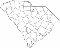 Location of Heath Springs, South Carolina | |
| Coordinates: 34°35′30″N 80°40′28″W | |
| Country | United States |
| State | South Carolina |
| County | Lancaster |
| Area | |
| • Total | 1.63 sq mi (4.21 km2) |
| • Land | 1.63 sq mi (4.21 km2) |
| • Water | 0.00 sq mi (0.00 km2) |
| Elevation | 719 ft (219 m) |
| Population (2010) | |
| • Total | 790 |
| • Estimate (2019)[2] | 1,019 |
| • Density | 627.08/sq mi (242.10/km2) |
| Time zone | UTC-5 (Eastern (EST)) |
| • Summer (DST) | UTC-4 (EDT) |
| ZIP code | 29058 |
| Area code(s) | 803, 839 |
| FIPS code | 45-32965[3] |
| GNIS feature ID | 1245936[4] |
| Website | townofheathsprings |
History
Heath Springs was incorporated in 1890. It was named for the firm Heath & Springs.[5]
The Battle of Hanging Rock Historic Site and Heath Springs Depot are listed on the National Register of Historic Places.[6]
Geography
Heath Springs is located at 34°35′30″N 80°40′28″W (34.591550, -80.674510).[7]
According to the United States Census Bureau, the town has a total area of 1.3 square miles (3.4 km2), all land.
The largest company in Heath Springs is Rico Industries, maker of fine quality sports-licensed products such as wallets, flags and grill covers.
Demographics
| Historical population | |||
|---|---|---|---|
| Census | Pop. | %± | |
| 1900 | 266 | — | |
| 1910 | 452 | 69.9% | |
| 1920 | 505 | 11.7% | |
| 1930 | 520 | 3.0% | |
| 1940 | 570 | 9.6% | |
| 1950 | 694 | 21.8% | |
| 1960 | 832 | 19.9% | |
| 1970 | 955 | 14.8% | |
| 1980 | 979 | 2.5% | |
| 1990 | 907 | −7.4% | |
| 2000 | 864 | −4.7% | |
| 2010 | 790 | −8.6% | |
| 2019 (est.) | 1,019 | [2] | 29.0% |
| U.S. Decennial Census[8] | |||
As of the census[3] of 2000, there were 864 people, 328 households, and 225 families residing in the town. The population density was 256.6/km2 (667.1/sq mi). There were 366 housing units at an average density of 282.6 per square mile (108.7/km2). The racial makeup of the town was 48.38% White, 51.04% African American, 0.46% from other races, and 0.12% from two or more races. Hispanic or Latino of any race were 0.93% of the population.
There were 328 households, out of which 26.5% had children under the age of 18 living with them, 43.0% were married couples living together, 19.5% had a female householder with no husband present, and 31.1% were non-families. 28.7% of all households were made up of individuals, and 11.3% had someone living alone who was 65 years of age or older. The average household size was 2.50 and the average family size was 3.07.
In the town, the population was spread out, with 22.8% under the age of 18, 9.6% from 18 to 24, 22.2% from 25 to 44, 26.6% from 45 to 64, and 18.8% who were 65 years of age or older. The median age was 42 years. For every 100 females age 18 and under there were 80.4 males. For every 100 females age 18 and over, there were 75.1 males.
The median income for a household in the town was $24,000, and the median income for a family was $29,688. Males had a median income of $26,458 versus $20,463 for females. The per capita income for the town was $10,407. About 24.0% of families and 32.7% of the population were below the poverty line, including 37.8% of those under age 18 and 42.3% of those age 65 or over.
References
- "2019 U.S. Gazetteer Files". United States Census Bureau. Retrieved July 29, 2020.
- "Population and Housing Unit Estimates". United States Census Bureau. May 24, 2020. Retrieved May 27, 2020.
- "U.S. Census website". United States Census Bureau. Retrieved 2008-01-31.
- "US Board on Geographic Names". United States Geological Survey. 2007-10-25. Retrieved 2008-01-31.
- Gannett, Henry (1905). The Origin of Certain Place Names in the United States. Govt. Print. Off. pp. 153.
- "National Register Information System". National Register of Historic Places. National Park Service. July 9, 2010.
- "US Gazetteer files: 2010, 2000, and 1990". United States Census Bureau. 2011-02-12. Retrieved 2011-04-23.
- "Census of Population and Housing". Census.gov. Retrieved June 4, 2015.
Municipalities and communities of Lancaster County, South Carolina, United States | ||
|---|---|---|
| City | 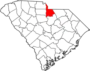 Map of South Carolina highlighting Lancaster County | |
| Towns | ||
| CDPs | ||
| Unincorporated communities | ||
| Footnotes | ‡This populated place also has portions in an adjacent county or counties | |
| ||