Helena, California
Helena is a ghost town in Trinity County, California, United States. Helena is located on the North Fork of the Trinity River, 10 miles (16 km) west-northwest of Weaverville.
Helena, California | |
|---|---|
 Helena, California | |
| Coordinates: 40°46′25″N 123°07′42″W | |
| Country | United States |
| State | California |
| County | Trinity |
| Elevation | 1,391 ft (424 m) |
| Time zone | UTC-8 (Pacific (PST)) |
| • Summer (DST) | UTC-7 (PDT) |
| Area code(s) | 530 |
| GNIS feature ID | 261237[1] |
Helena Historic District | |
| Location | California |
| Nearest city | Junction City, California |
| Architectural style | Various; Southwestern U.S. frontier-style, late-19th to early-20th century. |
| NRHP reference No. | 84001219 |
| Significant dates | |
| Added to NRHP | May 24, 1984 [2] |
| Designated | May 24, 1984 |
History
The community was settled in 1851 as a mining camp on the site of an old Chimariko village. It was known as Bagdad, North Fork, and The Cove before its post office opened in 1891; the post office was named Helena after the postmaster Mr. Meckel’s wife to avoid confusion with another California community called North Fork.[3]
John and Christian Meckel, who moved to the area and established a home on a group of mining claims that totaled 160 acres. In 1854, the Meckels opened a general merchandise store and later a hotel. The town was first known as North Fork, but it was popularly known as “Bagdad,” a name given to the settlement reportedly because it was as rowdy and bizarre as the ancient city with the same name on the Tigris River. [4]
In 1859 the Meckel brothers built and operated a brewery in Helena, then called North Fork.
In 1923 the final stretch of road was built from Helena to South Fork, which connects it to the coast.
When the gold mining was drying up the town soon followed, with slight upticks during the Great Depression.
In 1931 when State Route 299 was completed it ended the necessity of the town as it was now being bypassed.
In 1966 the entire town was bought by F. I. DiNapoli in 1966 for $50,000.
In 1984 the entire former city was added to the National Register of Historical Places.
Current Status
Today the town is abandoned and owned by the trustee of a deceased businessman from San Jose. The Currie Cottage (1859), the Meckel Store (1858), the Shlomer Brick Building (1859), The Shlomer Feed Stable (1860), the Meckel Barn (1860), and a rental building built in the 1930s remain. The Helena Cemetery is located near the townsite off of Cemetery road from 299. It has 109 known graves.
Directions
 State Route 299. State route 299 runs right past the former town. Then take East Fork road to the remaining townsite.
See also
References
- U.S. Geological Survey Geographic Names Information System: Helena, California
- "National Register Information System". National Register of Historic Places. National Park Service. April 15, 2008.
- Durham, David L. (1998). California's Geographic Names: A Gazetteer of Historic and Modern Names of the State. Quill Driver Books. p. 75. ISBN 1-884995-14-4.
- Smith, Dottie (2008). "Helena". Record Searchlight.
Municipalities and communities of Trinity County, California, United States | ||
|---|---|---|
| CDPs | 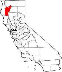 Trinity County map | |
| Unincorporated communities | ||
| Indian reservation | ||
| Ghost towns | ||
| ||