Helgafell (Hafnarfjörður)
Helgafell (Hafnarfjörður) is a mountain on Reykjanes peninsula, Iceland.[1] The height of the mountain is 338m.[2]
| Helgafell (Hafnarfjörður) | |
|---|---|
.JPG.webp) Helgafell | |
| Highest point | |
| Elevation | 338 m (1,109 ft) (Ari Trausti Guðmundsson, Pétur Þorsteinsson: Íslensk fjöll. Gönguleiðir á 152 tind. Reykjavík 2004, p. 98 ) |
| Coordinates | 64°00′37″N 21°51′05″W |
| Naming | |
| English translation | Holy Mountain |
| Language of name | Icelandic |
| Geography | |
 Helgafell (Hafnarfjörður) Iceland | |
| Geology | |
| Age of rock | Pleistocene (Weichselian) |
| Mountain type | Subglacial mound |
| Last eruption | Pleistocene |
| Climbing | |
| Easiest route | marked hiking trail |
Name
Many mountains in Iceland bear the name of Helgafell. It means “holy mountain”[3] and is thought that in the times of pagan vikings, these mountains played a special – if unknown – role in the worship of their gods.[2] An architect from Reykjavík measured out the positions of the very old cairn on top of Helgafell as well as the cairns of two other mountains in the vicinity and came to the conclusion that by using the positions of the sun as well as the shades of the cairns, the vikings had constructed a calendar.[2]
Subglacial volcano
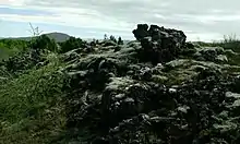
The mountain is actually a hyaloclastite ridge from the Pleistocene (Weichselian).[2] Its typical form shows well as there is not much vegetation on its slopes.[4]
Helgafell is located in a tectonically and volcanically rather active region with the last eruptions on Reykjanes peninsula in the 13th [4] or 14th century,[5] depending on author.
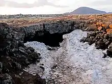
The mountain is situated within the area of Krýsuvík volcanic system. It “is thought to have formed in a single subglacial fissure eruption under at least 500 m of glacial ice“.[4] The original ridge was about 2 km long. Some Holocene lava flows, also from the neighbouring Brennisteinsfjöll volcanic system, surrounded the mountain later.
Helgafell is made mostly from palagonite, i.e. palagonitized tephra, dikes and a small amount of pillow lavas.[4] Since its formation, the mountain was not touched by another glacier, so it must be from the end of the last glacial spell.[4]
Formation of Helgafell
Helgafell is most probably a monogenetic subglacial mound, no traces of subaerial eruptions were found on its slopes. [6]
The Pleistocene ice shield under which Helgafell eruptions took place, was about 500 m thick at time of eruption.[6] In the beginning a fissure opened at right angles to the ice flow which was from the southeast to the northwest. It was about 15 km from the glacier snout. There is a big terminal moraine at the coast at Álftanes. Rapid ice melting was the consequence of explosive eruption and therefore magma fragmentation from the beginning on. The authors refer to their experience from watching and researching the Gjálp eruption from 1996 which has had many similarities to the Helgafell formation. At Helgafell next an edifice was formed about 300 m high in an ice vault, meltwater drained away very fast through subglacial channels so that the explosive activity continued to the end, which seems to have been after some days. This explains the fact, that Helgafell is next to overall made from mafic hyaloclastite, whereas most other researched smaller subglacial volcanoes showed a basis of pillow lavas. Of these and some small intrusions, the researchers just found minimal quantities.[6]
Aeolian erosion removed part of the summit in the Holocene and other parts of the mountain slumped.[6]
The lava fields surrounding Helgafell today are about 40 – 80 m in thickness as gravity surveys showed.[6]
Hut Kaldársel and river Kaldá
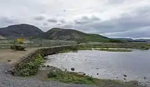
Kaldársel is a hut from an Icelandic youth organization (KFUM) where hikers also are welcome (sort of a youth hostel). It is possible to get by car along Kaldárselsvegur from Hafnarfjörður up to a parking lot in the vicinity.
The hut has its name from Kaldá, a small intermittent river nearby. The area around it is fenced in, because it is part of the drinking water resources of the neighboring towns.
Folk tales “explain” the disappearances of the river: Once a man could use witch craft, but lost two of his sons who drowned in the river. He shall then have used some of his tricks so that the river had to go underground.[7]
Hiking
The mountain is at just some kilometers distance from Hafnarfjördur as well as from Reykjavík. Many hiking trails are in its vicinity and also up on the mountain, so that it is a very popular hiking area. Even two long hiking trails are to be found at its foot: The Reykjavegur which makes it possible to hike all the length of Reykjanes Peninsula (about 120 km) and the old trail of Selvogsgata[8]
It is a rather easy hike up on the mountain[2] and even easier to hike around it or just up on Valahnúkarskarð between Helgafell and Valahnúkar (another subglacial mound from the Pleistocene as well as the mountain Húsfell in a certain distance).Only if you intend to go up on Valahnúkar, beware of the troll family (some strangely formed rock formations) at the top.[9]
See also
| Wikimedia Commons has media related to Helgafell (Reykjanesskagi). |
External links
References
- See map p. 48: Erica A. Massey: A Comparative Study of Glaciovolcanic Palagonitization of Tholeitic and Alkaline Sideromelane in Helgafell, Icland, and Wells Gray-Clearwater Volcanic Filed, BC, Canada. B.Sc., The University of British Columbia, 2014
- Ari Trausti Guðmundsson, Pétur Þorsteinsson: Íslensk fjöll. Gönguleiðir á 152 tind. Reykjavík 2004, p. 98
- http://digicoll.library.wisc.edu/cgi-bin/IcelOnline/IcelOnline.TEId-idx?type=simple&size=First+100&rgn=lemma&q1=b%C3%BAr&submit=Search Icelandic Online Dictionary and Readings. University of Wisconsin. Retrieved 5 August 2020.
- Erica A. Massey: A Comparative Study of Glaciovolcanic Palagonitization of Tholeitic and Alkaline Sideromelane in Helgafell, Icland, and Wells Gray-Clearwater Volcanic Filed, BC, Canada. B.Sc., The University of British Columbia, 2014
- Krýsuvík. In: Global Volcanism Program. Smithsonian Institution. Retrieved 6 August 2020.
- H.H.Schopka, M.T.Gudmundsson, H.Tuffen: The formation of Helgafell, southwest Iceland, a monogenetic subglacial hyaloclastite ridge: Sedimentology, hydrology and volcano–ice interaction. Journal of Volcanology and Geothermal Research 152 (2006) 359–377:Retrieved 9 August 2020.
- Reynir Ingibjartsson: 25 Gönguleiðir á Reykjanesskaga. Náttúrann við Bæjarveggin. Reykjavík , p. 12
- See t.d. map p. 11 in: Reynir Ingibjartsson: 25 Gönguleiðir á Reykjanesskaga. Náttúrann við Bæjarveggin. Reykjavík
- Reynir Ingibjartsson: 25 Gönguleiðir á Reykjanesskaga. Náttúrann við Bæjarveggin. Reykjavík , p. 10