Hodonín
Hodonín (Czech pronunciation: [ˈɦodoɲiːn]; German: Göding) is a town in the South Moravian Region of the Czech Republic. It has about 25,000 inhabitants. It lies on the Morava River, on the border with Slovakia.
Hodonín | |
|---|---|
Town | |
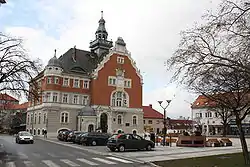 Town hall | |
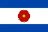 Flag 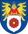 Coat of arms | |
 Hodonín Location in the Czech Republic | |
| Coordinates: 48°50′56″N 17°7′57″E | |
| Country | |
| Region | South Moravian |
| District | Hodonín |
| Founded | 11th century |
| Government | |
| • Mayor | Libor Střecha |
| Area | |
| • Total | 63.05 km2 (24.34 sq mi) |
| Elevation | 167 m (548 ft) |
| Population (2020-01-01[1]) | |
| • Total | 24,512 |
| • Density | 390/km2 (1,000/sq mi) |
| Time zone | UTC+1 (CET) |
| • Summer (DST) | UTC+2 (CEST) |
| Postal code | 695 01 |
| Website | www |
History
Hodonín was first mentioned in 1046. In 1228 it became a town. During the Thirty Years' War the town was severely damaged and the population decreased. In 18th century a local castle was rebuilt to a tobacco factory, whose production helped repopulate the town.[2]
Economy
In the vicinity of the town there is an oil field and a stratum of lignite, which was formerly transported to the town of Otrokovice, a few kilometers from the city of Zlín, by the Baťa Canal, which was built by the Czech entrepreneur Tomáš Baťa and now operates as a tourist attraction.
Demography
|
|
Notable people
- Tomáš Garrigue Masaryk (1850–1937), Czechoslovak politician, the first president of Czechoslovakia
- Zdeněk Škromach (born 1956), politician
- Dana Čechová (born 1983), table tennis player
- Vítězslav Veselý (born 1983), javelin thrower
- Michal Kempný (born 1990), ice hockey player
Twin towns – sister cities
 Holíč, Slovakia
 Jasło, Poland
- Skalica, Slovakia
- Trebišov, Slovakia
 Zistersdorf, Austria
References
- "Population of Municipalities – 1 January 2020". Czech Statistical Office. 30 April 2020.
- "Stručně z historie Hodonína". hodonin.eu (in Czech). Město Hodonín. Retrieved 29 September 2020.
- "Partnerská města" (in Czech). Město Hodonín. Retrieved 23 August 2020.