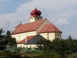
Horná Krupá
Horná Krupá is a village and municipality of Trnava District in the Trnava region of Slovakia.
Horná Krupá | |
|---|---|
Village | |
 | |
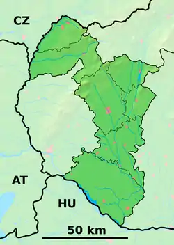 Horná Krupá Location of Horná Krupá in the Trnava Region  Horná Krupá Horná Krupá (Slovakia) | |
| Coordinates: 48°31′05″N 17°31′53″E | |
| Country | Slovakia |
| Region | Trnava |
| District | Trnava |
| First mentioned | 1113 |
| Area | |
| • Total | 8.65 km2 (3.34 sq mi) |
| Elevation | 216 m (709 ft) |
| Population (2004-12-31) | |
| • Total | 520 |
| • Density | 60/km2 (160/sq mi) |
| Postal code | 919 65 |
| Area code(s) | +421-33 |
| Car plate | TT |
| Website | hornakrupa.sk |
Genealogical resources
The records for genealogical research are available at the state archive "Statny Archiv in Bratislava, Slovakia"
- Roman Catholic church records (births/marriages/deaths): 1689-1895 (parish B)
External links
- https://web.archive.org/web/20061107032439/http://www.hornakrupa.com/
- Surnames of living people in Horna Krupa
This article is issued from Wikipedia. The text is licensed under Creative Commons - Attribution - Sharealike. Additional terms may apply for the media files.