Hradište, Partizánske District
Hradište (Hungarian: Sziklavárhely) is a village and municipality in Partizánske District in the Trenčín Region of western Slovakia.
Hradište | |
|---|---|
Municipality | |
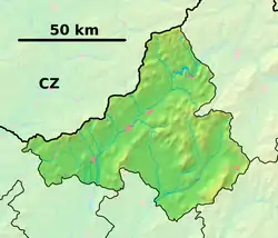 Hradište Location of Hradište in the Trenčín Region  Hradište Hradište (Slovakia) | |
| Coordinates: 48°41′00″N 18°22′30″E | |
| Country | Slovakia |
| Region | Trenčín |
| District | Partizánske |
| First mentioned | 1533 |
| Area | |
| • Total | 8.166 km2 (3.153 sq mi) |
| Elevation | 215 m (705 ft) |
| Population | |
| • Total | 1,030 |
| • Density | 130/km2 (330/sq mi) |
| Postal code | 958 54 |
| Area code(s) | 421-38 |
| Car plate | PE |
| Website | www.obec-hradiste.sk |
History
In historical records the village was first mentioned in 1533.
Geography
The municipality lies at an altitude of 215 metres and covers an area of 8.166 km². It has a population of about 1030 people.
Genealogical resources
The records for genealogical research are available at the state archive "Statny Archiv in Nitra, Slovakia"
- Roman Catholic church records (births/marriages/deaths): 1745-1942 (parish B)
External links
- Official page
- https://web.archive.org/web/20070513023228/http://www.statistics.sk/mosmis/eng/run.html
- Surnames of living people in Hradiste
Municipalities of Partizánske District | ||
|---|---|---|
This article is issued from Wikipedia. The text is licensed under Creative Commons - Attribution - Sharealike. Additional terms may apply for the media files.