Hranjigovci
Hranjigovci (pronounced [xɾaˈnjiːɡɔu̯tsi]) is a settlement in the Slovene Hills (Slovene: Slovenske gorice) northwest of Ormož in northeastern Slovenia. It belongs to the Municipality of Sveti Tomaž, which became an independent municipality in 2006. The area traditionally belonged to the Styria region and is now included in the Drava Statistical Region.[2]
Hranjigovci | |
|---|---|
 Hranjigovci Location in Slovenia | |
| Coordinates: 46°28′24.83″N 16°5′46.9″E | |
| Country | |
| Traditional region | Styria |
| Statistical region | Drava |
| Municipality | Sveti Tomaž |
| Area | |
| • Total | 2.35 km2 (0.91 sq mi) |
| Elevation | 228 m (748 ft) |
| Population (2002) | |
| • Total | 88 |
| [1] | |
There is a small roadside chapel-shrine with a belfry in the northeastern part of the village. It was built in the early 20th century.[3]
References
External links
| Settlements | 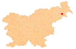 | |
|---|---|---|
| Landmarks |
| |
This article is issued from Wikipedia. The text is licensed under Creative Commons - Attribution - Sharealike. Additional terms may apply for the media files.
