Huacaybamba Province
The Huacaybamba Province is one of eleven provinces of the Huánuco Region in Peru. The capital of this province is the city of Huacaybamba.
Huacaybamba | |
|---|---|
 Aerial view of the city of Huacaybamba | |
 Flag  Coat of arms | |
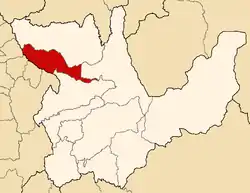 Location of Huacaybamba in the Huánuco Region | |
| Country | Peru |
| Region | Huánuco |
| Capital | Huacaybamba |
| Area | |
| • Total | 1,743.70 km2 (673.25 sq mi) |
| Population (2005 census) | |
| • Total | 19,876 |
| • Density | 11/km2 (30/sq mi) |
| UBIGEO | 1004 |
Boundaries
- North: Marañón Province
- East: Leoncio Prado Province
- South: Huamalíes Province
- West: Ancash Region
Geography
One of the highest peaks of the district is Kuntur Marka at approximately 4,400 m (14,400 ft). Other mountains are listed below:[1]
- Chakra Hirka
- Chawpi Marka
- Ch'aki Pilanku
- Hatun Hirka
- Ichik Runtu Pampa
- Kinwa Qucha
- Mata Mata
- Puchkayuq
- Puka Qaqa
- Rima Rima
- Runtu Pampa
- Ruri Qucha
- Saqra
- Tampu
- Tikira Punta
- Uqhu Pampa
- Uqhu Qucha
- Wank'a
- Wask'a Qucha
- Yura K'uchu
- Yura Qucha
- Yuraq Yaku
Political division
The province is divided into four districts, which are:
Ethnic groups
The people in the province are mainly indigenous citizens of Quechua descent. Quechua is the language which the majority of the population (78.86%) learnt to speak in childhood, 20.45% of the residents started speaking using the Spanish language (2007 Peru Census).[2]
See also
Sources
- escale.minedu.gob.pe/ UGEL map Huacaybamba Province (Huánuco Region)
- inei.gob.pe Archived 2013-01-27 at the Wayback Machine INEI, Peru, Censos Nacionales 2007
| |
|---|---|
This article is issued from Wikipedia. The text is licensed under Creative Commons - Attribution - Sharealike. Additional terms may apply for the media files.
